


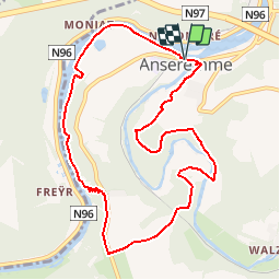


19,3 km | 26 km-effort


Benutzer


Kostenlosegpshiking-Anwendung
 SityTrail
IGN / Geografische Institute
SityTrail World
Die Welt öffnet sich für Sie
Tour Zu Fuß von 9,3 km verfügbar auf Wallonien, Namur, Dinant. Diese Tour wird von GerardBouche vorgeschlagen.
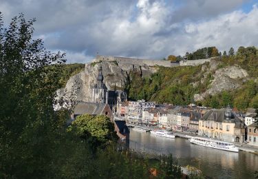
Très belle randonnée par la rive droite de Meuse. La montée depuis la Tête de Lion par les Rochers de Freyr est un chouïa physique. Un magnifique petit sentier par le Tienne Hubaille jusqu'au Pont St-Jean.

Wandern

Wandern

Wandern

Wandern

Wandern

Wandern

Wandern

Wandern
Wandern