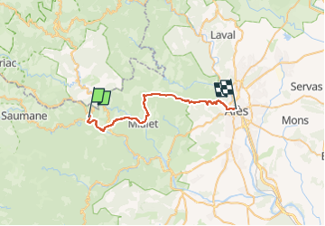
![](/images/other/stat-length.png)
![Tour Wandern Saint-Jean-du-Gard - E12 St Jean du Gard - Ales GR70 - Photo](https://media.geolcdn.com/t/1900/400/ext.pjpeg?maxdim=2&url=https%3A%2F%2Fstatic1.geolcdn.com%2Fsiteimages%2Fupload%2Ffiles%2F1553511878bg_sport_marche.png)
E12 St Jean du Gard - Ales GR70
Kargil
Benutzer GUIDE
![Länge](/images/other/stat-length.png)
![Maximale Höhe](https://static1.geolcdn.com/siteimages/upload/files/1508320355ic_sort_altitude_max_24dp.png)
![Positive Höhendifferenz](https://static1.geolcdn.com/siteimages/upload/files/1508320355ic_sort_den_pos_24dp.png)
![Km-Effort](/images/other/stat-length.png)
![Min. Höhe](https://static1.geolcdn.com/siteimages/upload/files/1508320355ic_sort_altitude_min_24dp.png)
![Negative Höhendifferenz](https://static1.geolcdn.com/siteimages/upload/files/1508320355ic_sort_den_neg_24dp.png)
![Boucle](https://static1.geolcdn.com/siteimages/upload/files/16400158638029165_repeat_loop_refresh_sync_direction_icon.png)
![Wandern](https://static1.geolcdn.com/sitytour/trail-icons/101.png)
8h20
Schwierigkeit : Sehr schwierig
![Scannen Sie diesen QR-Code, um die Tour in der SityTrail-Anwendung zu öffnen](https://capi.geolives.com/qq0zvz2zws4bq2lad0pu/sitytour/trails/2010630/qr.png?size=200)
Kostenlosegpshiking-Anwendung
Über SityTrail
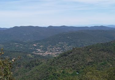
Tour Wandern von 29 km verfügbar auf Okzitanien, Gard, Saint-Jean-du-Gard. Diese Tour wird von Kargil vorgeschlagen.
Beschreibung
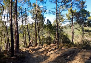
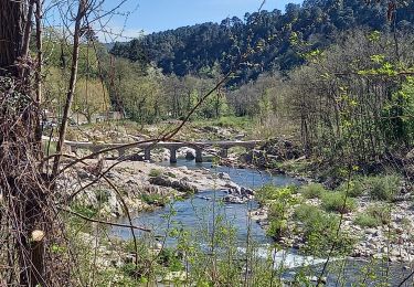
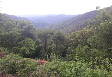
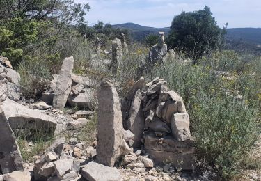
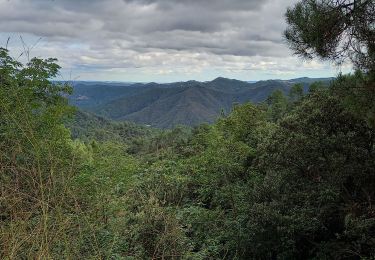
Ne pas écouter ce qui ce dit, c'est une très belle étape sportive, de belles belles vues, quelques brefs passages alpins mais dans l'ensemble de très beaux sentiers.
Attention, minimum 2 litres d'eau et il faut gérer !
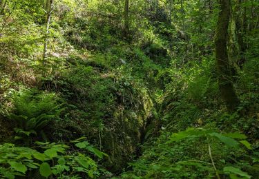
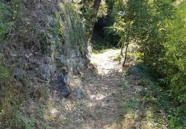
Il fait chaud mais le sentiers est en majorité sous les buis donc c'est supportable....en Septembre.
Ort
Kommentare
Touren in der Umgebung
![Tour Wandern Saint-Jean-du-Gard - rocher des chèvres - Photo](https://media.geolcdn.com/t/375/260/f651fafb-b1d1-4725-b624-a9394b90fcdc.jpg&format=jpg&maxdim=2)
![Wandern Wandern](https://static1.geolcdn.com/sitytour/trail-icons/101.png)
Wandern
![](/images/other/stat-length.png)
![](https://static1.geolcdn.com/siteimages/upload/files/16400158638029165_repeat_loop_refresh_sync_direction_icon.png)
![Tour Wandern Saint-Jean-du-Gard - Signal Saint Pierre - Photo](https://media.geolcdn.com/t/375/260/c97a240b-eff8-49fc-8022-a55a2f6c33fc.jpg&format=jpg&maxdim=2)
![Wandern Wandern](https://static1.geolcdn.com/sitytour/trail-icons/101.png)
Wandern
![](/images/other/stat-length.png)
![](https://static1.geolcdn.com/siteimages/upload/files/16400158638029165_repeat_loop_refresh_sync_direction_icon.png)
![Tour Wandern Peyrolles - la Diligence - Photo](https://media.geolcdn.com/t/375/260/586b4281-ee2f-4585-9155-506814e7d72d.jpg&format=jpg&maxdim=2)
![Wandern Wandern](https://static1.geolcdn.com/sitytour/trail-icons/101.png)
![Tour Wandern Saint-Jean-du-Gard - visite st jean du gard et de son train en attendant le bus pour Ales 1.50 - Photo](https://media.geolcdn.com/t/375/260/2380748b-87d2-4535-be2e-274dea353d02.jpg&format=jpg&maxdim=2)
![Wandern Wandern](https://static1.geolcdn.com/sitytour/trail-icons/101.png)
Wandern
![](/images/other/stat-length.png)
![](https://static1.geolcdn.com/siteimages/upload/files/16400158638029165_repeat_loop_refresh_sync_direction_icon.png)
![Tour Wandern Saint-Jean-du-Gard - 17-05-2023 E12 Saint Jean du Gard - Ales - Photo](https://media.geolcdn.com/t/375/260/1d8b4717-c204-41b3-a27c-5a1aef561e2f.jpg&format=jpg&maxdim=2)
![Wandern Wandern](https://static1.geolcdn.com/sitytour/trail-icons/101.png)
Wandern
![](/images/other/stat-length.png)
![](https://static1.geolcdn.com/siteimages/upload/files/16400158638029165_repeat_loop_refresh_sync_direction_icon.png)
![Tour Wandern Soudorgues - La Vallée Borgne - Photo](https://media.geolcdn.com/t/375/260/fc66911e-f8e1-402c-a199-faceb474f5bb.jpg&format=jpg&maxdim=2)
![Wandern Wandern](https://static1.geolcdn.com/sitytour/trail-icons/101.png)
Wandern
![](/images/other/stat-length.png)
![](https://static1.geolcdn.com/siteimages/upload/files/16400158638029165_repeat_loop_refresh_sync_direction_icon.png)
![Tour Wandern Saint-Jean-du-Gard - Col St Pierre, sentier d 'Auriol - Photo](https://media.geolcdn.com/t/375/260/09e6b908-e9c5-46fb-ad14-2e4b4e0e9d95.jpg&format=jpg&maxdim=2)
![Wandern Wandern](https://static1.geolcdn.com/sitytour/trail-icons/101.png)
Wandern
![](/images/other/stat-length.png)
![](https://static1.geolcdn.com/siteimages/upload/files/16400158638029165_repeat_loop_refresh_sync_direction_icon.png)
![Tour Wandern Saint-Jean-du-Gard - St jean du Gard - grotte de Rouville - Photo](https://media.geolcdn.com/t/375/260/96eb88ec-8c4a-47e5-95aa-608a80f25826.jpg&format=jpg&maxdim=2)
![Wandern Wandern](https://static1.geolcdn.com/sitytour/trail-icons/101.png)
Wandern
![](/images/other/stat-length.png)
![](https://static1.geolcdn.com/siteimages/upload/files/16400158638029165_repeat_loop_refresh_sync_direction_icon.png)
![Tour Wandern Peyrolles - gorges du Soucy Mont Brion Vallée Obscure - Photo](https://media.geolcdn.com/t/375/260/3f9cbe11-d175-4ae0-83b7-0dea456abff6.jpg&format=jpg&maxdim=2)
![Wandern Wandern](https://static1.geolcdn.com/sitytour/trail-icons/101.png)
Wandern
![](/images/other/stat-length.png)
![](https://static1.geolcdn.com/siteimages/upload/files/16400158638029165_repeat_loop_refresh_sync_direction_icon.png)