


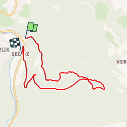

15,9 km | 21 km-effort

Benutzer GUIDE


Kostenlosegpshiking-Anwendung
 SityTrail
IGN / Geografische Institute
SityTrail World
Die Welt öffnet sich für Sie
Tour Wandern von 7,4 km verfügbar auf Wallonien, Lüttich, Aywaille. Diese Tour wird von Alfredy vorgeschlagen.
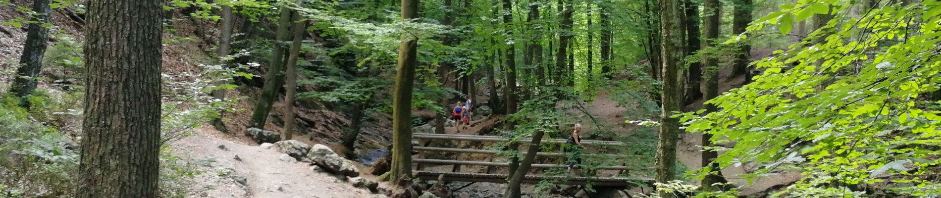
Belle randonnée mais attention pas facile de trouver une place de parking car il y a souvent beaucoup de monde du moins pendant les congés.


Wandern


Wandern

Wandern

Wandern

Wandern

Wandern

Wandern

Wandern