


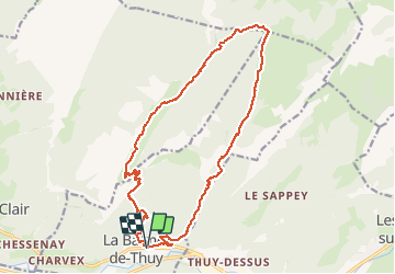

8,3 km | 19,8 km-effort

Benutzer GUIDE


Kostenlosegpshiking-Anwendung
 SityTrail
IGN / Geografische Institute
SityTrail World
Die Welt öffnet sich für Sie
Tour Wandern von 19,1 km verfügbar auf Auvergne-Rhone-Alpen, Hochsavoyen, La Balme-de-Thuy. Diese Tour wird von Kargil vorgeschlagen.
Grand tour entre La Balme de Thuy et les Glières.
A déconseiller par sentier humide.
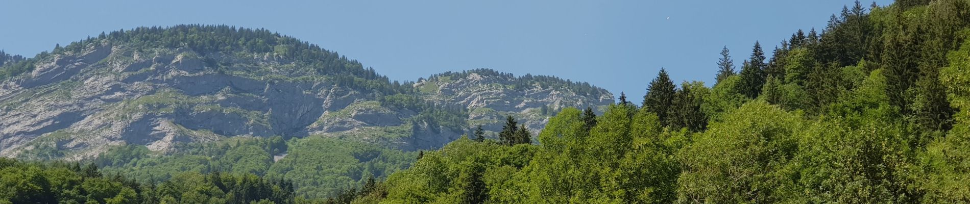
Superbe vue sur La Tournette et les Dents de Lanfon.


Wandern

Wandern

Wandern

Wandern
Wandern
Wandern
Zu Fuß
Wandern

Wandern