


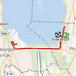

6,6 km | 13,7 km-effort


Benutzer


Kostenlosegpshiking-Anwendung
 SityTrail
IGN / Geografische Institute
SityTrail World
Die Welt öffnet sich für Sie
Tour Wandern von 7,6 km verfügbar auf Auvergne-Rhone-Alpen, Savoyen, Viviers-du-Lac. Diese Tour wird von cavpsy74 vorgeschlagen.
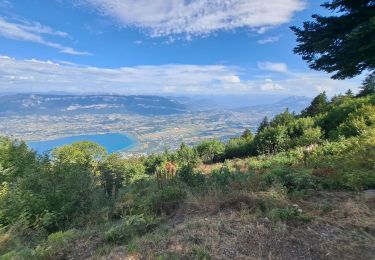
Ballade familiale au bord du Lac du Bourget, sans difficulté. Le domaine de Buttet est un beau lieu dans les marais du bout du Lac, on y trouve, outre les ruines du château, un poste d'observation ornithologique.

Wandern
Mountainbike

Wandern
Wandern

Klettersteig


sport
Wandern

Wandern
Wandern