


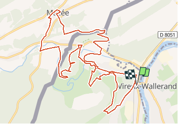


14,8 km | 21 km-effort


Benutzer


Kostenlosegpshiking-Anwendung
 SityTrail
IGN / Geografische Institute
SityTrail World
Die Welt öffnet sich für Sie
Tour Mountainbike von 14,4 km verfügbar auf Großer Osten, Ardennes, Vireux-Molhain. Diese Tour wird von tracegps vorgeschlagen.
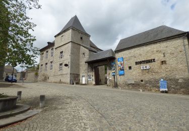
Par monts et vallées, la randonnée rencontre des points de vue exceptionnels sur la vallée du Viroin, la grande forêt des Ardennes Franco-Belges, la forêt de Thiérache et le site fortifié du Mont-Vireux. Départ: Eglise de Vireux-Molhain.


Wandern

Wandern

Wandern

Wandern

Wandern

Wandern
Zu Fuß
Zu Fuß