![](/images/other/stat-length.png)
![Tour Wandern Les Sables-d'Olonne - Forêt et Marais au Pays des Olonnes - Photo](https://media.geolcdn.com/t/1900/400/ext.pjpeg?maxdim=2&url=https%3A%2F%2Fservices.sitytrail.com%2FGeolivesWS%2FDownloadMedia.ashx%3FTrailID%3D191330%26Media%3D14886_5.jpg)
Forêt et Marais au Pays des Olonnes
tracegps
Benutzer
![Länge](/images/other/stat-length.png)
![Maximale Höhe](https://static1.geolcdn.com/siteimages/upload/files/1508320355ic_sort_altitude_max_24dp.png)
![Positive Höhendifferenz](https://static1.geolcdn.com/siteimages/upload/files/1508320355ic_sort_den_pos_24dp.png)
![Km-Effort](/images/other/stat-length.png)
![Min. Höhe](https://static1.geolcdn.com/siteimages/upload/files/1508320355ic_sort_altitude_min_24dp.png)
![Negative Höhendifferenz](https://static1.geolcdn.com/siteimages/upload/files/1508320355ic_sort_den_neg_24dp.png)
![Boucle](https://static1.geolcdn.com/siteimages/upload/files/16400158638029165_repeat_loop_refresh_sync_direction_icon.png)
![Wandern](https://static1.geolcdn.com/sitytour/trail-icons/101.png)
3h30
Schwierigkeit : Medium
![Scannen Sie diesen QR-Code, um die Tour in der SityTrail-Anwendung zu öffnen](https://capi.geolives.com/qq0zvz2zws4bq2lad0pu/sitytour/trails/191330/qr.png?size=200)
Kostenlosegpshiking-Anwendung
Über SityTrail
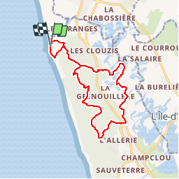
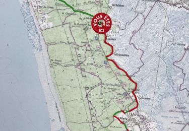
Tour Wandern von 15,3 km verfügbar auf Pays de la Loire, Vendée, Les Sables-d'Olonne. Diese Tour wird von tracegps vorgeschlagen.
Beschreibung
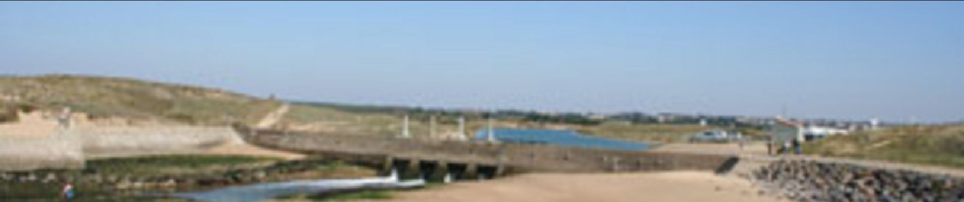
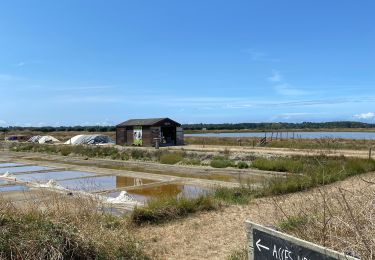
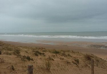
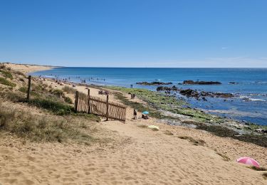
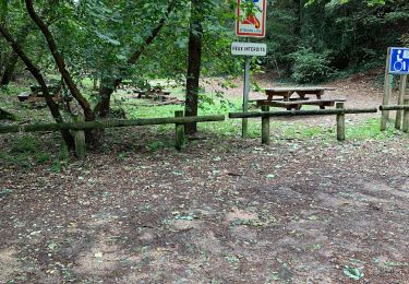
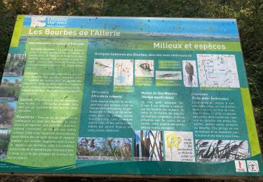
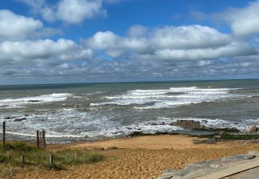
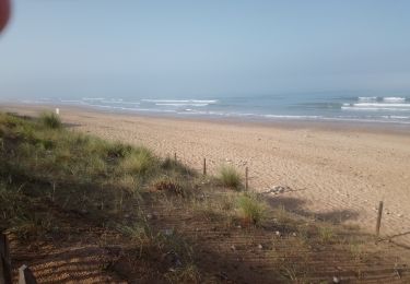
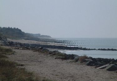
Départ du parking du Hâvre de la Gachère. C'est ici que se termine la rivière Auzance. Elle finie sa course après avoir passé les écluses qui régulent l'apport d'eau en fonction de la marée (pour les besoins des ostréiculteurs et des marais d'élevage). Suivez le fléchage du GR8 en direction de la dune et déjà vous appréciez les grands espaces avant de pénétrer dans la forêt domaniale. Elle est bordée à l'Ouest par la longue plage et les rochers baignés par l'océan Atlantique et à l'Est par le marais d'Olonne. Cette forêt couvre près de 1000ha. Vous atteignez ensuite le marais. Séparé de l'océan par la forêt domaniale ce marais abrite une avifaune d'une très grande richesse. Vous pourrez la découvrir depuis l'observatoire de la réserve (en présence d'un naturaliste) ou en participant aux visites guidées organisées par l'ADEV. Enfin vous reviendrez par la forêt. Bonne balade à tous.
Ort
Kommentare
Touren in der Umgebung
![Tour Wandern L'Île-d'Olonne - Sentier la fleur de sel - Photo](https://media.geolcdn.com/t/375/260/1ccf5a45-c40a-4459-b03e-737e931f1f29.jpg&format=jpg&maxdim=2)
![Wandern Wandern](https://static1.geolcdn.com/sitytour/trail-icons/101.png)
Wandern
![](/images/other/stat-length.png)
![](https://static1.geolcdn.com/siteimages/upload/files/16400158638029165_repeat_loop_refresh_sync_direction_icon.png)
![Tour Andere Aktivitäten Les Sables-d'Olonne - rando Dudu 05-01-2019 - Photo](https://media.geolcdn.com/t/375/260/ext.jpg?maxdim=2&url=https%3A%2F%2Fservices.sitytrail.com%2FGeolivesWS%2FDownloadMedia.ashx%3FTrailID%3D1092695%26Media%3D20190105170235.jpg)
![Andere Aktivitäten Andere Aktivitäten](https://static1.geolcdn.com/sitytour/trail-icons/900.png)
Andere Aktivitäten
![](/images/other/stat-length.png)
![](https://static1.geolcdn.com/siteimages/upload/files/16400158638029165_repeat_loop_refresh_sync_direction_icon.png)
![Tour Andere Aktivitäten Les Sables-d'Olonne - vert olonne - Photo](https://media.geolcdn.com/t/375/260/ext.jpg?maxdim=2&url=https%3A%2F%2Fservices.sitytrail.com%2FGeolivesWS%2FDownloadMedia.ashx%3FTrailID%3D684620%26Media%3Dfix__20170115104246.jpg)
![Andere Aktivitäten Andere Aktivitäten](https://static1.geolcdn.com/sitytour/trail-icons/900.png)
Andere Aktivitäten
![](/images/other/stat-length.png)
![](https://static1.geolcdn.com/siteimages/upload/files/16400158638029165_repeat_loop_refresh_sync_direction_icon.png)
![Tour Wandern Les Sables-d'Olonne - Vendée_Sables-d'Olonne_Plage_de_Sauveterre - Photo](https://media.geolcdn.com/t/375/260/c681cc1a-daed-4477-9ef7-8159f743e858.jpg&format=jpg&maxdim=2)
![Wandern Wandern](https://static1.geolcdn.com/sitytour/trail-icons/101.png)
Wandern
![](/images/other/stat-length.png)
![](https://static1.geolcdn.com/siteimages/upload/files/16400158638029165_repeat_loop_refresh_sync_direction_icon.png)
![Tour Wandern Les Sables-d'Olonne - Didi tanbouille - Photo](https://media.geolcdn.com/t/375/260/fe2891ef-a20d-4463-b030-d3d920b96253.jpg&format=jpg&maxdim=2)
![Wandern Wandern](https://static1.geolcdn.com/sitytour/trail-icons/101.png)
Wandern
![](/images/other/stat-length.png)
![](https://static1.geolcdn.com/siteimages/upload/files/16400158638029165_repeat_loop_refresh_sync_direction_icon.png)
![Tour Wandern Les Sables-d'Olonne - Sentier Les Bourbes - Photo](https://media.geolcdn.com/t/375/260/16dadf7e-c56c-4289-a0bb-7fcf5a98618e.jpg&format=jpg&maxdim=2)
![Wandern Wandern](https://static1.geolcdn.com/sitytour/trail-icons/101.png)
Wandern
![](/images/other/stat-length.png)
![](https://static1.geolcdn.com/siteimages/upload/files/16400158638029165_repeat_loop_refresh_sync_direction_icon.png)
![Tour Wandern Les Sables-d'Olonne - Circuit Champclou - Photo](https://media.geolcdn.com/t/375/260/1ce1689f-b1d5-4eb7-bc94-9b3b713436b7.jpg&format=jpg&maxdim=2)
![Wandern Wandern](https://static1.geolcdn.com/sitytour/trail-icons/101.png)
Wandern
![](/images/other/stat-length.png)
![](https://static1.geolcdn.com/siteimages/upload/files/16400158638029165_repeat_loop_refresh_sync_direction_icon.png)
![Tour Wandern Les Sables-d'Olonne - forêt D'olonne - Photo](https://media.geolcdn.com/t/375/260/a7d239c8-2f98-46a5-8087-995154c69e99.jpg&format=jpg&maxdim=2)
![Wandern Wandern](https://static1.geolcdn.com/sitytour/trail-icons/101.png)
Wandern
![](/images/other/stat-length.png)
![](https://static1.geolcdn.com/siteimages/upload/files/16400158638029165_repeat_loop_refresh_sync_direction_icon.png)
![Tour Rollerblading Les Sables-d'Olonne - Brem sur Mer à St Gilles Croix de Vie - Photo](https://media.geolcdn.com/t/375/260/ext.jpg?maxdim=2&url=https%3A%2F%2Fservices.sitytrail.com%2FGeolivesWS%2FDownloadMedia.ashx%3FTrailID%3D100762%26Media%3D273_2.jpg)
![Rollerblading Rollerblading](https://static1.geolcdn.com/sitytour/trail-icons/901.png)
Rollerblading
![](/images/other/stat-length.png)
![](https://static1.geolcdn.com/siteimages/upload/files/16400158638029165_repeat_loop_refresh_sync_direction_icon.png)