![](/images/other/stat-length.png)
![Tour Wandern Ulflingen - Boucle transfrontalière - Tronçon 2 - Troisvierges - Hoffelt - Photo](https://media.geolcdn.com/t/1900/400/ext.pjpeg?maxdim=2&url=https%3A%2F%2Fservices.sitytrail.com%2FGeolivesWS%2FDownloadMedia.ashx%3FTrailID%3D186892%26Media%3D82cf5866-78f3-4c0e-9740-e2c3edde4efe.jpg)
Boucle transfrontalière - Tronçon 2 - Troisvierges - Hoffelt
Escapardenne
Escapardenne, évadez-vous du quotidien GUIDE+
![Länge](/images/other/stat-length.png)
![Maximale Höhe](https://static1.geolcdn.com/siteimages/upload/files/1508320355ic_sort_altitude_max_24dp.png)
![Positive Höhendifferenz](https://static1.geolcdn.com/siteimages/upload/files/1508320355ic_sort_den_pos_24dp.png)
![Km-Effort](/images/other/stat-length.png)
![Min. Höhe](https://static1.geolcdn.com/siteimages/upload/files/1508320355ic_sort_altitude_min_24dp.png)
![Negative Höhendifferenz](https://static1.geolcdn.com/siteimages/upload/files/1508320355ic_sort_den_neg_24dp.png)
![Boucle](https://static1.geolcdn.com/siteimages/upload/files/16400158638029165_repeat_loop_refresh_sync_direction_icon.png)
![Wandern](https://static1.geolcdn.com/sitytour/trail-icons/101.png)
--
Schwierigkeit : Unbekannt
![Scannen Sie diesen QR-Code, um die Tour in der SityTrail-Anwendung zu öffnen](https://capi.geolives.com/qq0zvz2zws4bq2lad0pu/sitytour/trails/186892/qr.png?size=200)
Kostenlosegpshiking-Anwendung
Über SityTrail
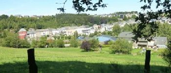
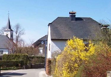
Tour Wandern von 15,4 km verfügbar auf Unbekannt, Kanton Clerf, Ulflingen. Diese Tour wird von Escapardenne vorgeschlagen.
Beschreibung
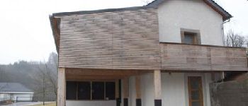
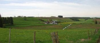
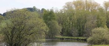
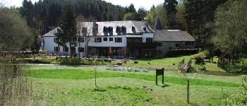
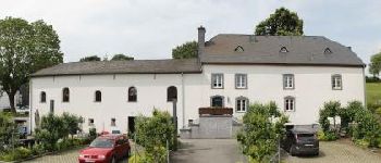
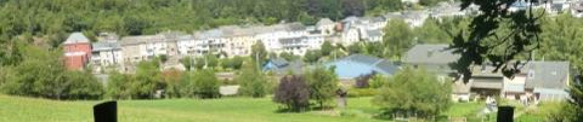
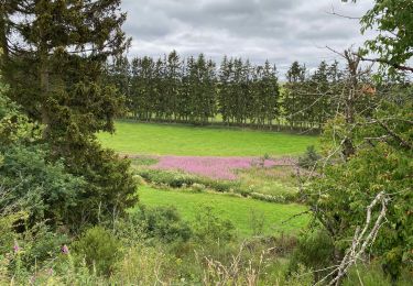
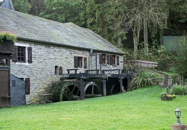
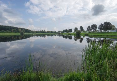
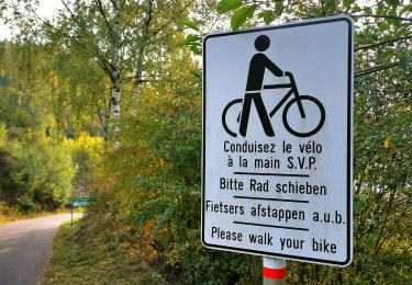
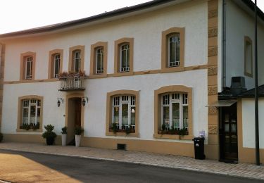
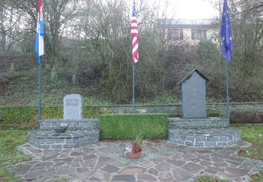
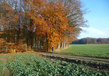
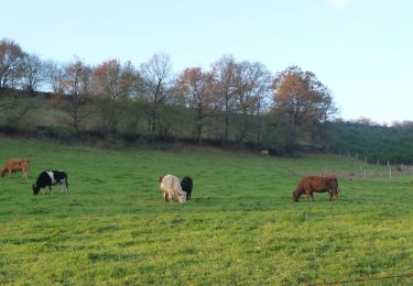
Tronçon 2 de la boucle transfrontalière "Entre Meuse et Rhin" (55km)Au départ de la gare de Gouvy, la randonnée suit le sentier qui mène à Ourthe et à Wathermal, lieux de sources où nait l''Ourthe Orientale. Le parcours traverse le village puis, en même temps que la frontière, franchit la ligne de partage des eaux entre bassin de la Meuse et bassin du Rhin. Le chemin mène à Troisvierges. A travers de superbes zones de nature, elle met le cap vers le moulin d''Asselborn et continue à serpenter dans la vallée. A nouveau, la frontière... Les villages belges de Steinbach et de Rettigny, bien préservés, attendent le randonneur. Le dernier sentier court dans la vallée de l''Ourthe, encore très naturelle et déjà Gouvy est en vue. C''est la fin de la boucle...
Ort
Kommentare
Touren in der Umgebung
![Tour Wandern Ulflingen - Boucle Entre Woltz et Our - Tronçon 1 - Troisvierges - Weiswampach - Photo](https://media.geolcdn.com/t/375/260/ext.jpg?maxdim=2&url=https%3A%2F%2Fservices.sitytrail.com%2FGeolivesWS%2FDownloadMedia.ashx%3FTrailID%3D186885%26Media%3Ddf1dbdd6-bafa-4baa-8694-c7fed5adc463.jpg)
![Wandern Wandern](https://static1.geolcdn.com/sitytour/trail-icons/101.png)
Wandern
![](/images/other/stat-length.png)
![](https://static1.geolcdn.com/siteimages/upload/files/16400158638029165_repeat_loop_refresh_sync_direction_icon.png)
![Tour Wandern Wintger - Escapardenne Eisleck Trail: Moulin d'Asselborn - Houffalize - Photo](https://media.geolcdn.com/t/375/260/92df795c-9ebe-4619-8d75-350f07c2d083.jpeg&format=jpg&maxdim=2)
![Wandern Wandern](https://static1.geolcdn.com/sitytour/trail-icons/101.png)
Wandern
![](/images/other/stat-length.png)
![](https://static1.geolcdn.com/siteimages/upload/files/16400158638029165_repeat_loop_refresh_sync_direction_icon.png)
![Tour Zu Fuß Wintger - Auto Pedestre Boxhorn - Photo](https://media.geolcdn.com/t/375/260/6e89663e-cdc4-4290-9137-b9abc28300a9.jpeg&format=jpg&maxdim=2)
![Zu Fuß Zu Fuß](https://static1.geolcdn.com/sitytour/trail-icons/100.png)
Zu Fuß
![](/images/other/stat-length.png)
![](https://static1.geolcdn.com/siteimages/upload/files/16400158638029165_repeat_loop_refresh_sync_direction_icon.png)
![Tour Zu Fuß Ulflingen - Conzefenn Naturpad - Photo](https://media.geolcdn.com/t/375/260/95fce115-4cfa-47f4-9bf4-72a395ed37cc.jpeg&format=jpg&maxdim=2)
![Zu Fuß Zu Fuß](https://static1.geolcdn.com/sitytour/trail-icons/100.png)
Zu Fuß
![](/images/other/stat-length.png)
![](https://static1.geolcdn.com/siteimages/upload/files/16400158638029165_repeat_loop_refresh_sync_direction_icon.png)
![Tour Zu Fuß Wintger - Troisvierges A - Photo](https://media.geolcdn.com/t/375/260/f03936ea-0eaf-4722-82d1-ed4aa67af3f4.jpeg&format=jpg&maxdim=2)
![Zu Fuß Zu Fuß](https://static1.geolcdn.com/sitytour/trail-icons/100.png)
Zu Fuß
![](/images/other/stat-length.png)
![](https://static1.geolcdn.com/siteimages/upload/files/16400158638029165_repeat_loop_refresh_sync_direction_icon.png)
![Tour Zu Fuß Ulflingen - Village de Resistance - Photo](https://media.geolcdn.com/t/375/260/fce2c022-6c40-4b95-aaa5-9116df691b2d.jpeg&format=jpg&maxdim=2)
![Zu Fuß Zu Fuß](https://static1.geolcdn.com/sitytour/trail-icons/100.png)
Zu Fuß
![](/images/other/stat-length.png)
![](https://static1.geolcdn.com/siteimages/upload/files/16400158638029165_repeat_loop_refresh_sync_direction_icon.png)
![Tour Zu Fuß Ulflingen - Cornelysmillen Pfad - Photo](https://media.geolcdn.com/t/375/260/24f696c2-c09b-4c50-a806-71835cb8e583.jpeg&format=jpg&maxdim=2)
![Zu Fuß Zu Fuß](https://static1.geolcdn.com/sitytour/trail-icons/100.png)
Zu Fuß
![](/images/other/stat-length.png)
![](https://static1.geolcdn.com/siteimages/upload/files/16400158638029165_repeat_loop_refresh_sync_direction_icon.png)
![Zu Fuß Zu Fuß](https://static1.geolcdn.com/sitytour/trail-icons/100.png)
Zu Fuß
![](/images/other/stat-length.png)
![](https://static1.geolcdn.com/siteimages/upload/files/16400158638029165_repeat_loop_refresh_sync_direction_icon.png)
![Zu Fuß Zu Fuß](https://static1.geolcdn.com/sitytour/trail-icons/100.png)
Zu Fuß
![](/images/other/stat-length.png)
![](https://static1.geolcdn.com/siteimages/upload/files/16400158638029165_repeat_loop_refresh_sync_direction_icon.png)