


6,7 km | 8,5 km-effort


Benutzer


Kostenlosegpshiking-Anwendung
 SityTrail
IGN / Geografische Institute
SityTrail World
Die Welt öffnet sich für Sie
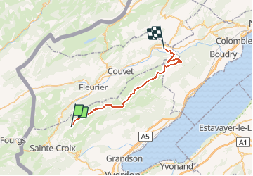
Tour Andere Aktivitäten von 28 km verfügbar auf Waadt, District du Jura-Nord vaudois, Bullet. Diese Tour wird von Romrando vorgeschlagen.
Source:geocities.com/romrando
Superbe échappée d''un week-end quand le brouillard occulte la plaine. Terrain assez sauvage sur la 2ème partie.
Du sommet du Chasseron, suivre la crête puis après environ 500 m puis basculer à gauche (assez raide ) pour gagner un petit plateau. Traverser celui-ci en restant sur sa droite et rejoindre la "Grandsonne-Dessus" puis à travers une forêt clairsemée vers l''ENE (orientation difficile par mauvais temps) rejoindre une grande combe où l''on croise une route (non déneigée).
Suivre cette combe vers le NE, passer aux "Cernets-Dessus" puis rejoindre la forêt. Descendre d''abord le fond de la combe puis dès que possible (après environ 50 m) prendre sur la gauche un chemin forestier d''abord en légère montée puis qui descend sur 1 km jusqu''à une croisée.
Revenir alors à droite et rejoindre le fond du vallon. Descendre celui-ci sur 500 m puis prendre sur la droite une route qui mène à plat vers la ferme de "La Vaux". Suivre cette route sur 2 km environ et prendre à gauche un sentier (peu visible) qui contourne une vague colline (Point 1303 m) et rejoindre "La Combe".
De là on va rejoindre puis suivre une vague crête vers le NE jusqu''au Creux du Van (le plus souvent tracé à la machine mais en cas de mauvais temps l''orientation est vraiment difficile et le terrain très exposé au vent !) en passant plus ou moins à l''E des "Prises Gaille", puis "Vers chez Amiet", les "Petites Fauconnières".
De là quitter les traces vers l''E pour rejoindre "La Baronne" puis gagner au N le Creux du Van. Suivre son rebord vers l''E puis rejoindre la combe qui mène à "La Grand Vy". Suivre une petite route forestière ENE sur 1 km jusqu''à une croisée. Prendre à gauche une autre route vers le NW puis l''W qui vous ramène en descente douce au fond du cirque du Creux du Van puis à la "Ferme Robert".
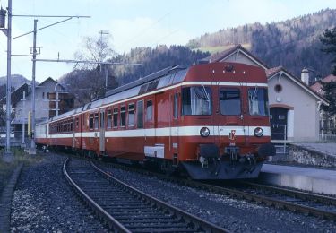
De là à pied jusqu''à la gare de Noiraigue. Retour en train par Neuchâtel sur Yverdon.
Zu Fuß
Zu Fuß
Zu Fuß

Zu Fuß

Zu Fuß

Wandern

Zu Fuß
Zu Fuß

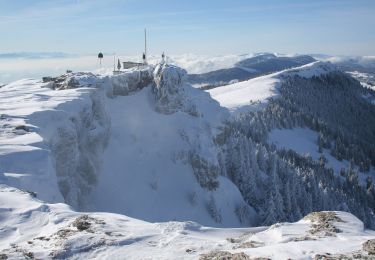
Schneeschuhwandern