


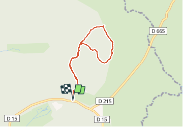

11 km | 15,4 km-effort


Benutzer


Kostenlosegpshiking-Anwendung
 SityTrail
IGN / Geografische Institute
SityTrail World
Die Welt öffnet sich für Sie
Tour Wandern von 3,5 km verfügbar auf Okzitanien, Aveyron, Laguiole. Diese Tour wird von tracegps vorgeschlagen.
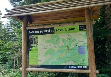
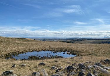
Le circuit botanique de Laguiole est un circuit pédestre très facile sur le plateau de l'Aubrac. Le parcours est bien indiqué et le sentier est facile à suivre même en hiver avec la neige. Vous pourrez trouver une description plus précise sur randozone.com.

Wandern

Wandern
Wandern

Wandern
Wandern
Wandern

Wandern
Wandern