![](/images/other/stat-length.png)
![Tour Wandern Châtel-Montagne - Autour du mont Aigu - Châtel-Montagne - Photo](https://media.geolcdn.com/t/1900/400/ext.pjpeg?maxdim=2&url=https%3A%2F%2Fservices.sitytrail.com%2FGeolivesWS%2FDownloadMedia.ashx%3FTrailID%3D172958%26Media%3D14440_1.jpg)
Autour du mont Aigu - Châtel-Montagne
tracegps
Benutzer
![Länge](/images/other/stat-length.png)
Länge
14 km
![Maximale Höhe](https://static1.geolcdn.com/siteimages/upload/files/1508320355ic_sort_altitude_max_24dp.png)
Maximale Höhe
538 m
![Positive Höhendifferenz](https://static1.geolcdn.com/siteimages/upload/files/1508320355ic_sort_den_pos_24dp.png)
Positive Höhendifferenz
438 m
![Km-Effort](/images/other/stat-length.png)
Km-Effort
19,9 km
![Min. Höhe](https://static1.geolcdn.com/siteimages/upload/files/1508320355ic_sort_altitude_min_24dp.png)
Min. Höhe
361 m
![Negative Höhendifferenz](https://static1.geolcdn.com/siteimages/upload/files/1508320355ic_sort_den_neg_24dp.png)
Negative Höhendifferenz
438 m
![Boucle](https://static1.geolcdn.com/siteimages/upload/files/16400158638029165_repeat_loop_refresh_sync_direction_icon.png)
Boucle
Ja
Erstellungsdatum :
2014-12-10 00:00:00.0
Letzte Änderung :
2014-12-10 00:00:00.0
![Wandern](https://static1.geolcdn.com/sitytour/trail-icons/101.png)
4h00
Schwierigkeit : Schwierig
![Scannen Sie diesen QR-Code, um die Tour in der SityTrail-Anwendung zu öffnen](https://capi.geolives.com/qq0zvz2zws4bq2lad0pu/sitytour/trails/172958/qr.png?size=200)
Kostenlosegpshiking-Anwendung
Über SityTrail
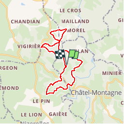
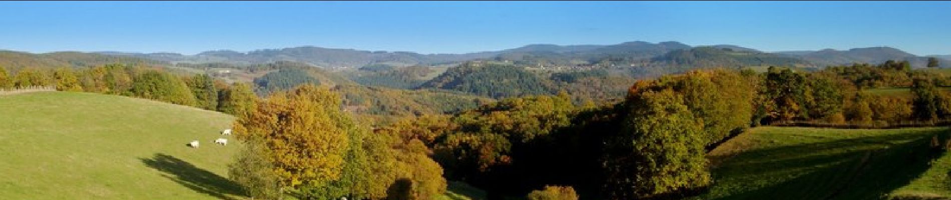
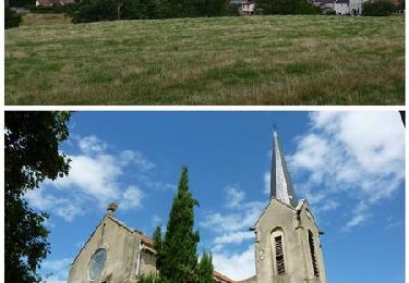
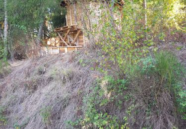
Tour Wandern von 14 km verfügbar auf Auvergne-Rhone-Alpen, Allier, Châtel-Montagne. Diese Tour wird von tracegps vorgeschlagen.
Beschreibung
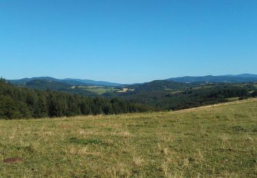
Départs possibles depuis "chez Gade" ou "Landier" ou "Baratin". Montée difficile depuis la route du barrage à "Charnant". Eviter ce circuit en période de chasse. Circuit ombragé qui peut être pratiqué par forte chaleur.
Ort
Land:
France
Region :
Auvergne-Rhone-Alpen
Abteilung/Provinz :
Allier
Kommune :
Châtel-Montagne
Standort:
Unknown
Gehen Sie:(Dec)
Gehen Sie:(UTM)
551136 ; 5108363 (31T) N.
Kommentare
Touren in der Umgebung
![Tour Mountainbike Isserpent - VTT à Isserpent - Photo](https://media.geolcdn.com/t/375/260/ext.jpg?maxdim=2&url=https%3A%2F%2Fservices.sitytrail.com%2FGeolivesWS%2FDownloadMedia.ashx%3FTrailID%3D106779%26Media%3D11466_6.jpg)
![Mountainbike Mountainbike](https://static1.geolcdn.com/sitytour/trail-icons/202.png)
VTT à Isserpent
Mountainbike
Sehr schwierig
(1)
Isserpent,
Auvergne-Rhone-Alpen,
Allier,
France
![](/images/other/stat-length.png)
42 km | 56 km-effort
3h 30min
![](https://static1.geolcdn.com/siteimages/upload/files/16400158638029165_repeat_loop_refresh_sync_direction_icon.png)
Ja
![Tour Laufen Châtel-Montagne - jour 7 CAP Jeanot - Photo](https://media.geolcdn.com/t/375/260/8a698184-4193-4775-82fc-8cbe0040237c.jpg&format=jpg&maxdim=2)
![Laufen Laufen](https://static1.geolcdn.com/sitytour/trail-icons/103.png)
jour 7 CAP Jeanot
Laufen
Sehr leicht
Châtel-Montagne,
Auvergne-Rhone-Alpen,
Allier,
France
![](/images/other/stat-length.png)
33 km | 43 km-effort
4h 29min
![](https://static1.geolcdn.com/siteimages/upload/files/16400158638029165_repeat_loop_refresh_sync_direction_icon.png)
Nein
![Tour Wandern Châtel-Montagne - Le Puy du Roc - Châtel-Montagne - Photo](https://media.geolcdn.com/t/375/260/ext.jpg?maxdim=2&url=https%3A%2F%2Fservices.sitytrail.com%2FGeolivesWS%2FDownloadMedia.ashx%3FTrailID%3D173073%26Media%3D14605_6.jpg)
![Wandern Wandern](https://static1.geolcdn.com/sitytour/trail-icons/101.png)
Le Puy du Roc - Châtel-Montagne
Wandern
Medium
Châtel-Montagne,
Auvergne-Rhone-Alpen,
Allier,
France
![](/images/other/stat-length.png)
10,2 km | 15,3 km-effort
3h 0min
![](https://static1.geolcdn.com/siteimages/upload/files/16400158638029165_repeat_loop_refresh_sync_direction_icon.png)
Ja
![Tour Wandern Isserpent - Promenade des Veyles - Isserpent - Photo](https://media.geolcdn.com/t/375/260/ext.jpg?maxdim=2&url=https%3A%2F%2Fservices.sitytrail.com%2FGeolivesWS%2FDownloadMedia.ashx%3FTrailID%3D107294%26Media%3D12181_6.jpg)
![Wandern Wandern](https://static1.geolcdn.com/sitytour/trail-icons/101.png)
Promenade des Veyles - Isserpent
Wandern
Einfach
Isserpent,
Auvergne-Rhone-Alpen,
Allier,
France
![](/images/other/stat-length.png)
6 km | 7,4 km-effort
1h 30min
![](https://static1.geolcdn.com/siteimages/upload/files/16400158638029165_repeat_loop_refresh_sync_direction_icon.png)
Ja
![Tour Hybrid-Bike Châtel-Montagne - jour 7 - Photo](https://media.geolcdn.com/t/375/260/e89c6336-8612-483e-aed3-1c25fc42c2f5.jpg&format=jpg&maxdim=2)
![Hybrid-Bike Hybrid-Bike](https://static1.geolcdn.com/sitytour/trail-icons/203.png)
jour 7
Hybrid-Bike
Sehr leicht
Châtel-Montagne,
Auvergne-Rhone-Alpen,
Allier,
France
![](/images/other/stat-length.png)
27 km | 32 km-effort
2h 6min
![](https://static1.geolcdn.com/siteimages/upload/files/16400158638029165_repeat_loop_refresh_sync_direction_icon.png)
Nein
![Tour Wandern Châtel-Montagne - Balade autour du Mont Aigu - Le Moulin Chatel - Photo](https://media.geolcdn.com/t/375/260/ext.jpg?maxdim=2&url=https%3A%2F%2Fservices.sitytrail.com%2FGeolivesWS%2FDownloadMedia.ashx%3FTrailID%3D191451%26Media%3D15040_2.jpg)
![Wandern Wandern](https://static1.geolcdn.com/sitytour/trail-icons/101.png)
Balade autour du Mont Aigu - Le Moulin Chatel
Wandern
Medium
Châtel-Montagne,
Auvergne-Rhone-Alpen,
Allier,
France
![](/images/other/stat-length.png)
10,4 km | 14,1 km-effort
2h 30min
![](https://static1.geolcdn.com/siteimages/upload/files/16400158638029165_repeat_loop_refresh_sync_direction_icon.png)
Ja
![Tour Wandern Châtel-Montagne - Chatel Montagne - centrale hydroelectrique - Photo](https://media.geolcdn.com/t/375/260/ext.jpg?maxdim=2&url=https%3A%2F%2Fservices.sitytrail.com%2FGeolivesWS%2FDownloadMedia.ashx%3FTrailID%3D595718%26Media%3Db3cd818e-6b88-44c4-afd8-54f2af56cebf.jpg)
![Wandern Wandern](https://static1.geolcdn.com/sitytour/trail-icons/101.png)
Chatel Montagne - centrale hydroelectrique
Wandern
Einfach
Châtel-Montagne,
Auvergne-Rhone-Alpen,
Allier,
France
![](/images/other/stat-length.png)
11,9 km | 17,1 km-effort
3h 40min
![](https://static1.geolcdn.com/siteimages/upload/files/16400158638029165_repeat_loop_refresh_sync_direction_icon.png)
Ja
![Tour Wandern Châtel-Montagne - w-frankrijk-moulin-chatel - Photo](https://media.geolcdn.com/t/375/260/ext.jpg?maxdim=2&url=https%3A%2F%2Fstatic1.geolcdn.com%2Fsiteimages%2Fupload%2Ffiles%2F1553511878bg_sport_marche.png)
![Wandern Wandern](https://static1.geolcdn.com/sitytour/trail-icons/101.png)
w-frankrijk-moulin-chatel
Wandern
Sehr leicht
Châtel-Montagne,
Auvergne-Rhone-Alpen,
Allier,
France
![](/images/other/stat-length.png)
11,7 km | 16,9 km-effort
Unbekannt
![](https://static1.geolcdn.com/siteimages/upload/files/16400158638029165_repeat_loop_refresh_sync_direction_icon.png)
Ja
![Tour Wandern Châtel-Montagne - w-frankrijk-circuit-de-montmorillon - Photo](https://media.geolcdn.com/t/375/260/ext.jpg?maxdim=2&url=https%3A%2F%2Fstatic1.geolcdn.com%2Fsiteimages%2Fupload%2Ffiles%2F1553511878bg_sport_marche.png)
![Wandern Wandern](https://static1.geolcdn.com/sitytour/trail-icons/101.png)
w-frankrijk-circuit-de-montmorillon
Wandern
Sehr leicht
Châtel-Montagne,
Auvergne-Rhone-Alpen,
Allier,
France
![](/images/other/stat-length.png)
12,7 km | 18,7 km-effort
Unbekannt
![](https://static1.geolcdn.com/siteimages/upload/files/16400158638029165_repeat_loop_refresh_sync_direction_icon.png)
Ja