![](/images/other/stat-length.png)
![Tour Laufen Les Omergues - Sommet de Larran (1379 m) - Les Omergues - Photo](https://media.geolcdn.com/t/1900/400/ext.pjpeg?maxdim=2&url=https%3A%2F%2Fservices.sitytrail.com%2FGeolivesWS%2FDownloadMedia.ashx%3FTrailID%3D172728%26Media%3D14120_1.jpg)
Sommet de Larran (1379 m) - Les Omergues
tracegps
Benutzer
![Länge](/images/other/stat-length.png)
![Maximale Höhe](https://static1.geolcdn.com/siteimages/upload/files/1508320355ic_sort_altitude_max_24dp.png)
![Positive Höhendifferenz](https://static1.geolcdn.com/siteimages/upload/files/1508320355ic_sort_den_pos_24dp.png)
![Km-Effort](/images/other/stat-length.png)
![Min. Höhe](https://static1.geolcdn.com/siteimages/upload/files/1508320355ic_sort_altitude_min_24dp.png)
![Negative Höhendifferenz](https://static1.geolcdn.com/siteimages/upload/files/1508320355ic_sort_den_neg_24dp.png)
![Boucle](https://static1.geolcdn.com/siteimages/upload/files/16400158638029165_repeat_loop_refresh_sync_direction_icon.png)
![Laufen](https://static1.geolcdn.com/sitytour/trail-icons/103.png)
2h30
Schwierigkeit : Schwierig
![Scannen Sie diesen QR-Code, um die Tour in der SityTrail-Anwendung zu öffnen](https://capi.geolives.com/qq0zvz2zws4bq2lad0pu/sitytour/trails/172728/qr.png?size=200)
Kostenlosegpshiking-Anwendung
Über SityTrail
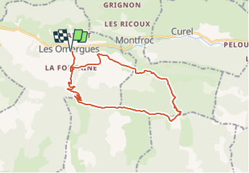
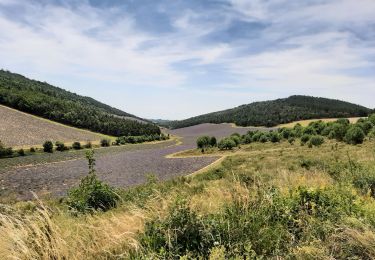
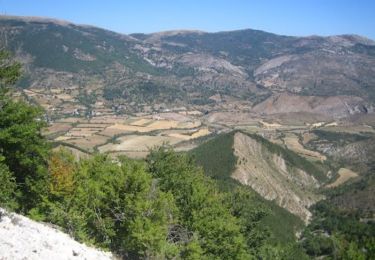
Tour Laufen von 16,8 km verfügbar auf Provence-Alpes-Côte d'Azur, Alpes-de-Haute-Provence, Les Omergues. Diese Tour wird von tracegps vorgeschlagen.
Beschreibung
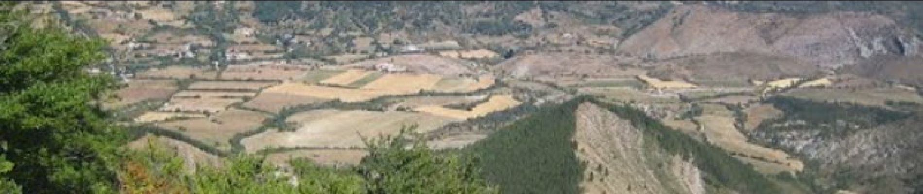
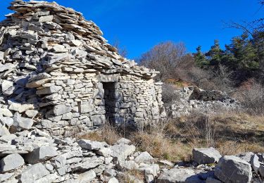
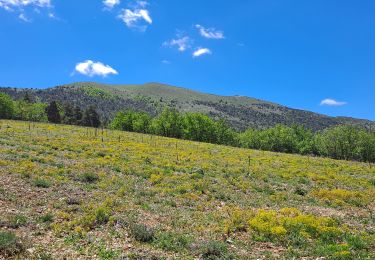
Départ des Omergues. Prendre la direction du Pas de Redortiers par le hameau "Les Fontaines". Une longue piste monte progressivement et vous amènera au sommet (1214 m). Prendre ensuite à gauche la ligne de crête pour rejoindre le Sommet de Larran (1379 m) par le GR de Pays (marquage jaune et rouge). Si vous avez le temps, faites un détour pour aller voir le Jas des Agneaux. Le GR descend jusqu'au col de la Roche (1314 m). Le suivre jusqu'au ravin de Paillar. Vous déboucherez sur une route forestière et là, prendre à gauche jusqu'au hameau de Villevieille. Suivre le PR (jaune) jusqu'au hameau des Fontaines et redescendre aux Omergues.
Ort
Kommentare
Touren in der Umgebung
![Tour Wandern Les Omergues - LES OMERGUES pas de Redortiers . Crêtes de la Faye col de la Roche. Ville o vieille - Photo](https://media.geolcdn.com/t/375/260/ext.jpg?maxdim=2&url=https%3A%2F%2Fstatic1.geolcdn.com%2Fsiteimages%2Fupload%2Ffiles%2F1553511878bg_sport_marche.png)
![Wandern Wandern](https://static1.geolcdn.com/sitytour/trail-icons/101.png)
Wandern
![](/images/other/stat-length.png)
![](https://static1.geolcdn.com/siteimages/upload/files/16400158638029165_repeat_loop_refresh_sync_direction_icon.png)
![Tour Wandern Séderon - Du Sommet du Négron au Sommet de Larran - Photo](https://media.geolcdn.com/t/375/260/49c6bfc8-8613-4acb-a0dd-7c747ab3c1fb.jpg&format=jpg&maxdim=2)
![Wandern Wandern](https://static1.geolcdn.com/sitytour/trail-icons/101.png)
Wandern
![](/images/other/stat-length.png)
![](https://static1.geolcdn.com/siteimages/upload/files/16400158638029165_repeat_loop_refresh_sync_direction_icon.png)
![Tour Wandern Montfroc - 720505 - Photo](https://media.geolcdn.com/t/375/260/b23d15a2-fdcf-4624-b2d6-0b11087cf3c9.jpg&format=jpg&maxdim=2)
![Wandern Wandern](https://static1.geolcdn.com/sitytour/trail-icons/101.png)
Wandern
![](/images/other/stat-length.png)
![](https://static1.geolcdn.com/siteimages/upload/files/16400158638029165_repeat_loop_refresh_sync_direction_icon.png)
![Tour Wandern Les Omergues - Saint André de villeseche. la pyramide du moine - Photo](https://media.geolcdn.com/t/375/260/f0d3a24b-5790-4360-ba83-c34cca9fe40d.jpg&format=jpg&maxdim=2)
![Wandern Wandern](https://static1.geolcdn.com/sitytour/trail-icons/101.png)
Wandern
![](/images/other/stat-length.png)
![](https://static1.geolcdn.com/siteimages/upload/files/16400158638029165_repeat_loop_refresh_sync_direction_icon.png)
![Tour Wandern Barret-de-Lioure - du col du negron à la pyramide du moine - Photo](https://media.geolcdn.com/t/375/260/1cd7000a-0b07-408e-a63a-e1f455a6250f.jpg&format=jpg&maxdim=2)
![Wandern Wandern](https://static1.geolcdn.com/sitytour/trail-icons/101.png)
Wandern
![](/images/other/stat-length.png)
![](https://static1.geolcdn.com/siteimages/upload/files/16400158638029165_repeat_loop_refresh_sync_direction_icon.png)
![Tour Laufen Curel - Les Chaux - Curel - Photo](https://media.geolcdn.com/t/375/260/ext.jpg?maxdim=2&url=https%3A%2F%2Fservices.sitytrail.com%2FGeolivesWS%2FDownloadMedia.ashx%3FTrailID%3D173204%26Media%3D14799_3.jpg)
![Laufen Laufen](https://static1.geolcdn.com/sitytour/trail-icons/103.png)
Laufen
![](/images/other/stat-length.png)
![](https://static1.geolcdn.com/siteimages/upload/files/16400158638029165_repeat_loop_refresh_sync_direction_icon.png)
![Tour Wandern Curel - Les Chaux - Curel - Photo](https://media.geolcdn.com/t/375/260/ext.jpg?maxdim=2&url=https%3A%2F%2Fservices.sitytrail.com%2FGeolivesWS%2FDownloadMedia.ashx%3FTrailID%3D173203%26Media%3D14799_3.jpg)
![Wandern Wandern](https://static1.geolcdn.com/sitytour/trail-icons/101.png)
Wandern
![](/images/other/stat-length.png)
![](https://static1.geolcdn.com/siteimages/upload/files/16400158638029165_repeat_loop_refresh_sync_direction_icon.png)
![Tour Wandern Séderon - Autour du col du Negron - Photo](https://media.geolcdn.com/t/375/260/d2519b62-47ac-4bae-a411-e3275e9ce84c.jpg&format=jpg&maxdim=2)
![Wandern Wandern](https://static1.geolcdn.com/sitytour/trail-icons/101.png)
Wandern
![](/images/other/stat-length.png)
![](https://static1.geolcdn.com/siteimages/upload/files/16400158638029165_repeat_loop_refresh_sync_direction_icon.png)
![Tour Pfad Les Omergues - t16315-MNT - Photo](https://media.geolcdn.com/t/375/260/a68aee12-4703-4c84-a12c-d2b13c1d04ce.jpg&format=jpg&maxdim=2)
![Pfad Pfad](https://static1.geolcdn.com/sitytour/trail-icons/104.png)
Pfad
![](/images/other/stat-length.png)
![](https://static1.geolcdn.com/siteimages/upload/files/16400158638029165_repeat_loop_refresh_sync_direction_icon.png)