![](/images/other/stat-length.png)
![Tour Wandern Freycenet-la-Cuche - Tour du Tourte - Les Estables - Photo](https://media.geolcdn.com/t/1900/400/ext.pjpeg?maxdim=2&url=https%3A%2F%2Fservices.sitytrail.com%2FGeolivesWS%2FDownloadMedia.ashx%3FTrailID%3D172618%26Media%3D13984_3.jpg)
Tour du Tourte - Les Estables
tracegps
Benutzer
![Länge](/images/other/stat-length.png)
![Maximale Höhe](https://static1.geolcdn.com/siteimages/upload/files/1508320355ic_sort_altitude_max_24dp.png)
![Positive Höhendifferenz](https://static1.geolcdn.com/siteimages/upload/files/1508320355ic_sort_den_pos_24dp.png)
![Km-Effort](/images/other/stat-length.png)
![Min. Höhe](https://static1.geolcdn.com/siteimages/upload/files/1508320355ic_sort_altitude_min_24dp.png)
![Negative Höhendifferenz](https://static1.geolcdn.com/siteimages/upload/files/1508320355ic_sort_den_neg_24dp.png)
![Boucle](https://static1.geolcdn.com/siteimages/upload/files/16400158638029165_repeat_loop_refresh_sync_direction_icon.png)
![Wandern](https://static1.geolcdn.com/sitytour/trail-icons/101.png)
3h30
Schwierigkeit : Medium
![Scannen Sie diesen QR-Code, um die Tour in der SityTrail-Anwendung zu öffnen](https://capi.geolives.com/qq0zvz2zws4bq2lad0pu/sitytour/trails/172618/qr.png?size=200)
Kostenlosegpshiking-Anwendung
Über SityTrail
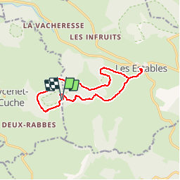
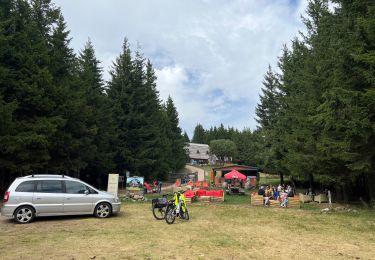
Tour Wandern von 12,7 km verfügbar auf Auvergne-Rhone-Alpen, Haute-Loire, Freycenet-la-Cuche. Diese Tour wird von tracegps vorgeschlagen.
Beschreibung
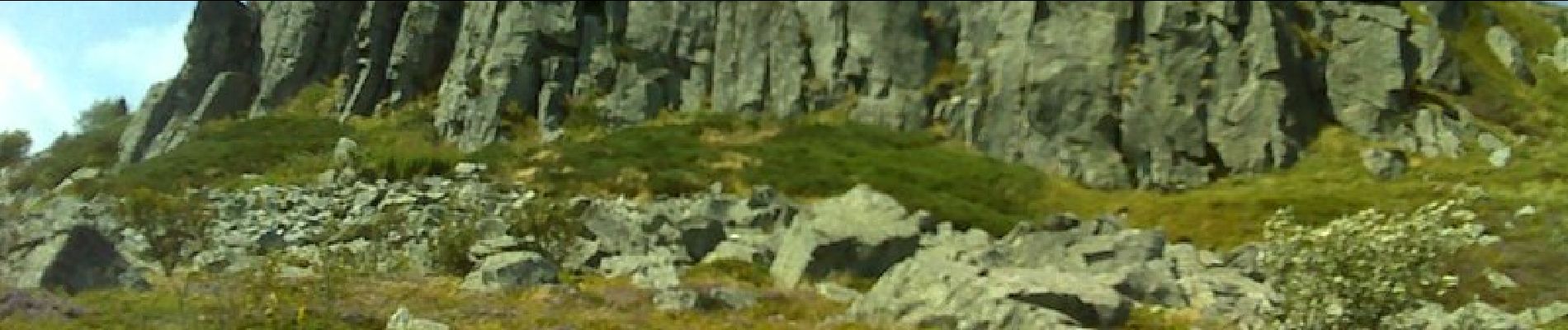
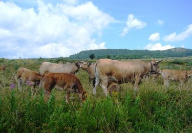
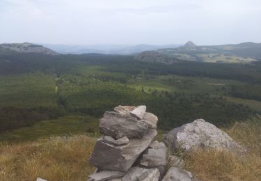
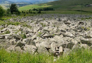
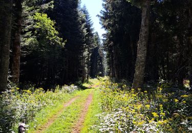
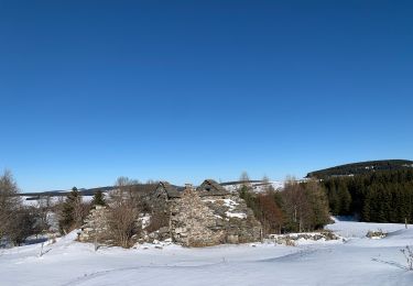
Circuit balisé autour du Rocher Tourte 1535m au travers des prairies et de la forêt. Fraîcheur, l'été, assurée... L'ascension du Mont offre une vue exceptionnelle sur la région. Un 360° sur l'Ardèche, la Haute-loire et ses principaux sommets. La nature offre ses fruits : framboises et myrtilles, cèpes et girolles.
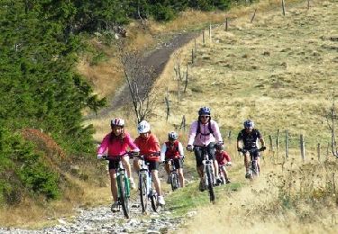
Ort
Kommentare
Touren in der Umgebung
![Tour Mountainbike Les Estables - Site VTT FFC du Mézenc et de la Loire sauvage - Circuit n° 04 - Tour du Mont Alambre - Photo](https://media.geolcdn.com/t/375/260/ext.jpg?maxdim=2&url=https%3A%2F%2Fservices.sitytrail.com%2FGeolivesWS%2FDownloadMedia.ashx%3FTrailID%3D107489%26Media%3D12434_3.jpg)
![Mountainbike Mountainbike](https://static1.geolcdn.com/sitytour/trail-icons/202.png)
Mountainbike
![](/images/other/stat-length.png)
![](https://static1.geolcdn.com/siteimages/upload/files/16400158638029165_repeat_loop_refresh_sync_direction_icon.png)
![Tour Mountainbike Les Estables - Site VTT FFC du Mézenc et de la Loire sauvage - Circuit n° 07 - Boucle en foret domaniale - Photo](https://media.geolcdn.com/t/375/260/ext.jpg?maxdim=2&url=https%3A%2F%2Fservices.sitytrail.com%2FGeolivesWS%2FDownloadMedia.ashx%3FTrailID%3D107492%26Media%3D12437_2.jpg)
![Mountainbike Mountainbike](https://static1.geolcdn.com/sitytour/trail-icons/202.png)
Mountainbike
![](/images/other/stat-length.png)
![](https://static1.geolcdn.com/siteimages/upload/files/16400158638029165_repeat_loop_refresh_sync_direction_icon.png)
![Tour Wandern Le Béage - suc du montfol et lauzière - Photo](https://media.geolcdn.com/t/375/260/d7f86ecc-e74b-4b11-a732-571b54443e1e.jpg&format=jpg&maxdim=2)
![Wandern Wandern](https://static1.geolcdn.com/sitytour/trail-icons/101.png)
Wandern
![](/images/other/stat-length.png)
![](https://static1.geolcdn.com/siteimages/upload/files/16400158638029165_repeat_loop_refresh_sync_direction_icon.png)
![Tour Wandern Les Estables - Mont Mezenc - Photo](https://media.geolcdn.com/t/375/260/ce0fbf1f-346a-43be-bffd-dfd03dc61c12.jpg&format=jpg&maxdim=2)
![Wandern Wandern](https://static1.geolcdn.com/sitytour/trail-icons/101.png)
Wandern
![](/images/other/stat-length.png)
![](https://static1.geolcdn.com/siteimages/upload/files/16400158638029165_repeat_loop_refresh_sync_direction_icon.png)
![Tour Wandern Le Béage - Le tour des cinq sucs au départ du Béage - Photo](https://media.geolcdn.com/t/375/260/c0574d3a-d54f-48f9-b08a-ab54d05d1368.jpg&format=jpg&maxdim=2)
![Wandern Wandern](https://static1.geolcdn.com/sitytour/trail-icons/101.png)
Wandern
![](/images/other/stat-length.png)
![](https://static1.geolcdn.com/siteimages/upload/files/16400158638029165_repeat_loop_refresh_sync_direction_icon.png)
![Tour Wandern Les Estables - Mont Mezenc Tour et sommet - Photo](https://media.geolcdn.com/t/375/260/fadc45c1-ba83-4e9a-a452-756f5fd46c63.jpg&format=jpg&maxdim=2)
![Wandern Wandern](https://static1.geolcdn.com/sitytour/trail-icons/101.png)
Wandern
![](/images/other/stat-length.png)
![](https://static1.geolcdn.com/siteimages/upload/files/16400158638029165_repeat_loop_refresh_sync_direction_icon.png)
![Tour Wandern Les Estables - Circuit incluant le sommet du Mezenc - Photo](https://media.geolcdn.com/t/375/260/f9b8e22d-f239-491b-8f20-19a91b900080.jpg&format=jpg&maxdim=2)
![Wandern Wandern](https://static1.geolcdn.com/sitytour/trail-icons/101.png)
Wandern
![](/images/other/stat-length.png)
![](https://static1.geolcdn.com/siteimages/upload/files/16400158638029165_repeat_loop_refresh_sync_direction_icon.png)
![Tour Skiwanderen Saint-Front - 2022 01 RANDONNÉE EN MÉZENC : descente vers Estaples puis La Croix Pecata, roche pointu, les dents du diable, traversée du Lignon. - Photo](https://media.geolcdn.com/t/375/260/a27294ef-ba71-44bb-a5e6-32e891d3fcd9.jpg&format=jpg&maxdim=2)
![Skiwanderen Skiwanderen](https://static1.geolcdn.com/sitytour/trail-icons/503.png)
Skiwanderen
![](/images/other/stat-length.png)
![](https://static1.geolcdn.com/siteimages/upload/files/16400158638029165_repeat_loop_refresh_sync_direction_icon.png)
![Tour Skiwanderen Saint-Front - 2022 01 randonnées en MEZENC : montée au Mont MEZENC et tour du Mont d’Alambre. - Photo](https://media.geolcdn.com/t/375/260/3dc38420-24e5-4489-a8ab-005c59551559.jpg&format=jpg&maxdim=2)
![Skiwanderen Skiwanderen](https://static1.geolcdn.com/sitytour/trail-icons/503.png)
Skiwanderen
![](/images/other/stat-length.png)
![](https://static1.geolcdn.com/siteimages/upload/files/16400158638029165_repeat_loop_refresh_sync_direction_icon.png)