![](/images/other/stat-length.png)
![Tour Mountainbike Douarnenez - Finistère Sud : Pointe du Raz - Douarnenez - Photo](https://media.geolcdn.com/t/1900/400/ext.pjpeg?maxdim=2&url=https%3A%2F%2Fservices.sitytrail.com%2FGeolivesWS%2FDownloadMedia.ashx%3FTrailID%3D172574%26Media%3D13941_1.jpg)
Finistère Sud : Pointe du Raz - Douarnenez
tracegps
Benutzer
![Länge](/images/other/stat-length.png)
![Maximale Höhe](https://static1.geolcdn.com/siteimages/upload/files/1508320355ic_sort_altitude_max_24dp.png)
![Positive Höhendifferenz](https://static1.geolcdn.com/siteimages/upload/files/1508320355ic_sort_den_pos_24dp.png)
![Km-Effort](/images/other/stat-length.png)
![Min. Höhe](https://static1.geolcdn.com/siteimages/upload/files/1508320355ic_sort_altitude_min_24dp.png)
![Negative Höhendifferenz](https://static1.geolcdn.com/siteimages/upload/files/1508320355ic_sort_den_neg_24dp.png)
![Boucle](https://static1.geolcdn.com/siteimages/upload/files/16400158638029165_repeat_loop_refresh_sync_direction_icon.png)
![Mountainbike](https://static1.geolcdn.com/sitytour/trail-icons/202.png)
9h00
Schwierigkeit : Medium
![Scannen Sie diesen QR-Code, um die Tour in der SityTrail-Anwendung zu öffnen](https://capi.geolives.com/qq0zvz2zws4bq2lad0pu/sitytour/trails/172574/qr.png?size=200)
Kostenlosegpshiking-Anwendung
Über SityTrail
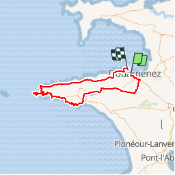
Tour Mountainbike von 92 km verfügbar auf Bretagne, Finistère, Douarnenez. Diese Tour wird von tracegps vorgeschlagen.
Beschreibung
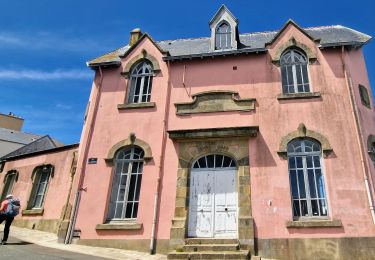
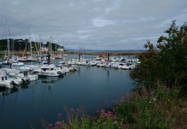
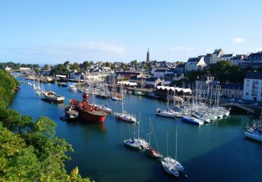
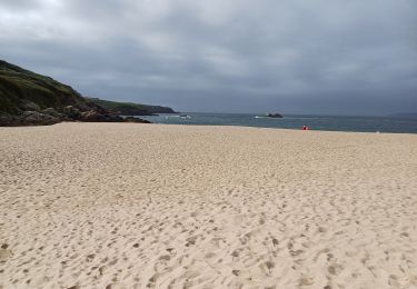
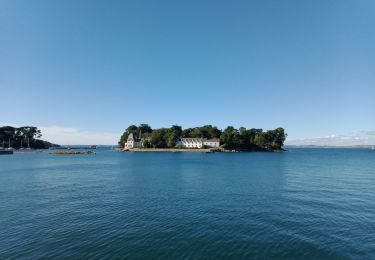
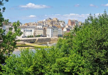
Belle rando en vtt pas très difficile (quasiment que de la route). De Douarnenez, on rejoint Pont-Croix par Pouldergat et Confort Meilars. De Pont Croix à Audierne l'estuaire du Goyen est magnifique. Un petit sentier en fait le tour très bien balisé avec la distance parcourue. De Audierne à la Pointe du Raz le sentier VTT est balisé (en vert) avec les points à visiter: remarquable. A la sortie d"Audierne, la plage de Trez Goarem est magnifique c'est l'une des plus belles plages que j'ai vue. Par contre de Pointe du Raz à Pointe du Van aucun fléchage. Grosse descente vers la Baie des Trepassés. Ensuite on a le choix entre 2 mega montées (j ai pris celle de gauche) pour arriver sur la Pointe du Van. Ensuite 25 km de route jusqu'à Douarnenez par la D7: 30 km avec le vent dans le dos, çà se fait tout seul!
Ort
Kommentare
Touren in der Umgebung
![Tour Wandern Douarnenez - Douarnenez - GR34 AR les Roches Blanches Pointe de la Jument - 9.3km 250m 3h30 - 2019 09 01 - Photo](https://media.geolcdn.com/t/375/260/ab448e69-f6b6-4c7f-80fa-8b9533bb0920.jpg&format=jpg&maxdim=2)
![Wandern Wandern](https://static1.geolcdn.com/sitytour/trail-icons/101.png)
Wandern
![](/images/other/stat-length.png)
![](https://static1.geolcdn.com/siteimages/upload/files/16400158638029165_repeat_loop_refresh_sync_direction_icon.png)
![Tour Wandern Douarnenez - TREK RCY GR34 2022 j2 Douarnenez- Beuzec - Photo](https://media.geolcdn.com/t/375/260/8fdd798e-9630-4ffb-bea5-9ee3ec61b3a8.jpg&format=jpg&maxdim=2)
![Wandern Wandern](https://static1.geolcdn.com/sitytour/trail-icons/101.png)
Wandern
![](/images/other/stat-length.png)
![](https://static1.geolcdn.com/siteimages/upload/files/16400158638029165_repeat_loop_refresh_sync_direction_icon.png)
![Tour Wandern Douarnenez - Trek RCY GR 34 2022- journée 1 Balade Douarnenez - Photo](https://media.geolcdn.com/t/375/260/e6241847-f9f8-4845-8061-377f37ea1e75.jpg&format=jpg&maxdim=2)
![Wandern Wandern](https://static1.geolcdn.com/sitytour/trail-icons/101.png)
Wandern
![](/images/other/stat-length.png)
![](https://static1.geolcdn.com/siteimages/upload/files/16400158638029165_repeat_loop_refresh_sync_direction_icon.png)
![Tour Zu Fuß Douarnenez - Le chemin de la sardine - Photo](https://media.geolcdn.com/t/375/260/9ce746a4-512e-4653-b738-0ff8fd3fd82c.jpeg&format=jpg&maxdim=2)
![Zu Fuß Zu Fuß](https://static1.geolcdn.com/sitytour/trail-icons/100.png)
Zu Fuß
![](/images/other/stat-length.png)
![](https://static1.geolcdn.com/siteimages/upload/files/16400158638029165_repeat_loop_refresh_sync_direction_icon.png)
![Tour Wandern Douarnenez - Douarnenez - GR34 du port de plaisance aux Roches Blanches - 9.7km 165m 2h30 - 2019 09 06 - Photo](https://media.geolcdn.com/t/375/260/d1eb9c88-a75c-496a-a8ef-0db250d9eb67.jpg&format=jpg&maxdim=2)
![Wandern Wandern](https://static1.geolcdn.com/sitytour/trail-icons/101.png)
Wandern
![](/images/other/stat-length.png)
![](https://static1.geolcdn.com/siteimages/upload/files/16400158638029165_repeat_loop_refresh_sync_direction_icon.png)
![Tour Wandern Douarnenez - Douarnenez - du Port Rhu - 5.8km 115m 1h45 - 2019 09 01 - Photo](https://media.geolcdn.com/t/375/260/28ac96a0-9369-40eb-a4d8-7b2ede676873.jpg&format=jpg&maxdim=2)
![Wandern Wandern](https://static1.geolcdn.com/sitytour/trail-icons/101.png)
Wandern
![](/images/other/stat-length.png)
![](https://static1.geolcdn.com/siteimages/upload/files/16400158638029165_repeat_loop_refresh_sync_direction_icon.png)
![Tour Wandern Douarnenez - GR34 Douarnenez-- Pors Peron - Photo](https://media.geolcdn.com/t/375/260/55c8cb23-826e-4476-a89b-d5fdee2975ce.jpg&format=jpg&maxdim=2)
![Wandern Wandern](https://static1.geolcdn.com/sitytour/trail-icons/101.png)
Wandern
![](/images/other/stat-length.png)
![](https://static1.geolcdn.com/siteimages/upload/files/16400158638029165_repeat_loop_refresh_sync_direction_icon.png)
![Tour Wandern Douarnenez - DOUARNENEZ - Photo](https://media.geolcdn.com/t/375/260/669ff4fd-0def-4571-a23c-23ec26be7050.jpg&format=jpg&maxdim=2)
![Wandern Wandern](https://static1.geolcdn.com/sitytour/trail-icons/101.png)
Wandern
![](/images/other/stat-length.png)
![](https://static1.geolcdn.com/siteimages/upload/files/16400158638029165_repeat_loop_refresh_sync_direction_icon.png)
![Tour Wandern Douarnenez - TREK RCY GR34 2022 J1 Balade du soir - Photo](https://media.geolcdn.com/t/375/260/6afdc80c-f966-4c00-935f-4079c9c4567d.jpg&format=jpg&maxdim=2)
![Wandern Wandern](https://static1.geolcdn.com/sitytour/trail-icons/101.png)
Wandern
![](/images/other/stat-length.png)
![](https://static1.geolcdn.com/siteimages/upload/files/16400158638029165_repeat_loop_refresh_sync_direction_icon.png)