![](/images/other/stat-length.png)
![Tour Wandern Concoules - Le sentier des Beaumes - Concoules - Photo](https://media.geolcdn.com/t/1900/400/ext.pjpeg?maxdim=2&url=https%3A%2F%2Fservices.sitytrail.com%2FGeolivesWS%2FDownloadMedia.ashx%3FTrailID%3D172452%26Media%3D13809_1.jpg)
Le sentier des Beaumes - Concoules
tracegps
Benutzer
![Länge](/images/other/stat-length.png)
![Maximale Höhe](https://static1.geolcdn.com/siteimages/upload/files/1508320355ic_sort_altitude_max_24dp.png)
![Positive Höhendifferenz](https://static1.geolcdn.com/siteimages/upload/files/1508320355ic_sort_den_pos_24dp.png)
![Km-Effort](/images/other/stat-length.png)
![Min. Höhe](https://static1.geolcdn.com/siteimages/upload/files/1508320355ic_sort_altitude_min_24dp.png)
![Negative Höhendifferenz](https://static1.geolcdn.com/siteimages/upload/files/1508320355ic_sort_den_neg_24dp.png)
![Boucle](https://static1.geolcdn.com/siteimages/upload/files/16400158638029165_repeat_loop_refresh_sync_direction_icon.png)
![Wandern](https://static1.geolcdn.com/sitytour/trail-icons/101.png)
6h00
Schwierigkeit : Schwierig
![Scannen Sie diesen QR-Code, um die Tour in der SityTrail-Anwendung zu öffnen](https://capi.geolives.com/qq0zvz2zws4bq2lad0pu/sitytour/trails/172452/qr.png?size=200)
Kostenlosegpshiking-Anwendung
Über SityTrail
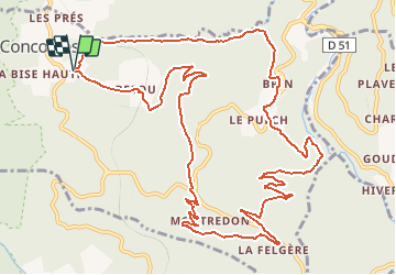
Tour Wandern von 15,9 km verfügbar auf Okzitanien, Gard, Concoules. Diese Tour wird von tracegps vorgeschlagen.
Beschreibung
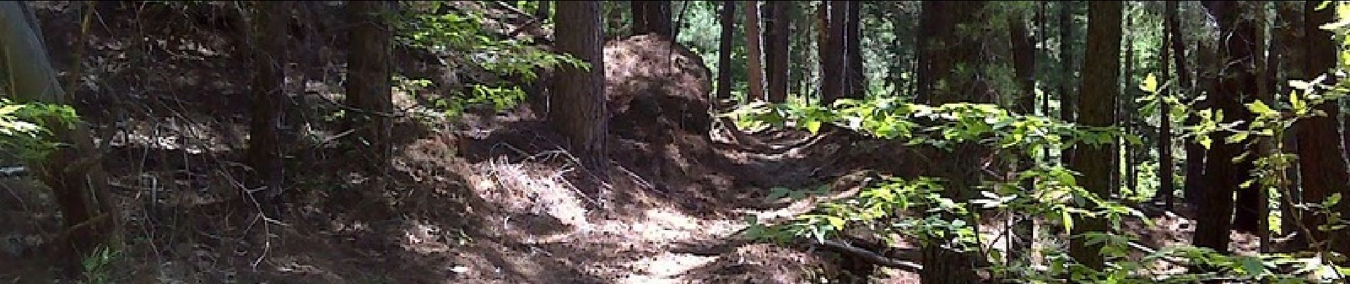
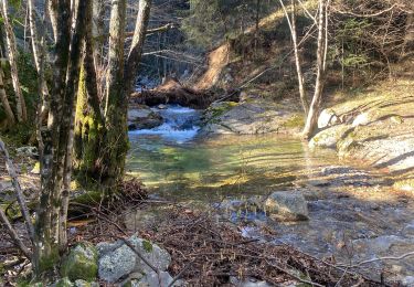
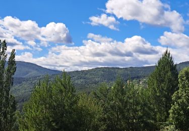
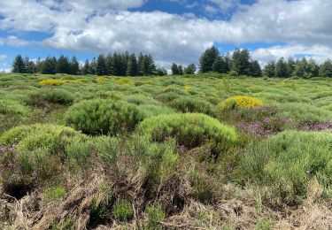
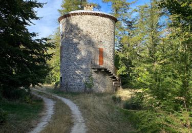
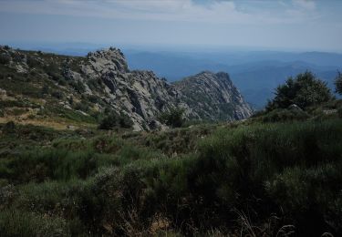
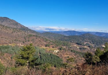
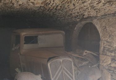
Superbe rando sur du beau sentier, un endroit qui monte très fort genre coupe feu. De la petite route sur la fin 2km pas désagréable. Je pense que ce circuit a été modifié pour des raisons de sécurité pour passer par la voie ferrée, il doit y avoir la possibilité de passer par les vignes ?? (waypoint) Départ du parking de la superbe piscine de Concoules, un petit tour à la piscine à la fin pour les amateurs !!! Voir quelques photos ICI.
Ort
Kommentare
Touren in der Umgebung
![Tour Wandern Concoules - 2023-01-22_15h09m14_Cirkwi-La_Virado_del_Ronc - Photo](https://media.geolcdn.com/t/375/260/ext.jpg?maxdim=2&url=https%3A%2F%2Fstatic1.geolcdn.com%2Fsiteimages%2Fupload%2Ffiles%2F1553511878bg_sport_marche.png)
![Wandern Wandern](https://static1.geolcdn.com/sitytour/trail-icons/101.png)
Wandern
![](/images/other/stat-length.png)
![](https://static1.geolcdn.com/siteimages/upload/files/16400158638029165_repeat_loop_refresh_sync_direction_icon.png)
![Tour Wandern Concoules - Conclûmes - Photo](https://media.geolcdn.com/t/375/260/b2b6c430-1ec3-4149-a53f-95b8b18f710b.jpg&format=jpg&maxdim=2)
![Wandern Wandern](https://static1.geolcdn.com/sitytour/trail-icons/101.png)
Wandern
![](/images/other/stat-length.png)
![](https://static1.geolcdn.com/siteimages/upload/files/16400158638029165_repeat_loop_refresh_sync_direction_icon.png)
![Tour Wandern Ponteils-et-Brésis - Nord haute Vallee de la Cèze - Photo](https://media.geolcdn.com/t/375/260/a0978cc5-8b4f-4e02-8320-6c6f5bf7123f.jpg&format=jpg&maxdim=2)
![Wandern Wandern](https://static1.geolcdn.com/sitytour/trail-icons/101.png)
Wandern
![](/images/other/stat-length.png)
![](https://static1.geolcdn.com/siteimages/upload/files/16400158638029165_repeat_loop_refresh_sync_direction_icon.png)
![Tour Wandern Ponteils-et-Brésis - Bour a es - Photo](https://media.geolcdn.com/t/375/260/33860b35-ef26-4087-9dbf-1e7324b8575e.jpg&format=jpg&maxdim=2)
![Wandern Wandern](https://static1.geolcdn.com/sitytour/trail-icons/101.png)
Wandern
![](/images/other/stat-length.png)
![](https://static1.geolcdn.com/siteimages/upload/files/16400158638029165_repeat_loop_refresh_sync_direction_icon.png)
![Tour Wandern Concoules - Mont Lozère au départ de Concoules - Photo](https://media.geolcdn.com/t/375/260/e8e04d59-7cd7-497b-bb8a-e594db86e8bf.jpg&format=jpg&maxdim=2)
![Wandern Wandern](https://static1.geolcdn.com/sitytour/trail-icons/101.png)
Wandern
![](/images/other/stat-length.png)
![](https://static1.geolcdn.com/siteimages/upload/files/16400158638029165_repeat_loop_refresh_sync_direction_icon.png)
![Tour Wandern Concoules - Conclûmes - Photo](https://media.geolcdn.com/t/375/260/976d86f2-d295-41c3-ab9d-ca7d48a522da.jpg&format=jpg&maxdim=2)
![Wandern Wandern](https://static1.geolcdn.com/sitytour/trail-icons/101.png)
Wandern
![](/images/other/stat-length.png)
![](https://static1.geolcdn.com/siteimages/upload/files/16400158638029165_repeat_loop_refresh_sync_direction_icon.png)
![Wandern Wandern](https://static1.geolcdn.com/sitytour/trail-icons/101.png)
Wandern
![](/images/other/stat-length.png)
![](https://static1.geolcdn.com/siteimages/upload/files/16400158638029165_repeat_loop_refresh_sync_direction_icon.png)
![Tour Wandern Génolhac - la Coste - Photo](https://media.geolcdn.com/t/375/260/0a4ec7c7-e3a0-4d1a-85eb-fcfccedf2330.jpg&format=jpg&maxdim=2)
![Wandern Wandern](https://static1.geolcdn.com/sitytour/trail-icons/101.png)
![Tour Wandern Génolhac - Régordane 5 - Génolhac-Drulhes - Photo](https://media.geolcdn.com/t/375/260/c5160c3d-c60e-4d1c-83e7-27998ee6ccb2.jpg&format=jpg&maxdim=2)
![Wandern Wandern](https://static1.geolcdn.com/sitytour/trail-icons/101.png)
Wandern
![](/images/other/stat-length.png)
![](https://static1.geolcdn.com/siteimages/upload/files/16400158638029165_repeat_loop_refresh_sync_direction_icon.png)