


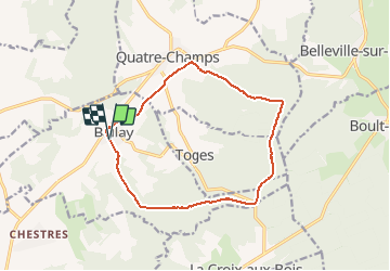

16,1 km | 19,7 km-effort

Benutzer


Kostenlosegpshiking-Anwendung
 SityTrail
IGN / Geografische Institute
SityTrail World
Die Welt öffnet sich für Sie
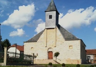
Tour Wandern von 12,5 km verfügbar auf Großer Osten, Ardennes, Ballay. Diese Tour wird von tracegps vorgeschlagen.
Départ place de Ballay, prendre la route forestière, passer au-dessus de Toges, redescendre jusqu'aux portes de Quatre Champs et revenir par la prairie.

Wandern
Wandern
Wandern
Wandern

Wandern
Wandern
Wandern

Nordic Walking