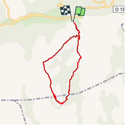

11,3 km | 20 km-effort


Benutzer


Kostenlosegpshiking-Anwendung
 SityTrail
IGN / Geografische Institute
SityTrail World
Die Welt öffnet sich für Sie
Tour Wandern von 7,1 km verfügbar auf Okzitanien, Hérault, Rosis. Diese Tour wird von jdelettrez vorgeschlagen.
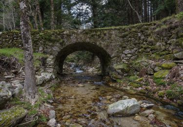
Montée sur le Caroux depuis la croix de Douch par le GR7.
Descente dans les gorges de Colombières par le Ravin de Cadiol devant le Bastion
!!!Attention descente très raide.Pour marcheur averti!!! Puis chemin de la Madeleine pour rejoindre La Fage

Wandern

Wandern

Wandern

Wandern

Wandern

Wandern

Wandern
Zu Fuß