![](/images/other/stat-length.png)
![Tour Wandern Fontainebleau - veneux les sablons - Photo](https://media.geolcdn.com/t/1900/400/ext.pjpeg?maxdim=2&url=https%3A%2F%2Fstatic1.geolcdn.com%2Fsiteimages%2Fupload%2Ffiles%2F1553511878bg_sport_marche.png)
veneux les sablons
jojo96
Benutzer
![Länge](/images/other/stat-length.png)
Länge
21 km
![Maximale Höhe](https://static1.geolcdn.com/siteimages/upload/files/1508320355ic_sort_altitude_max_24dp.png)
Maximale Höhe
139 m
![Positive Höhendifferenz](https://static1.geolcdn.com/siteimages/upload/files/1508320355ic_sort_den_pos_24dp.png)
Positive Höhendifferenz
260 m
![Km-Effort](/images/other/stat-length.png)
Km-Effort
25 km
![Min. Höhe](https://static1.geolcdn.com/siteimages/upload/files/1508320355ic_sort_altitude_min_24dp.png)
Min. Höhe
81 m
![Negative Höhendifferenz](https://static1.geolcdn.com/siteimages/upload/files/1508320355ic_sort_den_neg_24dp.png)
Negative Höhendifferenz
264 m
![Boucle](https://static1.geolcdn.com/siteimages/upload/files/16400158638029165_repeat_loop_refresh_sync_direction_icon.png)
Boucle
Ja
Erstellungsdatum :
2014-12-10 00:00:00.0
Letzte Änderung :
2014-12-10 00:00:00.0
![Wandern](https://static1.geolcdn.com/sitytour/trail-icons/101.png)
5h22
Schwierigkeit : Einfach
![Scannen Sie diesen QR-Code, um die Tour in der SityTrail-Anwendung zu öffnen](https://capi.geolives.com/qq0zvz2zws4bq2lad0pu/sitytour/trails/169003/qr.png?size=200)
Kostenlosegpshiking-Anwendung
Über SityTrail
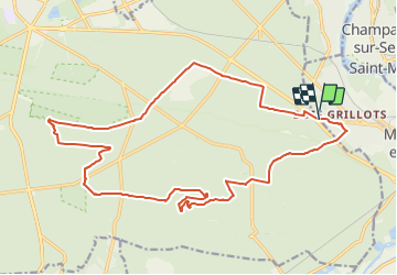
Tour Wandern von 21 km verfügbar auf Île-de-France, Seine-et-Marne, Fontainebleau. Diese Tour wird von jojo96 vorgeschlagen.
Beschreibung
Parking carrefour de la porte Nadon passer sous la N6 en suivant la bretelle de sortie jusqu à la route de Marion des RochesRevenir en traversant sous la N6 par un passage plus au sud
Ort
Land:
France
Region :
Île-de-France
Abteilung/Provinz :
Seine-et-Marne
Kommune :
Fontainebleau
Standort:
Unknown
Gehen Sie:(Dec)
Gehen Sie:(UTM)
483848 ; 5358324 (31U) N.
Kommentare
Touren in der Umgebung
![Tour Wandern Champagne-sur-Seine - GLM-150507 - Champagne - Photo](https://media.geolcdn.com/t/375/260/ext.jpg?maxdim=2&url=https%3A%2F%2Fservices.sitytrail.com%2FGeolivesWS%2FDownloadMedia.ashx%3FTrailID%3D417747%26Media%3Dcf3441e3-cd65-4b43-a868-e5ea57f18914.jpg)
![Wandern Wandern](https://static1.geolcdn.com/sitytour/trail-icons/101.png)
GLM-150507 - Champagne
Wandern
Einfach
(1)
Champagne-sur-Seine,
Île-de-France,
Seine-et-Marne,
France
![](/images/other/stat-length.png)
17,3 km | 20 km-effort
4h 20min
![](https://static1.geolcdn.com/siteimages/upload/files/16400158638029165_repeat_loop_refresh_sync_direction_icon.png)
Ja
![Tour Wandern Fontainebleau - GLM-150311 - PVerte-Fourceau-Béatrix - Photo](https://media.geolcdn.com/t/375/260/ext.jpg?maxdim=2&url=https%3A%2F%2Fservices.sitytrail.com%2FGeolivesWS%2FDownloadMedia.ashx%3FTrailID%3D394980%26Media%3D3b15c306-0eca-40de-a57d-3cf59ddfeba2.jpg)
![Wandern Wandern](https://static1.geolcdn.com/sitytour/trail-icons/101.png)
GLM-150311 - PVerte-Fourceau-Béatrix
Wandern
Medium
(1)
Fontainebleau,
Île-de-France,
Seine-et-Marne,
France
![](/images/other/stat-length.png)
16,5 km | 20 km-effort
6h 0min
![](https://static1.geolcdn.com/siteimages/upload/files/16400158638029165_repeat_loop_refresh_sync_direction_icon.png)
Ja
![Tour Wandern Fontainebleau - Boucle 30 km Veni Venelles Vici - Photo](https://media.geolcdn.com/t/375/260/ext.jpg?maxdim=2&url=https%3A%2F%2Fstatic1.geolcdn.com%2Fsiteimages%2Fupload%2Ffiles%2F1553511878bg_sport_marche.png)
![Wandern Wandern](https://static1.geolcdn.com/sitytour/trail-icons/101.png)
Boucle 30 km Veni Venelles Vici
Wandern
Sehr schwierig
(1)
Fontainebleau,
Île-de-France,
Seine-et-Marne,
France
![](/images/other/stat-length.png)
30 km | 35 km-effort
6h 0min
![](https://static1.geolcdn.com/siteimages/upload/files/16400158638029165_repeat_loop_refresh_sync_direction_icon.png)
Nein
![Tour Wandern Fontainebleau - Rocher Fourceau-Petit Mont Chauvet SR210523Ve?? fmg - Photo](https://media.geolcdn.com/t/375/260/cabc9437-0e04-4fa0-9f5b-0c9f73ac9000.jpg&format=jpg&maxdim=2)
![Wandern Wandern](https://static1.geolcdn.com/sitytour/trail-icons/101.png)
Rocher Fourceau-Petit Mont Chauvet SR210523Ve?? fmg
Wandern
Sehr schwierig
(2)
Fontainebleau,
Île-de-France,
Seine-et-Marne,
France
![](/images/other/stat-length.png)
19,5 km | 24 km-effort
5h 27min
![](https://static1.geolcdn.com/siteimages/upload/files/16400158638029165_repeat_loop_refresh_sync_direction_icon.png)
Ja
![Tour Wandern Fontainebleau - viennes carosses - Photo](https://media.geolcdn.com/t/375/260/9b54e644-4214-4411-b7b4-ea5a49e11005.jpg&format=jpg&maxdim=2)
![Wandern Wandern](https://static1.geolcdn.com/sitytour/trail-icons/101.png)
viennes carosses
Wandern
Sehr leicht
(2)
Fontainebleau,
Île-de-France,
Seine-et-Marne,
France
![](/images/other/stat-length.png)
10,8 km | 14 km-effort
2h 50min
![](https://static1.geolcdn.com/siteimages/upload/files/16400158638029165_repeat_loop_refresh_sync_direction_icon.png)
Ja
![Tour Andere Aktivitäten Thomery - forêt de fontainebleau - Photo](https://media.geolcdn.com/t/375/260/ext.jpg?maxdim=2&url=https%3A%2F%2Fservices.sitytrail.com%2FGeolivesWS%2FDownloadMedia.ashx%3FTrailID%3D703736%26Media%3D20170223103030.jpg)
![Andere Aktivitäten Andere Aktivitäten](https://static1.geolcdn.com/sitytour/trail-icons/900.png)
forêt de fontainebleau
Andere Aktivitäten
Medium
(1)
Thomery,
Île-de-France,
Seine-et-Marne,
France
![](/images/other/stat-length.png)
20 km | 23 km-effort
5h 40min
![](https://static1.geolcdn.com/siteimages/upload/files/16400158638029165_repeat_loop_refresh_sync_direction_icon.png)
Ja
![Tour Wandern Fontainebleau - Boucle 30 km Thomery - Photo](https://media.geolcdn.com/t/375/260/0874c90c-8e55-44c8-845b-1a3f1ab9994c.jpg&format=jpg&maxdim=2)
![Wandern Wandern](https://static1.geolcdn.com/sitytour/trail-icons/101.png)
Boucle 30 km Thomery
Wandern
Schwierig
Fontainebleau,
Île-de-France,
Seine-et-Marne,
France
![](/images/other/stat-length.png)
31 km | 36 km-effort
6h 8min
![](https://static1.geolcdn.com/siteimages/upload/files/16400158638029165_repeat_loop_refresh_sync_direction_icon.png)
Ja
![Tour Wandern Champagne-sur-Seine - Boucle Champagne/ Seine - Moret - St Mammes - Thomery - Photo](https://media.geolcdn.com/t/375/260/a76c9969-6152-4085-be7d-0578611d1cc7.jpg&format=jpg&maxdim=2)
![Wandern Wandern](https://static1.geolcdn.com/sitytour/trail-icons/101.png)
Boucle Champagne/ Seine - Moret - St Mammes - Thomery
Wandern
Einfach
Champagne-sur-Seine,
Île-de-France,
Seine-et-Marne,
France
![](/images/other/stat-length.png)
24 km | 27 km-effort
5h 15min
![](https://static1.geolcdn.com/siteimages/upload/files/16400158638029165_repeat_loop_refresh_sync_direction_icon.png)
Ja
![Tour Zu Fuß Fontainebleau - Sur les traces de Rosa Bonheur - Thomery - Photo](https://media.geolcdn.com/t/375/260/324d54be-66a3-49af-bf6e-2e2e4110383f.jpg&format=jpg&maxdim=2)
![Zu Fuß Zu Fuß](https://static1.geolcdn.com/sitytour/trail-icons/100.png)
Sur les traces de Rosa Bonheur - Thomery
Zu Fuß
Medium
Fontainebleau,
Île-de-France,
Seine-et-Marne,
France
![](/images/other/stat-length.png)
30 km | 35 km-effort
7h 53min
![](https://static1.geolcdn.com/siteimages/upload/files/16400158638029165_repeat_loop_refresh_sync_direction_icon.png)
Ja