


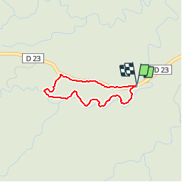

11,8 km | 16,4 km-effort


Benutzer


Kostenlosegpshiking-Anwendung
 SityTrail
IGN / Geografische Institute
SityTrail World
Die Welt öffnet sich für Sie
Tour Andere Aktivitäten von 3,3 km verfügbar auf Guadeloupe, Unbekannt, Petit-Bourg. Diese Tour wird von sphinkie vorgeschlagen.
-355h:-44m:-16s | 3.2km
Longueur - 3.2km
Points - 131
Créé - 2012-12-03 06:50:11
Vitesse Max - 14.0km/h
Altitude Min - 192m
Altitude Max - 263m
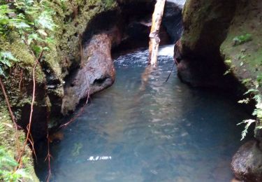
Wandern
Zu Fuß
Pfad
Wandern

Wandern

Wandern
Pfad