![](/images/other/stat-length.png)
![Tour Wandern Modave - MODAVE - Linchet - Photo](https://media.geolcdn.com/t/1900/400/ext.pjpeg?maxdim=2&url=https%3A%2F%2Fservices.sitytrail.com%2FGeolivesWS%2FDownloadMedia.ashx%3FTrailID%3D163547%26Media%3D246e0719-e036-4347-8ba8-5ec5db6ee055.jpg)
MODAVE - Linchet
tourcondroz
Benutzer
![Länge](/images/other/stat-length.png)
Länge
5,1 km
![Maximale Höhe](https://static1.geolcdn.com/siteimages/upload/files/1508320355ic_sort_altitude_max_24dp.png)
Maximale Höhe
251 m
![Positive Höhendifferenz](https://static1.geolcdn.com/siteimages/upload/files/1508320355ic_sort_den_pos_24dp.png)
Positive Höhendifferenz
90 m
![Km-Effort](/images/other/stat-length.png)
Km-Effort
6,3 km
![Min. Höhe](https://static1.geolcdn.com/siteimages/upload/files/1508320355ic_sort_altitude_min_24dp.png)
Min. Höhe
202 m
![Negative Höhendifferenz](https://static1.geolcdn.com/siteimages/upload/files/1508320355ic_sort_den_neg_24dp.png)
Negative Höhendifferenz
90 m
![Boucle](https://static1.geolcdn.com/siteimages/upload/files/16400158638029165_repeat_loop_refresh_sync_direction_icon.png)
Boucle
Ja
![Kennzeichnung](https://services.sitytrail.com/GeolivesWS/DownloadMedia.ashx?TrailID=163547&Media=balise.png)
Kennzeichnung
Erstellungsdatum :
2019-04-01 13:27:38.638
Letzte Änderung :
2019-04-01 13:27:38.738
![Wandern](https://static1.geolcdn.com/sitytour/trail-icons/101.png)
1h26
Schwierigkeit : Einfach
![Scannen Sie diesen QR-Code, um die Tour in der SityTrail-Anwendung zu öffnen](https://capi.geolives.com/qq0zvz2zws4bq2lad0pu/sitytour/trails/163547/qr.png?size=200)
Kostenlosegpshiking-Anwendung
Über SityTrail
Tour Wandern von 5,1 km verfügbar auf Wallonien, Lüttich, Modave. Diese Tour wird von tourcondroz vorgeschlagen.
Beschreibung
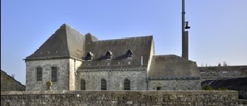
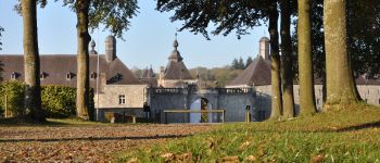
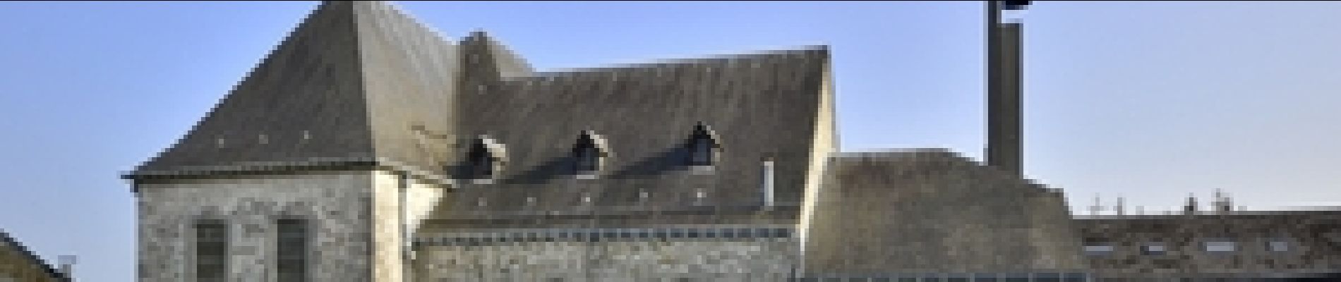
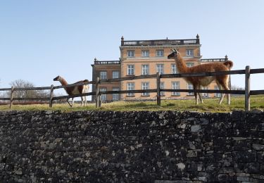
Au départ de l'église de Modave, cette promenade permet de parcourir les campagnes de notre Condroz et de découvrir le village de Modave.
BALISE: rectangle rouge horizontal rectangle blanc vertical
Sources: SIVH
Crédits photographiques: J. Borghoms – SIVH
POIs
Ort
Land:
Belgium
Region :
Wallonien
Abteilung/Provinz :
Lüttich
Kommune :
Modave
Standort:
Modave
Gehen Sie:(Dec)
Gehen Sie:(UTM)
663424 ; 5590359 (31U) N.
Kommentare
Touren in der Umgebung
![Tour Wandern Clavier - RB-Lg-01 - Raccourci - Photo](https://media.geolcdn.com/t/375/260/ext.jpg?maxdim=2&url=https%3A%2F%2Fservices.sitytrail.com%2FGeolivesWS%2FDownloadMedia.ashx%3FTrailID%3D209390%26Media%3D22266d26-9089-4b3a-b5ae-a6da953afba4.jpg)
![Wandern Wandern](https://static1.geolcdn.com/sitytour/trail-icons/101.png)
RB-Lg-01 - Raccourci
Wandern
Medium
(8)
Clavier,
Wallonien,
Lüttich,
Belgium
![](/images/other/stat-length.png)
17,1 km | 21 km-effort
4h 34min
![](https://static1.geolcdn.com/siteimages/upload/files/16400158638029165_repeat_loop_refresh_sync_direction_icon.png)
Ja
![Tour Wandern Clavier - RB-Lg-01 - Dans les vallées du Hoyoux et du ruisseau de Pailhe - Photo](https://media.geolcdn.com/t/375/260/ext.jpg?maxdim=2&url=https%3A%2F%2Fservices.sitytrail.com%2FGeolivesWS%2FDownloadMedia.ashx%3FTrailID%3D179556%26Media%3D22266d26-9089-4b3a-b5ae-a6da953afba4.jpg)
![Wandern Wandern](https://static1.geolcdn.com/sitytour/trail-icons/101.png)
RB-Lg-01 - Dans les vallées du Hoyoux et du ruisseau de Pailhe
Wandern
Medium
(12)
Clavier,
Wallonien,
Lüttich,
Belgium
![](/images/other/stat-length.png)
20 km | 25 km-effort
5h 23min
![](https://static1.geolcdn.com/siteimages/upload/files/16400158638029165_repeat_loop_refresh_sync_direction_icon.png)
Ja
![Tour Wandern Modave - Modave. Natura 2000, des sites qui valent le détour ! Lg4 - Photo](https://media.geolcdn.com/t/375/260/ext.jpg?maxdim=2&url=https%3A%2F%2Fservices.sitytrail.com%2FGeolivesWS%2FDownloadMedia.ashx%3FTrailID%3D161410%26Media%3Dd7c559bb-fafd-4624-b5f1-8908c3c540dc.JPG)
![Wandern Wandern](https://static1.geolcdn.com/sitytour/trail-icons/101.png)
Modave. Natura 2000, des sites qui valent le détour ! Lg4
Wandern
Medium
(12)
Modave,
Wallonien,
Lüttich,
Belgium
![](/images/other/stat-length.png)
8,2 km | 10,1 km-effort
2h 12min
![](https://static1.geolcdn.com/siteimages/upload/files/16400158638029165_repeat_loop_refresh_sync_direction_icon.png)
Ja
![Tour Wandern Clavier - CLAVIER - La Romantique - Photo](https://media.geolcdn.com/t/375/260/ext.jpg?maxdim=2&url=https%3A%2F%2Fservices.sitytrail.com%2FGeolivesWS%2FDownloadMedia.ashx%3FTrailID%3D162888%26Media%3D9ae93777-447a-4289-aab4-f0814b4e414d.jpg)
![Wandern Wandern](https://static1.geolcdn.com/sitytour/trail-icons/101.png)
CLAVIER - La Romantique
Wandern
Einfach
(11)
Clavier,
Wallonien,
Lüttich,
Belgium
![](/images/other/stat-length.png)
12,6 km | 15,3 km-effort
3h 18min
![](https://static1.geolcdn.com/siteimages/upload/files/16400158638029165_repeat_loop_refresh_sync_direction_icon.png)
Ja
![Tour Wandern Marchin - MARCHIN - Chemin de la Mémoire - Photo](https://media.geolcdn.com/t/375/260/ext.jpg?maxdim=2&url=https%3A%2F%2Fservices.sitytrail.com%2FGeolivesWS%2FDownloadMedia.ashx%3FTrailID%3D134945%26Media%3D9baec6a8-ffff-4223-8cd2-41c1e7b6afda.jpg)
![Wandern Wandern](https://static1.geolcdn.com/sitytour/trail-icons/101.png)
MARCHIN - Chemin de la Mémoire
Wandern
Medium
(5)
Marchin,
Wallonien,
Lüttich,
Belgium
![](/images/other/stat-length.png)
9 km | 11 km-effort
2h 15min
![](https://static1.geolcdn.com/siteimages/upload/files/16400158638029165_repeat_loop_refresh_sync_direction_icon.png)
Ja
![Tour Wandern Clavier - CLAVIER - Magnifique Hoyoux - Photo](https://media.geolcdn.com/t/375/260/ext.jpg?maxdim=2&url=https%3A%2F%2Fservices.sitytrail.com%2FGeolivesWS%2FDownloadMedia.ashx%3FTrailID%3D161792%26Media%3De8c9d35f-218b-443c-9500-f69ccd009442.jpg)
![Wandern Wandern](https://static1.geolcdn.com/sitytour/trail-icons/101.png)
CLAVIER - Magnifique Hoyoux
Wandern
Medium
(6)
Clavier,
Wallonien,
Lüttich,
Belgium
![](/images/other/stat-length.png)
4,1 km | 4,9 km-effort
1h 15min
![](https://static1.geolcdn.com/siteimages/upload/files/16400158638029165_repeat_loop_refresh_sync_direction_icon.png)
Ja
![Tour Wandern Modave - Circuit de Petit-Modave - Modave(MD 01) - Photo](https://media.geolcdn.com/t/375/260/ext.jpg?maxdim=2&url=https%3A%2F%2Fservices.sitytrail.com%2FGeolivesWS%2FDownloadMedia.ashx%3FTrailID%3D211950%26Media%3D225bb37c-a1e6-4f9b-b5fa-27b4f60e72ba.JPG)
![Wandern Wandern](https://static1.geolcdn.com/sitytour/trail-icons/101.png)
Circuit de Petit-Modave - Modave(MD 01)
Wandern
Medium
(21)
Modave,
Wallonien,
Lüttich,
Belgium
![](/images/other/stat-length.png)
7,6 km | 9,4 km-effort
2h 0min
![](https://static1.geolcdn.com/siteimages/upload/files/16400158638029165_repeat_loop_refresh_sync_direction_icon.png)
Ja
![Tour Wandern Modave - Balade à Modave - Photo](https://media.geolcdn.com/t/375/260/efa446e4-aa4c-4b7a-afaa-1e1b5351db79.jpeg&format=jpg&maxdim=2)
![Wandern Wandern](https://static1.geolcdn.com/sitytour/trail-icons/101.png)
Balade à Modave
Wandern
Sehr leicht
(2)
Modave,
Wallonien,
Lüttich,
Belgium
![](/images/other/stat-length.png)
8,9 km | 10,9 km-effort
3h 40min
![](https://static1.geolcdn.com/siteimages/upload/files/16400158638029165_repeat_loop_refresh_sync_direction_icon.png)
Ja
![Tour Wandern Clavier - st fontaine-tahier-ossogne-st fontaine ac - Photo](https://media.geolcdn.com/t/375/260/ad0e5e7e-7707-40ef-b1db-8690b3354224.jpg&format=jpg&maxdim=2)
![Wandern Wandern](https://static1.geolcdn.com/sitytour/trail-icons/101.png)
st fontaine-tahier-ossogne-st fontaine ac
Wandern
Einfach
(3)
Clavier,
Wallonien,
Lüttich,
Belgium
![](/images/other/stat-length.png)
7,4 km | 9,7 km-effort
2h 25min
![](https://static1.geolcdn.com/siteimages/upload/files/16400158638029165_repeat_loop_refresh_sync_direction_icon.png)
Ja
Belle promenade avec quelques vues inattendues.
Promenade agréable principalement sur routes rurales asphaltées. Parcours facile.
Parcours agréable. Aucune difficulté particulière.