![](/images/other/stat-length.png)
![Tour Wandern Cluny - La marche des Moines, Cluny 2012 - Photo](https://media.geolcdn.com/t/1900/400/ext.pjpeg?maxdim=2&url=https%3A%2F%2Fservices.sitytrail.com%2FGeolivesWS%2FDownloadMedia.ashx%3FTrailID%3D162282%26Media%3D20121111123029.jpg)
La marche des Moines, Cluny 2012
robertdurand
Benutzer
![Länge](/images/other/stat-length.png)
Länge
11,8 km
![Maximale Höhe](https://static1.geolcdn.com/siteimages/upload/files/1508320355ic_sort_altitude_max_24dp.png)
Maximale Höhe
466 m
![Positive Höhendifferenz](https://static1.geolcdn.com/siteimages/upload/files/1508320355ic_sort_den_pos_24dp.png)
Positive Höhendifferenz
321 m
![Km-Effort](/images/other/stat-length.png)
Km-Effort
16,1 km
![Min. Höhe](https://static1.geolcdn.com/siteimages/upload/files/1508320355ic_sort_altitude_min_24dp.png)
Min. Höhe
232 m
![Negative Höhendifferenz](https://static1.geolcdn.com/siteimages/upload/files/1508320355ic_sort_den_neg_24dp.png)
Negative Höhendifferenz
321 m
![Boucle](https://static1.geolcdn.com/siteimages/upload/files/16400158638029165_repeat_loop_refresh_sync_direction_icon.png)
Boucle
Ja
Erstellungsdatum :
2014-12-10 00:00:00.0
Letzte Änderung :
2014-12-10 00:00:00.0
![Wandern](https://static1.geolcdn.com/sitytour/trail-icons/101.png)
3h14
Schwierigkeit : Unbekannt
![Scannen Sie diesen QR-Code, um die Tour in der SityTrail-Anwendung zu öffnen](https://capi.geolives.com/qq0zvz2zws4bq2lad0pu/sitytour/trails/162282/qr.png?size=200)
Kostenlosegpshiking-Anwendung
Über SityTrail
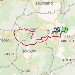
Tour Wandern von 11,8 km verfügbar auf Burgund und Freigrafschaft, Saône-et-Loire, Cluny. Diese Tour wird von robertdurand vorgeschlagen.
Beschreibung
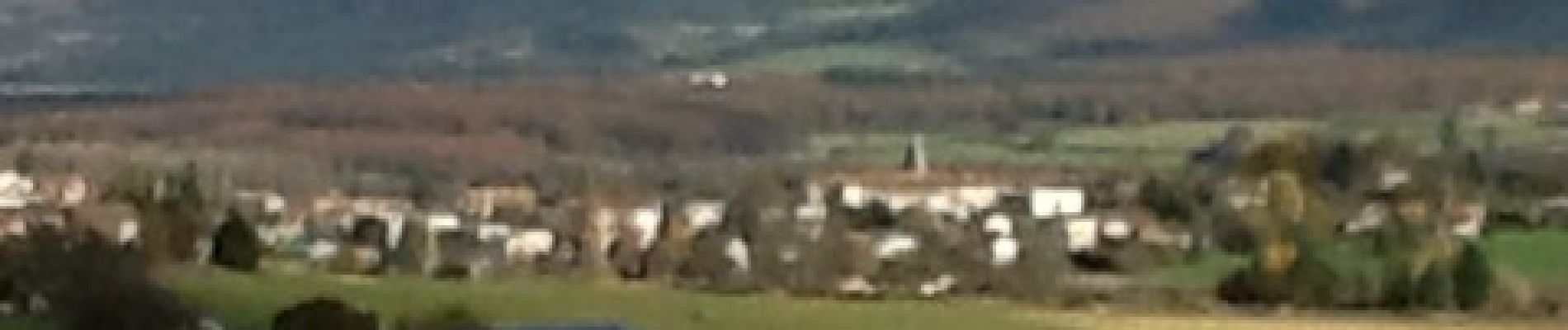
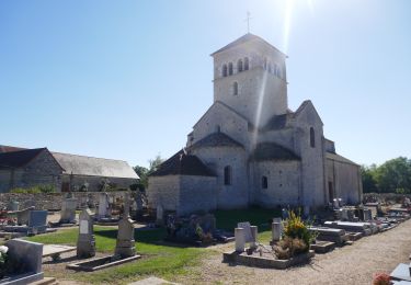
Au départ de Cluny pour la découverte de l'ouest Clunysois par des chemins de terre.
Ort
Land:
France
Region :
Burgund und Freigrafschaft
Abteilung/Provinz :
Saône-et-Loire
Kommune :
Cluny
Standort:
Unknown
Gehen Sie:(Dec)
Gehen Sie:(UTM)
628133 ; 5143216 (31T) N.
Kommentare
Touren in der Umgebung
![Tour Wandern Donzy-le-Pertuis - Donzy le Perthuis la fontaine des croix page 66 - Photo](https://media.geolcdn.com/t/375/260/a4b0f069-00b6-4a98-988d-c366d01428aa.jpg&format=jpg&maxdim=2)
![Wandern Wandern](https://static1.geolcdn.com/sitytour/trail-icons/101.png)
Donzy le Perthuis la fontaine des croix page 66
Wandern
Sehr schwierig
(3)
Donzy-le-Pertuis,
Burgund und Freigrafschaft,
Saône-et-Loire,
France
![](/images/other/stat-length.png)
16,8 km | 23 km-effort
5h 18min
![](https://static1.geolcdn.com/siteimages/upload/files/16400158638029165_repeat_loop_refresh_sync_direction_icon.png)
Ja
![Tour Zu Fuß Cluny - Cluny Berzé le Chatel Tunnel du bois clair page 160 - Photo](https://media.geolcdn.com/t/375/260/ext.jpg?maxdim=2&url=https%3A%2F%2Fstatic1.geolcdn.com%2Fsiteimages%2Fupload%2Ffiles%2F1545311037marcheuse_200dpi.jpg)
![Zu Fuß Zu Fuß](https://static1.geolcdn.com/sitytour/trail-icons/100.png)
Cluny Berzé le Chatel Tunnel du bois clair page 160
Zu Fuß
Medium
(1)
Cluny,
Burgund und Freigrafschaft,
Saône-et-Loire,
France
![](/images/other/stat-length.png)
18,5 km | 26 km-effort
4h 41min
![](https://static1.geolcdn.com/siteimages/upload/files/16400158638029165_repeat_loop_refresh_sync_direction_icon.png)
Ja
![Tour Elektrofahrrad Cluny - Nord est de Cluny - Photo](https://media.geolcdn.com/t/375/260/ext.jpg?maxdim=2&url=https%3A%2F%2Fstatic1.geolcdn.com%2Fsiteimages%2Fupload%2Ffiles%2F1524743154velo.jpg)
![Elektrofahrrad Elektrofahrrad](https://static1.geolcdn.com/sitytour/trail-icons/205.png)
Nord est de Cluny
Elektrofahrrad
Medium
(1)
Cluny,
Burgund und Freigrafschaft,
Saône-et-Loire,
France
![](/images/other/stat-length.png)
43 km | 54 km-effort
4h 0min
![](https://static1.geolcdn.com/siteimages/upload/files/16400158638029165_repeat_loop_refresh_sync_direction_icon.png)
Ja
![Tour Nordic Walking Lournand - Lournand_MN_G1_validé_29_03_2023 - Photo](https://media.geolcdn.com/t/375/260/ext.jpg?maxdim=2&url=https%3A%2F%2Fstatic1.geolcdn.com%2Fsiteimages%2Fupload%2Ffiles%2F1545311037marcheuse_200dpi.jpg)
![Nordic Walking Nordic Walking](https://static1.geolcdn.com/sitytour/trail-icons/102.png)
Lournand_MN_G1_validé_29_03_2023
Nordic Walking
Schwierig
(1)
Lournand,
Burgund und Freigrafschaft,
Saône-et-Loire,
France
![](/images/other/stat-length.png)
12,9 km | 18 km-effort
Unbekannt
![](https://static1.geolcdn.com/siteimages/upload/files/16400158638029165_repeat_loop_refresh_sync_direction_icon.png)
Ja
![Tour Nordic Walking Lournand - Lournand_MN_G2_G3_validé_29_03_2023 - Photo](https://media.geolcdn.com/t/375/260/ext.jpg?maxdim=2&url=https%3A%2F%2Fstatic1.geolcdn.com%2Fsiteimages%2Fupload%2Ffiles%2F1545311037marcheuse_200dpi.jpg)
![Nordic Walking Nordic Walking](https://static1.geolcdn.com/sitytour/trail-icons/102.png)
Lournand_MN_G2_G3_validé_29_03_2023
Nordic Walking
Schwierig
(4)
Lournand,
Burgund und Freigrafschaft,
Saône-et-Loire,
France
![](/images/other/stat-length.png)
10,6 km | 14,9 km-effort
Unbekannt
![](https://static1.geolcdn.com/siteimages/upload/files/16400158638029165_repeat_loop_refresh_sync_direction_icon.png)
Ja
![Tour Wandern Cluny - Cluny Rando des moines - Photo](https://media.geolcdn.com/t/375/260/bc5a470b-37f6-4245-a631-4a1a06dbb825.jpg&format=jpg&maxdim=2)
![Wandern Wandern](https://static1.geolcdn.com/sitytour/trail-icons/101.png)
Cluny Rando des moines
Wandern
Schwierig
Cluny,
Burgund und Freigrafschaft,
Saône-et-Loire,
France
![](/images/other/stat-length.png)
21 km | 28 km-effort
4h 13min
![](https://static1.geolcdn.com/siteimages/upload/files/16400158638029165_repeat_loop_refresh_sync_direction_icon.png)
Ja
![Elektrofahrrad Elektrofahrrad](https://static1.geolcdn.com/sitytour/trail-icons/205.png)
Boucle Cluny - Malay
Elektrofahrrad
Einfach
Cluny,
Burgund und Freigrafschaft,
Saône-et-Loire,
France
![](/images/other/stat-length.png)
49 km | 57 km-effort
5h 36min
![](https://static1.geolcdn.com/siteimages/upload/files/16400158638029165_repeat_loop_refresh_sync_direction_icon.png)
Nein
![Elektrofahrrad Elektrofahrrad](https://static1.geolcdn.com/sitytour/trail-icons/205.png)
Boucle Cluny -Milly Lamartine
Elektrofahrrad
Medium
Cluny,
Burgund und Freigrafschaft,
Saône-et-Loire,
France
![](/images/other/stat-length.png)
37 km | 47 km-effort
4h 41min
![](https://static1.geolcdn.com/siteimages/upload/files/16400158638029165_repeat_loop_refresh_sync_direction_icon.png)
Nein
![Tour Zu Fuß Cluny - randonnée autour de Cluny - Photo](https://media.geolcdn.com/t/375/260/ee88a29e-0c27-4814-ac3d-e43872988bc7.jpeg&format=jpg&maxdim=2)
![Zu Fuß Zu Fuß](https://static1.geolcdn.com/sitytour/trail-icons/100.png)
randonnée autour de Cluny
Zu Fuß
Einfach
Cluny,
Burgund und Freigrafschaft,
Saône-et-Loire,
France
![](/images/other/stat-length.png)
5,1 km | 7,3 km-effort
1h 38min
![](https://static1.geolcdn.com/siteimages/upload/files/16400158638029165_repeat_loop_refresh_sync_direction_icon.png)
Nein
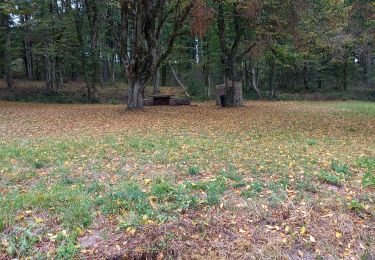
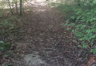
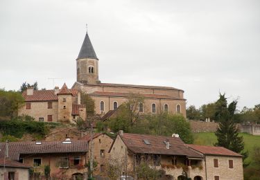
Belle balade à faire de préférence le matin quand le soleil ne cogne pas encore.