![](/images/other/stat-length.png)
![Tour Wandern Le Pellerin - Canal de la Martinière - Photo](https://media.geolcdn.com/t/1900/400/ext.pjpeg?maxdim=2&url=https%3A%2F%2Fstatic1.geolcdn.com%2Fsiteimages%2Fupload%2Ffiles%2F1553511878bg_sport_marche.png)
Canal de la Martinière
Mitche44
Benutzer
![Länge](/images/other/stat-length.png)
Länge
9,7 km
![Maximale Höhe](https://static1.geolcdn.com/siteimages/upload/files/1508320355ic_sort_altitude_max_24dp.png)
Maximale Höhe
18 m
![Positive Höhendifferenz](https://static1.geolcdn.com/siteimages/upload/files/1508320355ic_sort_den_pos_24dp.png)
Positive Höhendifferenz
50 m
![Km-Effort](/images/other/stat-length.png)
Km-Effort
10,4 km
![Min. Höhe](https://static1.geolcdn.com/siteimages/upload/files/1508320355ic_sort_altitude_min_24dp.png)
Min. Höhe
0 m
![Negative Höhendifferenz](https://static1.geolcdn.com/siteimages/upload/files/1508320355ic_sort_den_neg_24dp.png)
Negative Höhendifferenz
51 m
![Boucle](https://static1.geolcdn.com/siteimages/upload/files/16400158638029165_repeat_loop_refresh_sync_direction_icon.png)
Boucle
Ja
Erstellungsdatum :
2014-12-10 00:00:00.0
Letzte Änderung :
2014-12-10 00:00:00.0
![Wandern](https://static1.geolcdn.com/sitytour/trail-icons/101.png)
2h19
Schwierigkeit : Sehr leicht
![Scannen Sie diesen QR-Code, um die Tour in der SityTrail-Anwendung zu öffnen](https://capi.geolives.com/qq0zvz2zws4bq2lad0pu/sitytour/trails/160698/qr.png?size=200)
Kostenlosegpshiking-Anwendung
Über SityTrail
Tour Wandern von 9,7 km verfügbar auf Pays de la Loire, Loire-Atlantique, Le Pellerin. Diese Tour wird von Mitche44 vorgeschlagen.
Beschreibung
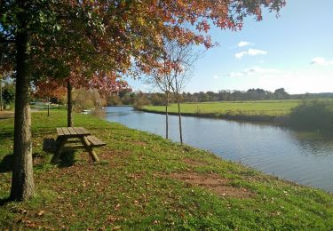
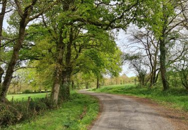
Départ randonnée : Lieu-dit Le Pé de Buzay au bord du canal (Loire-Atlantique 44) Ra randonnée le long du canal de la Martinière.Randonnée facile sans dénivelé.Bonne randonnée
Ort
Land:
France
Region :
Pays de la Loire
Abteilung/Provinz :
Loire-Atlantique
Kommune :
Le Pellerin
Standort:
Unknown
Gehen Sie:(Dec)
Gehen Sie:(UTM)
590274 ; 5228829 (30T) N.
Kommentare
Touren in der Umgebung
![Tour Radtourismus Le Pellerin - Activity - Photo](https://media.geolcdn.com/t/375/260/ext.jpg?maxdim=2&url=https%3A%2F%2Fstatic1.geolcdn.com%2Fsiteimages%2Fupload%2Ffiles%2F1524743154velo.jpg)
![Radtourismus Radtourismus](https://static1.geolcdn.com/sitytour/trail-icons/204.png)
Activity
Radtourismus
Sehr leicht
(1)
Le Pellerin,
Pays de la Loire,
Loire-Atlantique,
France
![](/images/other/stat-length.png)
57 km | 62 km-effort
6h 0min
![](https://static1.geolcdn.com/siteimages/upload/files/16400158638029165_repeat_loop_refresh_sync_direction_icon.png)
Nein
![Tour Wandern Rouans - Le Grand Chemin - Photo](https://media.geolcdn.com/t/375/260/ext.jpg?maxdim=2&url=https%3A%2F%2Fstatic1.geolcdn.com%2Fsiteimages%2Fupload%2Ffiles%2F1553511878bg_sport_marche.png)
![Wandern Wandern](https://static1.geolcdn.com/sitytour/trail-icons/101.png)
Le Grand Chemin
Wandern
Medium
(1)
Rouans,
Pays de la Loire,
Loire-Atlantique,
France
![](/images/other/stat-length.png)
21 km | 23 km-effort
5h 12min
![](https://static1.geolcdn.com/siteimages/upload/files/16400158638029165_repeat_loop_refresh_sync_direction_icon.png)
Ja
![Tour Zu Fuß Rouans - Le Grand Chemin - Photo](https://media.geolcdn.com/t/375/260/ccc1942d-8581-406d-94c5-4139b1118e7a.jpeg&format=jpg&maxdim=2)
![Zu Fuß Zu Fuß](https://static1.geolcdn.com/sitytour/trail-icons/100.png)
Le Grand Chemin
Zu Fuß
Medium
Rouans,
Pays de la Loire,
Loire-Atlantique,
France
![](/images/other/stat-length.png)
21 km | 23 km-effort
5h 17min
![](https://static1.geolcdn.com/siteimages/upload/files/16400158638029165_repeat_loop_refresh_sync_direction_icon.png)
Ja
![Tour Wandern Couëron - boucle lac de beaulieu - Photo](https://media.geolcdn.com/t/375/260/ext.jpg?maxdim=2&url=https%3A%2F%2Fstatic1.geolcdn.com%2Fsiteimages%2Fupload%2Ffiles%2F1553511878bg_sport_marche.png)
![Wandern Wandern](https://static1.geolcdn.com/sitytour/trail-icons/101.png)
boucle lac de beaulieu
Wandern
Sehr schwierig
(1)
Couëron,
Pays de la Loire,
Loire-Atlantique,
France
![](/images/other/stat-length.png)
17,5 km | 19,6 km-effort
4h 34min
![](https://static1.geolcdn.com/siteimages/upload/files/16400158638029165_repeat_loop_refresh_sync_direction_icon.png)
Ja
![Tour Wandern Cheix-en-Retz - La Pierre tremblante - Photo](https://media.geolcdn.com/t/375/260/ext.jpg?maxdim=2&url=https%3A%2F%2Fservices.sitytrail.com%2FGeolivesWS%2FDownloadMedia.ashx%3FTrailID%3D857658%26Media%3D8c1c9c67-71c3-4739-9ee7-b5df8936e39b.jpg)
![Wandern Wandern](https://static1.geolcdn.com/sitytour/trail-icons/101.png)
La Pierre tremblante
Wandern
Einfach
Cheix-en-Retz,
Pays de la Loire,
Loire-Atlantique,
France
![](/images/other/stat-length.png)
11,2 km | 12,2 km-effort
2h 40min
![](https://static1.geolcdn.com/siteimages/upload/files/16400158638029165_repeat_loop_refresh_sync_direction_icon.png)
Ja
![Tour Wandern Le Pellerin - Canal de la Martiniere - Photo](https://media.geolcdn.com/t/375/260/ext.jpg?maxdim=2&url=https%3A%2F%2Fstatic1.geolcdn.com%2Fsiteimages%2Fupload%2Ffiles%2F1553511878bg_sport_marche.png)
![Wandern Wandern](https://static1.geolcdn.com/sitytour/trail-icons/101.png)
Canal de la Martiniere
Wandern
Medium
Le Pellerin,
Pays de la Loire,
Loire-Atlantique,
France
![](/images/other/stat-length.png)
6,5 km | 6,9 km-effort
1h 48min
![](https://static1.geolcdn.com/siteimages/upload/files/16400158638029165_repeat_loop_refresh_sync_direction_icon.png)
Ja
![Tour Radtourismus Le Pellerin - Le Pèlerin - La plaine sur mer - 57 km - Photo](https://media.geolcdn.com/t/375/260/ext.jpg?maxdim=2&url=https%3A%2F%2Fstatic1.geolcdn.com%2Fsiteimages%2Fupload%2Ffiles%2F1524743154velo.jpg)
![Radtourismus Radtourismus](https://static1.geolcdn.com/sitytour/trail-icons/204.png)
Le Pèlerin - La plaine sur mer - 57 km
Radtourismus
Sehr schwierig
Le Pellerin,
Pays de la Loire,
Loire-Atlantique,
France
![](/images/other/stat-length.png)
57 km | 61 km-effort
4h 4min
![](https://static1.geolcdn.com/siteimages/upload/files/16400158638029165_repeat_loop_refresh_sync_direction_icon.png)
Nein
![Tour Wandern Le Pellerin - le pellerin __boiseau - Photo](https://media.geolcdn.com/t/375/260/ext.jpg?maxdim=2&url=https%3A%2F%2Fstatic1.geolcdn.com%2Fsiteimages%2Fupload%2Ffiles%2F1553511878bg_sport_marche.png)
![Wandern Wandern](https://static1.geolcdn.com/sitytour/trail-icons/101.png)
le pellerin __boiseau
Wandern
Sehr leicht
Le Pellerin,
Pays de la Loire,
Loire-Atlantique,
France
![](/images/other/stat-length.png)
6,9 km | 7,7 km-effort
1h 32min
![](https://static1.geolcdn.com/siteimages/upload/files/16400158638029165_repeat_loop_refresh_sync_direction_icon.png)
Nein
![Tour Wandern Le Pellerin - Boucle autour de Le Pèlerin - Photo](https://media.geolcdn.com/t/375/260/832d1272-35b5-4af9-8050-004f27174c25.jpg&format=jpg&maxdim=2)
![Wandern Wandern](https://static1.geolcdn.com/sitytour/trail-icons/101.png)
Boucle autour de Le Pèlerin
Wandern
Medium
Le Pellerin,
Pays de la Loire,
Loire-Atlantique,
France
![](/images/other/stat-length.png)
12,4 km | 13,5 km-effort
3h 5min
![](https://static1.geolcdn.com/siteimages/upload/files/16400158638029165_repeat_loop_refresh_sync_direction_icon.png)
Ja