


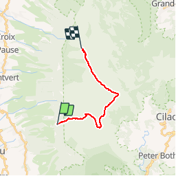

11,2 km | 16,9 km-effort


Benutzer


Kostenlosegpshiking-Anwendung
 SityTrail
IGN / Geografische Institute
SityTrail World
Die Welt öffnet sich für Sie
Tour Wandern von 18,7 km verfügbar auf Réunion, Unbekannt, Saint-Leu. Diese Tour wird von mferraci vorgeschlagen.
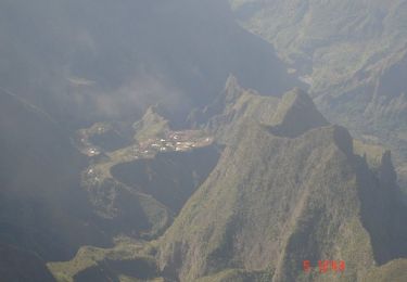
Le brulé de St-Leu, la Caverne du piton rouge, le petit Bénare, les crètes de Cilaos, le Grand Bénare et les crètes de Mafate jusqu'a Maido
Wandern
Wandern

Elektrofahrrad
Mountainbike

Wandern
Wandern
Wandern
Wandern
pas utile