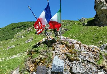
Tour Wandern Courmayeur - courmayeur bertone bonatti - Photo

courmayeur bertone bonatti

© OpenStreetMap contributors
Länge
Länge
11,9 km
Maximale Höhe
Maximale Höhe
2034 m
Positive Höhendifferenz
1093 m
Km-Effort
Km-Effort  
24 km
Min. Höhe
Min. Höhe
1203 m
Negative Höhendifferenz
273 m
Boucle
Boucle
Nein
Erstellungsdatum :
2014-12-10 00:00:00.0
Letzte Änderung :
2014-12-10 00:00:00.0

(0 Nachricht)

Wandern
Wandern
--
Schwierigkeit : Medium

Scannen Sie diesen QR-Code, um die Tour in der SityTrail-Anwendung zu öffnen

Kostenlosegpshiking-Anwendung

Logo SityTrail SityTrail

IGN / Geografische Institute

SityTrail aus dem App Store herunterladen SityTrail von Google Play herunterladen

Logo SityTrail SityTrail World

Die Welt öffnet sich für Sie

SityTrail aus dem App Store herunterladen SityTrail von Google Play herunterladen SityTrail auf Huawei AppGallery herunterladen

Über SityTrail

Tour Wandern von 11,9 km verfügbar auf Aostatal, Unbekannt, Courmayeur. Diese Tour wird von lebail.frederic vorgeschlagen.

Beschreibung

Etapa del Tour del Mont Blanc, entre la localidad de Courmayeur y el Refugio Walter Bonatti (Alpes, Italia).

Desde Courmayeur ascendemos al Refugio G. Bertone, continuamos a media ladera, y tras pasar por Arpe Leche y Arpe Secheron, llegamos al Refugio W. Bonatti.

*** Datos Ruta ***
Ruta: Courmayeur (1.210 mts) – Ref. Bertone (1.989 mts) – Ref. Bonatti (2.022 mts)
Distancia: 5’6 kmts – 7’8 kmts = 13’4 kmts
Desnivel Ascendido: 780 mts - 315 mts = 1.095 mts
Desnivel Descendido: 0 mts - 285 mts = 285 mts
Tiempo (sin paradas): 2h – 3h = 5h

Höhenprofil

POIs

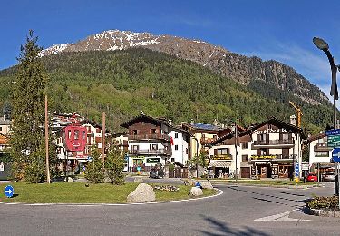
POI Courmayeur - Arpe Leche - Photo
lebail.frederic
COURMAYEUR 
POI Courmayeur - Arpe Secheron - Photo
lebail.frederic
COURMAYEUR 
POI Courmayeur - Courmayeur - Photo
lebail.frederic
COURMAYEUR 
POI Courmayeur - Ref Bertone - Photo
lebail.frederic
COURMAYEUR 
POI Courmayeur - Ref Bonatti - Photo
lebail.frederic
COURMAYEUR 

Ort

Land:
Italy
Region :
Aostatal
Abteilung/Provinz :
Unbekannt
Kommune :
Courmayeur
Standort:
Unknown
Gehen Sie:(Dec)
Gehen Sie:(UTM)
342257 ; 5072829 (32T) N.

Touren in der Umgebung

Tour Zu Fuß Courmayeur - Alta Via n. 2 della Valle d'Aosta - Tappa 1 - Photo
Zu Fuß
GUIDE+

Zu Fuß

Schwierig
Courmayeur, Aostatal, Unbekannt, Italy
15,2 km | 32 km-effort
7h 15min
Nein
Tour Zu Fuß Courmayeur - (SI F08) Courmayeur - Rifugio Bonatti - Photo
Zu Fuß
GUIDE+

Zu Fuß

Medium
Courmayeur, Aostatal, Unbekannt, Italy
11,9 km | 24 km-effort
5h 22min
Nein
Tour Wandern Morgex - arpy . lac d arpy . arpy 2h50 - Photo
Wandern
GUIDE
stef789

Wandern

Sehr leicht
Morgex, Aostatal, Unbekannt, Italy
10,3 km | 16,1 km-effort
3h 36min
Ja
Tour Wandern Courmayeur - étape monte Bianco mottets - Photo
Wandern
Bernadette Noirant

Wandern

Schwierig
Courmayeur, Aostatal, Unbekannt, Italy
21 km | 38 km-effort
8h 17min
Nein
Tour Wandern Courmayeur - TMB J5 Ref. BIANCO - LES MOTTETS - Photo
Wandern
GerardBouche

Wandern

Schwierig
Courmayeur, Aostatal, Unbekannt, Italy
20 km | 38 km-effort
7h 49min
Nein
Tour Wandern Courmayeur - TMB - Etape 5 - Photo
Wandern
maxime.ranchin@aliceadsl.fr

Wandern

Schwierig
(1)
Courmayeur, Aostatal, Unbekannt, Italy
16,5 km | 34 km-effort
6h 47min
Nein
Tour Wandern Courmayeur - TMB Étape 4 : Camping des Grandes Jorasses au Gite de La Peule - Photo
Wandern
Timothée ZARAGORI

Wandern

Sehr schwierig
Courmayeur, Aostatal, Unbekannt, Italy
18,6 km | 36 km-effort
8h 11min
Nein
Tour Wandern Courmayeur - tmb2024 étape 4 - Photo
Wandern
marcagif

Wandern

Schwierig
Courmayeur, Aostatal, Unbekannt, Italy
17,8 km | 33 km-effort
6h 56min
Nein
Tour Wandern Courmayeur - TMB 05 - Courmayeur -> Arnouva (chalet du Val Ferret) - Photo
Wandern
uru2010

Wandern

Schwierig
Courmayeur, Aostatal, Unbekannt, Italy
17,6 km | 32 km-effort
6h 59min
Nein


Schließen
Meine Abonnements