


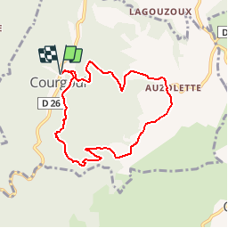

10 km | 14,7 km-effort


Benutzer


Kostenlosegpshiking-Anwendung
 SityTrail
IGN / Geografische Institute
SityTrail World
Die Welt öffnet sich für Sie
Tour Wandern von 7,5 km verfügbar auf Auvergne-Rhone-Alpen, Puy-de-Dôme, Courgoul. Diese Tour wird von tracegps vorgeschlagen.
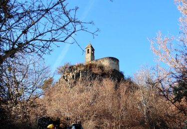
Départ à l'entrée de Courgoul (deux autres randonnées possibles). Balade pas très longue mais physique: 450 mètres de dénivelé sur 3 km. Après avoir cheminé en sous bois, on arrive sur un plateau offrant de très belles vues. On rejoint Courgoul par un large chemin.


Zu Fuß

Zu Fuß
Zu Fuß

Zu Fuß
Wandern
Wandern
Zu Fuß

Zu Fuß
Wandern