![](/images/other/stat-length.png)
![Tour Wandern Benet - Aziré - Photo](https://media.geolcdn.com/t/1900/400/ext.pjpeg?maxdim=2&url=https%3A%2F%2Fstatic1.geolcdn.com%2Fsiteimages%2Fupload%2Ffiles%2F1553511878bg_sport_marche.png)
Aziré
olaze
Benutzer
![Länge](/images/other/stat-length.png)
Länge
9 km
![Maximale Höhe](https://static1.geolcdn.com/siteimages/upload/files/1508320355ic_sort_altitude_max_24dp.png)
Maximale Höhe
9 m
![Positive Höhendifferenz](https://static1.geolcdn.com/siteimages/upload/files/1508320355ic_sort_den_pos_24dp.png)
Positive Höhendifferenz
49 m
![Km-Effort](/images/other/stat-length.png)
Km-Effort
9,6 km
![Min. Höhe](https://static1.geolcdn.com/siteimages/upload/files/1508320355ic_sort_altitude_min_24dp.png)
Min. Höhe
0 m
![Negative Höhendifferenz](https://static1.geolcdn.com/siteimages/upload/files/1508320355ic_sort_den_neg_24dp.png)
Negative Höhendifferenz
48 m
![Boucle](https://static1.geolcdn.com/siteimages/upload/files/16400158638029165_repeat_loop_refresh_sync_direction_icon.png)
Boucle
Ja
Erstellungsdatum :
2014-12-10 00:00:00.0
Letzte Änderung :
2014-12-10 00:00:00.0
![Wandern](https://static1.geolcdn.com/sitytour/trail-icons/101.png)
--
Schwierigkeit : Einfach
![Scannen Sie diesen QR-Code, um die Tour in der SityTrail-Anwendung zu öffnen](https://capi.geolives.com/qq0zvz2zws4bq2lad0pu/sitytour/trails/132747/qr.png?size=200)
Kostenlosegpshiking-Anwendung
Über SityTrail
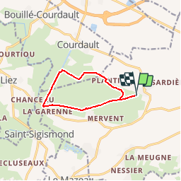
Tour Wandern von 9 km verfügbar auf Pays de la Loire, Vendée, Benet. Diese Tour wird von olaze vorgeschlagen.
Beschreibung
Rando ATSCAF79:
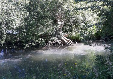
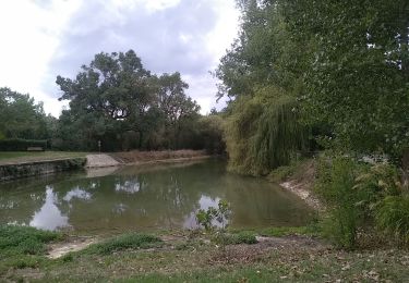
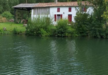
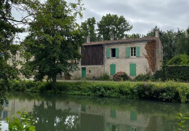
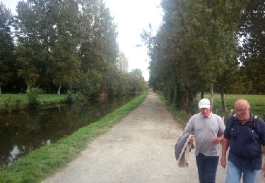
Promenade dans le marais, la campagne,le canal de Courdault, la rigole d'Aziré.
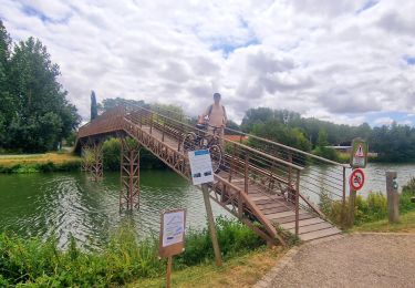
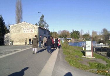
Départ & retour du port d'Aziré
Ort
Land:
France
Region :
Pays de la Loire
Abteilung/Provinz :
Vendée
Kommune :
Benet
Standort:
Unknown
Gehen Sie:(Dec)
Gehen Sie:(UTM)
681420 ; 5137213 (30T) N.
Kommentare
Touren in der Umgebung
![Tour Wandern Bouillé-Courdault - bouille - Photo](https://media.geolcdn.com/t/375/260/5ab1bec1-8161-429a-b08b-93e7df517407.jpg&format=jpg&maxdim=2)
![Wandern Wandern](https://static1.geolcdn.com/sitytour/trail-icons/101.png)
bouille
Wandern
Sehr leicht
(1)
Bouillé-Courdault,
Pays de la Loire,
Vendée,
France
![](/images/other/stat-length.png)
11,3 km | 12,1 km-effort
3h 52min
![](https://static1.geolcdn.com/siteimages/upload/files/16400158638029165_repeat_loop_refresh_sync_direction_icon.png)
Nein
![Tour Hybrid-Bike Le Mazeau - Cyclo dans le marais Poitevin - Photo](https://media.geolcdn.com/t/375/260/86905f3c-566b-4bf0-9e35-0be64feae71f.jpg&format=jpg&maxdim=2)
![Hybrid-Bike Hybrid-Bike](https://static1.geolcdn.com/sitytour/trail-icons/203.png)
Cyclo dans le marais Poitevin
Hybrid-Bike
Einfach
Le Mazeau,
Pays de la Loire,
Vendée,
France
![](/images/other/stat-length.png)
48 km | 51 km-effort
4h 10min
![](https://static1.geolcdn.com/siteimages/upload/files/16400158638029165_repeat_loop_refresh_sync_direction_icon.png)
Ja
![Tour Mountainbike Coulon - Le Marais à VTT - Coulon - Photo](https://media.geolcdn.com/t/375/260/ext.jpg?maxdim=2&url=https%3A%2F%2Fstatic1.geolcdn.com%2Fsiteimages%2Fupload%2Ffiles%2F1524743154velo.jpg)
![Mountainbike Mountainbike](https://static1.geolcdn.com/sitytour/trail-icons/202.png)
Le Marais à VTT - Coulon
Mountainbike
Einfach
(1)
Coulon,
Neu-Aquitanien,
Deux-Sèvres,
France
![](/images/other/stat-length.png)
40 km | 44 km-effort
2h 0min
![](https://static1.geolcdn.com/siteimages/upload/files/16400158638029165_repeat_loop_refresh_sync_direction_icon.png)
Ja
![Tour Wandern Le Mazeau - Mazeau_Marais_Sauvage - Photo](https://media.geolcdn.com/t/375/260/c928f69a-d8cb-467b-bfde-89b85eb625c6.jpg&format=jpg&maxdim=2)
![Wandern Wandern](https://static1.geolcdn.com/sitytour/trail-icons/101.png)
Mazeau_Marais_Sauvage
Wandern
Einfach
Le Mazeau,
Pays de la Loire,
Vendée,
France
![](/images/other/stat-length.png)
8,6 km | 9,2 km-effort
2h 45min
![](https://static1.geolcdn.com/siteimages/upload/files/16400158638029165_repeat_loop_refresh_sync_direction_icon.png)
Ja
![Tour Wandern Benet - Les Nattes - Photo](https://media.geolcdn.com/t/375/260/a97c3037-e825-40d3-8987-e43b5676dc7d.jpg&format=jpg&maxdim=2)
![Wandern Wandern](https://static1.geolcdn.com/sitytour/trail-icons/101.png)
Les Nattes
Wandern
Einfach
Benet,
Pays de la Loire,
Vendée,
France
![](/images/other/stat-length.png)
9,8 km | 10,5 km-effort
3h 17min
![](https://static1.geolcdn.com/siteimages/upload/files/16400158638029165_repeat_loop_refresh_sync_direction_icon.png)
Ja
![Tour Elektrofahrrad Coulon - Petit train de Coulon - Photo](https://media.geolcdn.com/t/375/260/f1d294eb-946d-4525-9985-772fb87c5582.jpg&format=jpg&maxdim=2)
![Elektrofahrrad Elektrofahrrad](https://static1.geolcdn.com/sitytour/trail-icons/205.png)
Petit train de Coulon
Elektrofahrrad
Sehr leicht
Coulon,
Neu-Aquitanien,
Deux-Sèvres,
France
![](/images/other/stat-length.png)
8,8 km | 9,3 km-effort
57min
![](https://static1.geolcdn.com/siteimages/upload/files/16400158638029165_repeat_loop_refresh_sync_direction_icon.png)
Ja
![Tour Wandern Coulon - Magné/Coulon - Sèvre et légendes - Photo](https://media.geolcdn.com/t/375/260/4f4ff755-9590-4a76-942c-56d12a5cae9d.jpg&format=jpg&maxdim=2)
![Wandern Wandern](https://static1.geolcdn.com/sitytour/trail-icons/101.png)
Magné/Coulon - Sèvre et légendes
Wandern
Einfach
Coulon,
Neu-Aquitanien,
Deux-Sèvres,
France
![](/images/other/stat-length.png)
13,5 km | 14,7 km-effort
3h 48min
![](https://static1.geolcdn.com/siteimages/upload/files/16400158638029165_repeat_loop_refresh_sync_direction_icon.png)
Ja
![Tour Wandern Le Mazeau - Le Mazeau 1 - Photo](https://media.geolcdn.com/t/375/260/ext.jpg?maxdim=2&url=https%3A%2F%2Fservices.sitytrail.com%2FGeolivesWS%2FDownloadMedia.ashx%3FTrailID%3D843604%26Media%3Dfix__20171010154548.jpg)
![Wandern Wandern](https://static1.geolcdn.com/sitytour/trail-icons/101.png)
Le Mazeau 1
Wandern
Einfach
Le Mazeau,
Pays de la Loire,
Vendée,
France
![](/images/other/stat-length.png)
8,6 km | 9,3 km-effort
2h 1min
![](https://static1.geolcdn.com/siteimages/upload/files/16400158638029165_repeat_loop_refresh_sync_direction_icon.png)
Ja
![Tour Wandern Coulon - Coulon- circuit 2 (7,8 km) - Photo](https://media.geolcdn.com/t/375/260/ext.jpg?maxdim=2&url=https%3A%2F%2Fservices.sitytrail.com%2FGeolivesWS%2FDownloadMedia.ashx%3FTrailID%3D234501%26Media%3Dfix__20131126150257.jpg)
![Wandern Wandern](https://static1.geolcdn.com/sitytour/trail-icons/101.png)
Coulon- circuit 2 (7,8 km)
Wandern
Sehr leicht
Coulon,
Neu-Aquitanien,
Deux-Sèvres,
France
![](/images/other/stat-length.png)
9,3 km | 9,9 km-effort
2h 11min
![](https://static1.geolcdn.com/siteimages/upload/files/16400158638029165_repeat_loop_refresh_sync_direction_icon.png)
Ja