![](/images/other/stat-length.png)
![Tour Wandern Beauregard-Baret - Le Pré de Cinq Sous - Montagne de Musan - Photo](https://media.geolcdn.com/t/1900/400/ext.pjpeg?maxdim=2&url=https%3A%2F%2Fservices.sitytrail.com%2FGeolivesWS%2FDownloadMedia.ashx%3FTrailID%3D129823%26Media%3D13374_1.jpg)
Le Pré de Cinq Sous - Montagne de Musan
tracegps
Benutzer
![Länge](/images/other/stat-length.png)
![Maximale Höhe](https://static1.geolcdn.com/siteimages/upload/files/1508320355ic_sort_altitude_max_24dp.png)
![Positive Höhendifferenz](https://static1.geolcdn.com/siteimages/upload/files/1508320355ic_sort_den_pos_24dp.png)
![Km-Effort](/images/other/stat-length.png)
![Min. Höhe](https://static1.geolcdn.com/siteimages/upload/files/1508320355ic_sort_altitude_min_24dp.png)
![Negative Höhendifferenz](https://static1.geolcdn.com/siteimages/upload/files/1508320355ic_sort_den_neg_24dp.png)
![Boucle](https://static1.geolcdn.com/siteimages/upload/files/16400158638029165_repeat_loop_refresh_sync_direction_icon.png)
![Wandern](https://static1.geolcdn.com/sitytour/trail-icons/101.png)
5h00
Schwierigkeit : Medium
![Scannen Sie diesen QR-Code, um die Tour in der SityTrail-Anwendung zu öffnen](https://capi.geolives.com/qq0zvz2zws4bq2lad0pu/sitytour/trails/129823/qr.png?size=200)
Kostenlosegpshiking-Anwendung
Über SityTrail
Tour Wandern von 10,7 km verfügbar auf Auvergne-Rhone-Alpen, Drôme, Beauregard-Baret. Diese Tour wird von tracegps vorgeschlagen.
Beschreibung
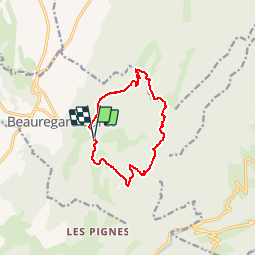
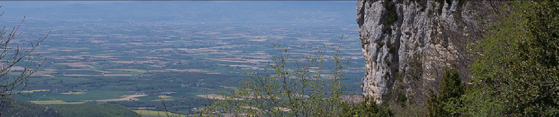
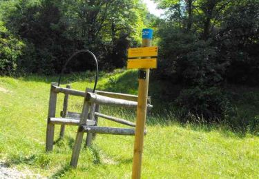
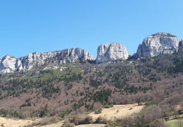
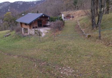
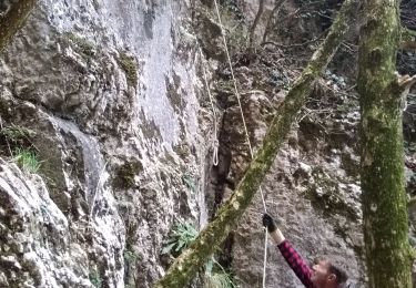
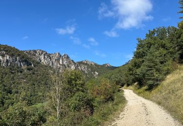
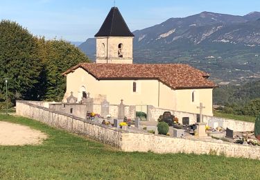
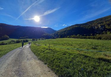
Vercors-Royan. À Beauregard-Baret, un défilé étroit donne accès à une sorte de vaste cirque formé par le versant Ouest de la Montagne de Musan – un anticlinal déjeté vers l'ouest, orienté au nord. Au départ du Passage du Tour le circuit d'aujourd'hui, monte suivre le Ravin de l'Ecalon par Champ-Riant, pour atteindre les Vereires, un collet sur la Montagne du Sey. Suit une traversée accidentée, orientée vers le Nord pour atteindre le Pré de Cinq Sous. Le retour traverse le Pré des Fourmis et le Col des Cordeliers pour arriver au Col des Marchands, et descendre la piste pastorale du Ravin de Combins et retrouver le point de départ. Description complète sur sentier-nature.com : Le Pré de Cinq Sous, Montagne de Musan Avertissement [Pénibilité 1/3]. Certains passages de cet itinéraire de montagne sont escarpés et/ou très exposés, il est déconseillé aux enfants non accompagnés et aux personnes sujettes au vertige. Pour votre sécurité, nous vous invitons à respecter les règles suivantes : être bien chaussé, ne pas s'engager par mauvais temps, ne pas s'écarter de l'itinéraire ni des sentiers.
Ort
Kommentare
Touren in der Umgebung
![Tour Wandern Beauregard-Baret - Pré de Cinq Sous - Beauregard Baret - Photo](https://media.geolcdn.com/t/375/260/ext.jpg?maxdim=2&url=https%3A%2F%2Fservices.sitytrail.com%2FGeolivesWS%2FDownloadMedia.ashx%3FTrailID%3D214828%26Media%3D15342_3.jpg)
![Wandern Wandern](https://static1.geolcdn.com/sitytour/trail-icons/101.png)
Wandern
![](/images/other/stat-length.png)
![](https://static1.geolcdn.com/siteimages/upload/files/16400158638029165_repeat_loop_refresh_sync_direction_icon.png)
![Tour Wandern Rochefort-Samson - Les Vachères - Combe d'oyans - Photo](https://media.geolcdn.com/t/375/260/b496d0d5-f9c5-4087-8105-422c092be197.jpg&format=jpg&maxdim=2)
![Wandern Wandern](https://static1.geolcdn.com/sitytour/trail-icons/101.png)
Wandern
![](/images/other/stat-length.png)
![](https://static1.geolcdn.com/siteimages/upload/files/16400158638029165_repeat_loop_refresh_sync_direction_icon.png)
![Tour Wandern Beauregard-Baret - reco cx st Gervais b baret - Photo](https://media.geolcdn.com/t/375/260/62f4b6af-f36d-4d7e-9bf7-cff82879ff65.jpg&format=jpg&maxdim=2)
![Wandern Wandern](https://static1.geolcdn.com/sitytour/trail-icons/101.png)
Wandern
![](/images/other/stat-length.png)
![](https://static1.geolcdn.com/siteimages/upload/files/16400158638029165_repeat_loop_refresh_sync_direction_icon.png)
![Tour Wandern Beauregard-Baret - croix st Gervais et Pas du loup - Photo](https://media.geolcdn.com/t/375/260/31db5131-e481-415d-9c06-0a841965de22.jpg&format=jpg&maxdim=2)
![Wandern Wandern](https://static1.geolcdn.com/sitytour/trail-icons/101.png)
Wandern
![](/images/other/stat-length.png)
![](https://static1.geolcdn.com/siteimages/upload/files/16400158638029165_repeat_loop_refresh_sync_direction_icon.png)
![Tour Wandern Barbières - 26 pierre chauve barbieres zel - Photo](https://media.geolcdn.com/t/375/260/92caf138-cce3-4645-835e-f3491e5ff577.jpg&format=jpg&maxdim=2)
![Wandern Wandern](https://static1.geolcdn.com/sitytour/trail-icons/101.png)
Wandern
![](/images/other/stat-length.png)
![](https://static1.geolcdn.com/siteimages/upload/files/16400158638029165_repeat_loop_refresh_sync_direction_icon.png)
![Tour sport Beauregard-Baret - Pierre rousse pas de pourceau l’eau basse - Photo](https://media.geolcdn.com/t/375/260/8f7985a7-111f-4318-9d67-55ef317841a8.jpg&format=jpg&maxdim=2)
sport
![](/images/other/stat-length.png)
![](https://static1.geolcdn.com/siteimages/upload/files/16400158638029165_repeat_loop_refresh_sync_direction_icon.png)
![Tour Wandern Barbières - Traversée Barbières Beauregard-Baret - Photo](https://media.geolcdn.com/t/375/260/2a3121e4-a036-4b19-8247-21a832e98ad8.jpg&format=jpg&maxdim=2)
![Wandern Wandern](https://static1.geolcdn.com/sitytour/trail-icons/101.png)
Wandern
![](/images/other/stat-length.png)
![](https://static1.geolcdn.com/siteimages/upload/files/16400158638029165_repeat_loop_refresh_sync_direction_icon.png)
![Tour Wandern Rochechinard - Rochechinard la Ragnole les Berthonettes - Photo](https://media.geolcdn.com/t/375/260/eb114973-ed3b-48be-acc9-8ba47652e0e1.jpg&format=jpg&maxdim=2)
![Wandern Wandern](https://static1.geolcdn.com/sitytour/trail-icons/101.png)
Wandern
![](/images/other/stat-length.png)
![](https://static1.geolcdn.com/siteimages/upload/files/16400158638029165_repeat_loop_refresh_sync_direction_icon.png)
![Tour Wandern Rochechinard - Chateau de Rochechinard - Photo](https://media.geolcdn.com/t/375/260/437f04f8-c584-4410-9de2-2a66f532620f.jpg&format=jpg&maxdim=2)
![Wandern Wandern](https://static1.geolcdn.com/sitytour/trail-icons/101.png)
Wandern
![](/images/other/stat-length.png)
![](https://static1.geolcdn.com/siteimages/upload/files/16400158638029165_repeat_loop_refresh_sync_direction_icon.png)
rando pas de pourceau