![](/images/other/stat-length.png)
![Tour Wandern Fontainebleau - Érables et Déluge. - Photo](https://media.geolcdn.com/t/1900/400/ext.pjpeg?maxdim=2&url=https%3A%2F%2Fstatic1.geolcdn.com%2Fsiteimages%2Fupload%2Ffiles%2F1553511878bg_sport_marche.png)
Érables et Déluge.
ulyssegauthier
Benutzer
![Länge](/images/other/stat-length.png)
Länge
6,2 km
![Maximale Höhe](https://static1.geolcdn.com/siteimages/upload/files/1508320355ic_sort_altitude_max_24dp.png)
Maximale Höhe
140 m
![Positive Höhendifferenz](https://static1.geolcdn.com/siteimages/upload/files/1508320355ic_sort_den_pos_24dp.png)
Positive Höhendifferenz
67 m
![Km-Effort](/images/other/stat-length.png)
Km-Effort
7,1 km
![Min. Höhe](https://static1.geolcdn.com/siteimages/upload/files/1508320355ic_sort_altitude_min_24dp.png)
Min. Höhe
99 m
![Negative Höhendifferenz](https://static1.geolcdn.com/siteimages/upload/files/1508320355ic_sort_den_neg_24dp.png)
Negative Höhendifferenz
68 m
![Boucle](https://static1.geolcdn.com/siteimages/upload/files/16400158638029165_repeat_loop_refresh_sync_direction_icon.png)
Boucle
Ja
Erstellungsdatum :
2014-12-10 00:00:00.0
Letzte Änderung :
2014-12-10 00:00:00.0
![Wandern](https://static1.geolcdn.com/sitytour/trail-icons/101.png)
--
Schwierigkeit : Einfach
![Scannen Sie diesen QR-Code, um die Tour in der SityTrail-Anwendung zu öffnen](https://capi.geolives.com/qq0zvz2zws4bq2lad0pu/sitytour/trails/129295/qr.png?size=200)
Kostenlosegpshiking-Anwendung
Über SityTrail
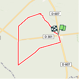
Tour Wandern von 6,2 km verfügbar auf Île-de-France, Seine-et-Marne, Fontainebleau. Diese Tour wird von ulyssegauthier vorgeschlagen.
Beschreibung
Parcours facile entièrement sur allées forestières.
RDV : Carrefour de la Croix de St-Hérem, sur la RN 7, parcelle [178].
Ort
Land:
France
Region :
Île-de-France
Abteilung/Provinz :
Seine-et-Marne
Kommune :
Fontainebleau
Standort:
Unknown
Gehen Sie:(Dec)
Gehen Sie:(UTM)
477136 ; 5356744 (31U) N.
Kommentare
Touren in der Umgebung
![Tour Wandern Fontainebleau - La Mare aux Fées 18km - Forêt de Fontainebleau - Photo](https://media.geolcdn.com/t/375/260/ext.jpg?maxdim=2&url=https%3A%2F%2Fstatic1.geolcdn.com%2Fsiteimages%2Fupload%2Ffiles%2F1553511878bg_sport_marche.png)
![Wandern Wandern](https://static1.geolcdn.com/sitytour/trail-icons/101.png)
La Mare aux Fées 18km - Forêt de Fontainebleau
Wandern
Medium
(5)
Fontainebleau,
Île-de-France,
Seine-et-Marne,
France
![](/images/other/stat-length.png)
18 km | 22 km-effort
4h 41min
![](https://static1.geolcdn.com/siteimages/upload/files/16400158638029165_repeat_loop_refresh_sync_direction_icon.png)
Ja
![Tour Wandern Recloses - Boucle recloses Nemours Grez/loing - Photo](https://media.geolcdn.com/t/375/260/191d15c7-1e16-40f7-89b9-dd7f9d0cddba.jpg&format=jpg&maxdim=2)
![Wandern Wandern](https://static1.geolcdn.com/sitytour/trail-icons/101.png)
Boucle recloses Nemours Grez/loing
Wandern
Medium
(1)
Recloses,
Île-de-France,
Seine-et-Marne,
France
![](/images/other/stat-length.png)
30 km | 34 km-effort
6h 20min
![](https://static1.geolcdn.com/siteimages/upload/files/16400158638029165_repeat_loop_refresh_sync_direction_icon.png)
Ja
![Tour Zu Fuß Fontainebleau - Boucle 28 km en forêt de Fontainebleau - Photo](https://media.geolcdn.com/t/375/260/21e3a864-d768-407e-8af1-222ee36d7889.jpg&format=jpg&maxdim=2)
![Zu Fuß Zu Fuß](https://static1.geolcdn.com/sitytour/trail-icons/100.png)
Boucle 28 km en forêt de Fontainebleau
Zu Fuß
Medium
(1)
Fontainebleau,
Île-de-France,
Seine-et-Marne,
France
![](/images/other/stat-length.png)
28 km | 34 km-effort
7h 43min
![](https://static1.geolcdn.com/siteimages/upload/files/16400158638029165_repeat_loop_refresh_sync_direction_icon.png)
Ja
![Tour Wandern Fontainebleau - GLM-150311 - PVerte-Fourceau-Béatrix - Photo](https://media.geolcdn.com/t/375/260/ext.jpg?maxdim=2&url=https%3A%2F%2Fservices.sitytrail.com%2FGeolivesWS%2FDownloadMedia.ashx%3FTrailID%3D394980%26Media%3D3b15c306-0eca-40de-a57d-3cf59ddfeba2.jpg)
![Wandern Wandern](https://static1.geolcdn.com/sitytour/trail-icons/101.png)
GLM-150311 - PVerte-Fourceau-Béatrix
Wandern
Medium
(1)
Fontainebleau,
Île-de-France,
Seine-et-Marne,
France
![](/images/other/stat-length.png)
16,5 km | 20 km-effort
6h 0min
![](https://static1.geolcdn.com/siteimages/upload/files/16400158638029165_repeat_loop_refresh_sync_direction_icon.png)
Ja
![Tour Wandern Bourron-Marlotte - Boucle Bourron Marlotte ( reco Didier) - Photo](https://media.geolcdn.com/t/375/260/ext.jpg?maxdim=2&url=https%3A%2F%2Fstatic1.geolcdn.com%2Fsiteimages%2Fupload%2Ffiles%2F1553511878bg_sport_marche.png)
![Wandern Wandern](https://static1.geolcdn.com/sitytour/trail-icons/101.png)
Boucle Bourron Marlotte ( reco Didier)
Wandern
Einfach
(1)
Bourron-Marlotte,
Île-de-France,
Seine-et-Marne,
France
![](/images/other/stat-length.png)
28 km | 32 km-effort
5h 35min
![](https://static1.geolcdn.com/siteimages/upload/files/16400158638029165_repeat_loop_refresh_sync_direction_icon.png)
Ja
![Tour Wandern Fontainebleau - Rocher Fourceau-Petit Mont Chauvet SR210523Ve?? fmg - Photo](https://media.geolcdn.com/t/375/260/cabc9437-0e04-4fa0-9f5b-0c9f73ac9000.jpg&format=jpg&maxdim=2)
![Wandern Wandern](https://static1.geolcdn.com/sitytour/trail-icons/101.png)
Rocher Fourceau-Petit Mont Chauvet SR210523Ve?? fmg
Wandern
Sehr schwierig
(2)
Fontainebleau,
Île-de-France,
Seine-et-Marne,
France
![](/images/other/stat-length.png)
19,5 km | 24 km-effort
5h 27min
![](https://static1.geolcdn.com/siteimages/upload/files/16400158638029165_repeat_loop_refresh_sync_direction_icon.png)
Ja
![Tour Wandern Fontainebleau - Rando mares aux fees Gilles18 km - Photo](https://media.geolcdn.com/t/375/260/1a2c21e9-241f-4517-a09c-d9710ae3d7d2.jpg&format=jpg&maxdim=2)
![Wandern Wandern](https://static1.geolcdn.com/sitytour/trail-icons/101.png)
Rando mares aux fees Gilles18 km
Wandern
Sehr schwierig
(1)
Fontainebleau,
Île-de-France,
Seine-et-Marne,
France
![](/images/other/stat-length.png)
17,8 km | 22 km-effort
4h 58min
![](https://static1.geolcdn.com/siteimages/upload/files/16400158638029165_repeat_loop_refresh_sync_direction_icon.png)
Ja
![Tour Wandern Fontainebleau - Boucle du Château de Fontainebleau à Thomery 21 km - Photo](https://media.geolcdn.com/t/375/260/22a500a3-91bf-4087-9234-7c012b4b260f.jpg&format=jpg&maxdim=2)
![Wandern Wandern](https://static1.geolcdn.com/sitytour/trail-icons/101.png)
Boucle du Château de Fontainebleau à Thomery 21 km
Wandern
Medium
Fontainebleau,
Île-de-France,
Seine-et-Marne,
France
![](/images/other/stat-length.png)
21 km | 24 km-effort
4h 27min
![](https://static1.geolcdn.com/siteimages/upload/files/16400158638029165_repeat_loop_refresh_sync_direction_icon.png)
Ja
![Tour Wandern Fontainebleau - Boucle 30 km Thomery - Photo](https://media.geolcdn.com/t/375/260/0874c90c-8e55-44c8-845b-1a3f1ab9994c.jpg&format=jpg&maxdim=2)
![Wandern Wandern](https://static1.geolcdn.com/sitytour/trail-icons/101.png)
Boucle 30 km Thomery
Wandern
Schwierig
Fontainebleau,
Île-de-France,
Seine-et-Marne,
France
![](/images/other/stat-length.png)
31 km | 36 km-effort
6h 8min
![](https://static1.geolcdn.com/siteimages/upload/files/16400158638029165_repeat_loop_refresh_sync_direction_icon.png)
Ja