![](/images/other/stat-length.png)
![Tour Mountainbike Mandeure - GTJ INTEGRALE - Photo](https://media.geolcdn.com/t/1900/400/ext.pjpeg?maxdim=2&url=https%3A%2F%2Fstatic1.geolcdn.com%2Fsiteimages%2Fupload%2Ffiles%2F1524743154velo.jpg)
GTJ INTEGRALE
DANCHAUD
Benutzer
![Länge](/images/other/stat-length.png)
Länge
365 km
![Maximale Höhe](https://static1.geolcdn.com/siteimages/upload/files/1508320355ic_sort_altitude_max_24dp.png)
Maximale Höhe
1351 m
![Positive Höhendifferenz](https://static1.geolcdn.com/siteimages/upload/files/1508320355ic_sort_den_pos_24dp.png)
Positive Höhendifferenz
9539 m
![Km-Effort](/images/other/stat-length.png)
Km-Effort
490 km
![Min. Höhe](https://static1.geolcdn.com/siteimages/upload/files/1508320355ic_sort_altitude_min_24dp.png)
Min. Höhe
335 m
![Negative Höhendifferenz](https://static1.geolcdn.com/siteimages/upload/files/1508320355ic_sort_den_neg_24dp.png)
Negative Höhendifferenz
8737 m
![Boucle](https://static1.geolcdn.com/siteimages/upload/files/16400158638029165_repeat_loop_refresh_sync_direction_icon.png)
Boucle
Nein
Erstellungsdatum :
2014-12-10 00:00:00.0
Letzte Änderung :
2014-12-10 00:00:00.0
![Mountainbike](https://static1.geolcdn.com/sitytour/trail-icons/202.png)
--
Schwierigkeit : Medium
![Scannen Sie diesen QR-Code, um die Tour in der SityTrail-Anwendung zu öffnen](https://capi.geolives.com/qq0zvz2zws4bq2lad0pu/sitytour/trails/124087/qr.png?size=200)
Kostenlosegpshiking-Anwendung
Über SityTrail
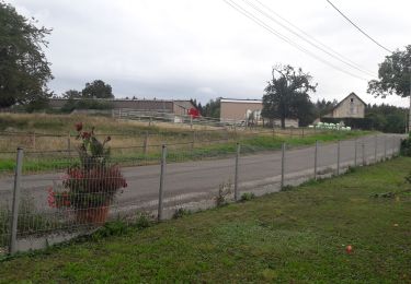
Tour Mountainbike von 365 km verfügbar auf Burgund und Freigrafschaft, Doubs, Mandeure. Diese Tour wird von DANCHAUD vorgeschlagen.
Beschreibung
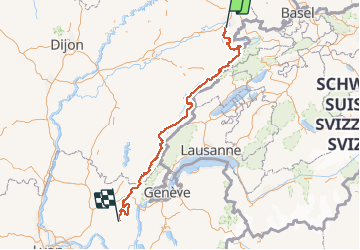
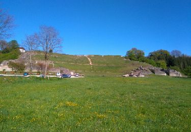
voici le tracé de la GTJ en version intégrale d’après le guide CHAMINA.La version light n'est pas tracé dans cette version.
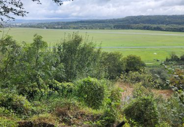
ATTENTION LE D N'EST PAS LE BON
car je n'ai pas calculer le D avant la sauvegarde.
Ort
Land:
France
Region :
Burgund und Freigrafschaft
Abteilung/Provinz :
Doubs
Kommune :
Mandeure
Standort:
Unknown
Gehen Sie:(Dec)
Gehen Sie:(UTM)
334316 ; 5257505 (32T) N.
Kommentare
Touren in der Umgebung
![Wandern Wandern](https://static1.geolcdn.com/sitytour/trail-icons/101.png)
Seloncourt, les 5 sapins (10 km )
Wandern
Medium
(1)
Seloncourt,
Burgund und Freigrafschaft,
Doubs,
France
![](/images/other/stat-length.png)
10,1 km | 13,5 km-effort
3h 3min
![](https://static1.geolcdn.com/siteimages/upload/files/16400158638029165_repeat_loop_refresh_sync_direction_icon.png)
Ja
![Wandern Wandern](https://static1.geolcdn.com/sitytour/trail-icons/101.png)
Mandeure, Les Grands Communaux 9.6 Km
Wandern
Schwierig
(1)
Mandeure,
Burgund und Freigrafschaft,
Doubs,
France
![](/images/other/stat-length.png)
9,6 km | 13,2 km-effort
2h 59min
![](https://static1.geolcdn.com/siteimages/upload/files/16400158638029165_repeat_loop_refresh_sync_direction_icon.png)
Ja
![Tour Wandern Bourguignon - Bourguignon, entre eau et forêt 9.5 Km - Photo](https://media.geolcdn.com/t/375/260/ext.jpg?maxdim=2&url=https%3A%2F%2Fstatic1.geolcdn.com%2Fsiteimages%2Fupload%2Ffiles%2F1553511878bg_sport_marche.png)
![Wandern Wandern](https://static1.geolcdn.com/sitytour/trail-icons/101.png)
Bourguignon, entre eau et forêt 9.5 Km
Wandern
Medium
(1)
Bourguignon,
Burgund und Freigrafschaft,
Doubs,
France
![](/images/other/stat-length.png)
9,5 km | 11,9 km-effort
2h 2min
![](https://static1.geolcdn.com/siteimages/upload/files/16400158638029165_repeat_loop_refresh_sync_direction_icon.png)
Ja
![Tour Wandern Roches-lès-Blamont - 2019.09.06.Roches - Photo](https://media.geolcdn.com/t/375/260/bed60826-1f59-4c84-aef0-6b99144c06d1.jpg&format=jpg&maxdim=2)
![Wandern Wandern](https://static1.geolcdn.com/sitytour/trail-icons/101.png)
2019.09.06.Roches
Wandern
Sehr leicht
Roches-lès-Blamont,
Burgund und Freigrafschaft,
Doubs,
France
![](/images/other/stat-length.png)
11,4 km | 16,5 km-effort
3h 12min
![](https://static1.geolcdn.com/siteimages/upload/files/16400158638029165_repeat_loop_refresh_sync_direction_icon.png)
Ja
![Tour Wandern Roches-lès-Blamont - 2019.09.05.Roches - Photo](https://media.geolcdn.com/t/375/260/b8f28288-bf02-4d23-8b44-8d678a5cf2af.jpg&format=jpg&maxdim=2)
![Wandern Wandern](https://static1.geolcdn.com/sitytour/trail-icons/101.png)
2019.09.05.Roches
Wandern
Sehr leicht
Roches-lès-Blamont,
Burgund und Freigrafschaft,
Doubs,
France
![](/images/other/stat-length.png)
10,8 km | 14,7 km-effort
2h 38min
![](https://static1.geolcdn.com/siteimages/upload/files/16400158638029165_repeat_loop_refresh_sync_direction_icon.png)
Ja
![Tour Andere Aktivitäten Voujeaucourt - de voujeaucourt à Dambelin, puis pont de roide - Photo](https://media.geolcdn.com/t/375/260/ext.jpg?maxdim=2&url=https%3A%2F%2Fservices.sitytrail.com%2FGeolivesWS%2FDownloadMedia.ashx%3FTrailID%3D737146%26Media%3Dfix__20170421173351.jpg)
![Andere Aktivitäten Andere Aktivitäten](https://static1.geolcdn.com/sitytour/trail-icons/900.png)
de voujeaucourt à Dambelin, puis pont de roide
Andere Aktivitäten
Sehr leicht
Voujeaucourt,
Burgund und Freigrafschaft,
Doubs,
France
![](/images/other/stat-length.png)
57 km | 77 km-effort
4h 46min
![](https://static1.geolcdn.com/siteimages/upload/files/16400158638029165_repeat_loop_refresh_sync_direction_icon.png)
Ja
![Tour Nordic Walking Courcelles-lès-Montbéliard - randonnée du lion 2024 - Photo](https://media.geolcdn.com/t/375/260/3f9f281c-6be4-4486-9d0b-09b5ebf8048a.jpg&format=jpg&maxdim=2)
![Nordic Walking Nordic Walking](https://static1.geolcdn.com/sitytour/trail-icons/102.png)
randonnée du lion 2024
Nordic Walking
Sehr leicht
Courcelles-lès-Montbéliard,
Burgund und Freigrafschaft,
Doubs,
France
![](/images/other/stat-length.png)
18,1 km | 22 km-effort
4h 3min
![](https://static1.geolcdn.com/siteimages/upload/files/16400158638029165_repeat_loop_refresh_sync_direction_icon.png)
Nein
![Tour Radtourismus Arbouans - GTJ #1 - Photo](https://media.geolcdn.com/t/375/260/bc869aa9-9c52-4e94-806e-b0926b148033.jpg&format=jpg&maxdim=2)
![Radtourismus Radtourismus](https://static1.geolcdn.com/sitytour/trail-icons/204.png)
GTJ #1
Radtourismus
Sehr schwierig
Arbouans,
Burgund und Freigrafschaft,
Doubs,
France
![](/images/other/stat-length.png)
108 km | 142 km-effort
10h 18min
![](https://static1.geolcdn.com/siteimages/upload/files/16400158638029165_repeat_loop_refresh_sync_direction_icon.png)
Nein
![Tour Wandern Mandeure - source Charles - Photo](https://media.geolcdn.com/t/375/260/648031c0-b4de-472e-85c6-7607594dcf29.jpg&format=jpg&maxdim=2)
![Wandern Wandern](https://static1.geolcdn.com/sitytour/trail-icons/101.png)
source Charles
Wandern
Einfach
Mandeure,
Burgund und Freigrafschaft,
Doubs,
France
![](/images/other/stat-length.png)
5 km | 6,4 km-effort
1h 35min
![](https://static1.geolcdn.com/siteimages/upload/files/16400158638029165_repeat_loop_refresh_sync_direction_icon.png)
Nein