![](/images/other/stat-length.png)
![Tour Schneeschuhwandern Albiès - Raquette au plateau de Beille - Les Cabannes - Photo](https://media.geolcdn.com/t/1900/400/ext.pjpeg?maxdim=2&url=https%3A%2F%2Fservices.sitytrail.com%2FGeolivesWS%2FDownloadMedia.ashx%3FTrailID%3D118820%26Media%3D13031_2.jpg)
Raquette au plateau de Beille - Les Cabannes
tracegps
Benutzer
![Länge](/images/other/stat-length.png)
Länge
7,7 km
![Maximale Höhe](https://static1.geolcdn.com/siteimages/upload/files/1508320355ic_sort_altitude_max_24dp.png)
Maximale Höhe
1979 m
![Positive Höhendifferenz](https://static1.geolcdn.com/siteimages/upload/files/1508320355ic_sort_den_pos_24dp.png)
Positive Höhendifferenz
245 m
![Km-Effort](/images/other/stat-length.png)
Km-Effort
10,9 km
![Min. Höhe](https://static1.geolcdn.com/siteimages/upload/files/1508320355ic_sort_altitude_min_24dp.png)
Min. Höhe
1766 m
![Negative Höhendifferenz](https://static1.geolcdn.com/siteimages/upload/files/1508320355ic_sort_den_neg_24dp.png)
Negative Höhendifferenz
246 m
![Boucle](https://static1.geolcdn.com/siteimages/upload/files/16400158638029165_repeat_loop_refresh_sync_direction_icon.png)
Boucle
Ja
Erstellungsdatum :
2014-12-10 00:00:00.0
Letzte Änderung :
2014-12-10 00:00:00.0
![Schneeschuhwandern](https://static1.geolcdn.com/sitytour/trail-icons/504.png)
4h30
Schwierigkeit : Medium
![Scannen Sie diesen QR-Code, um die Tour in der SityTrail-Anwendung zu öffnen](https://capi.geolives.com/qq0zvz2zws4bq2lad0pu/sitytour/trails/118820/qr.png?size=200)
Kostenlosegpshiking-Anwendung
Über SityTrail
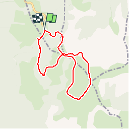
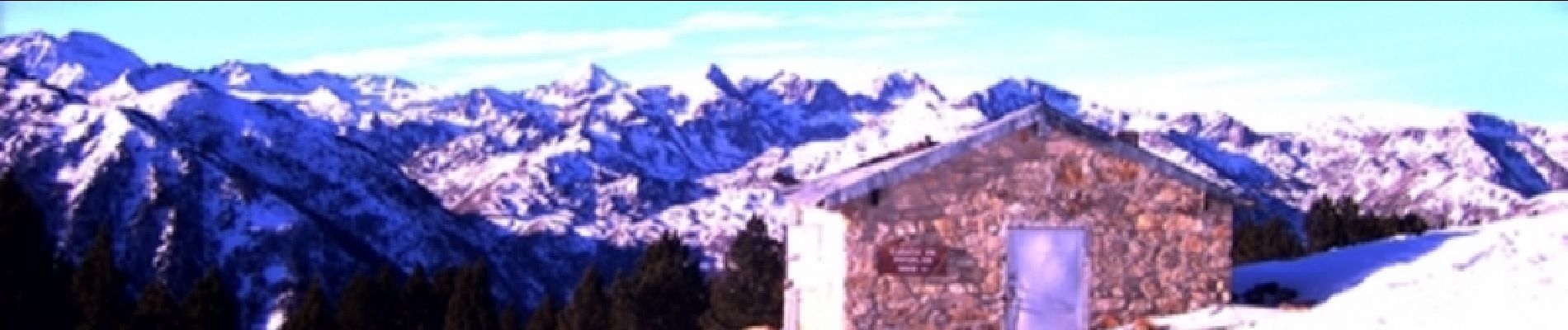
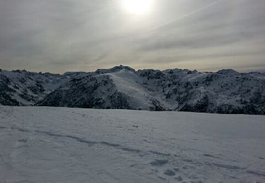
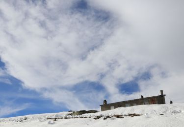
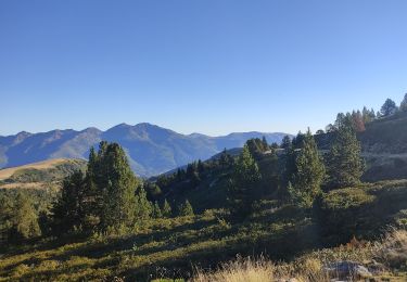
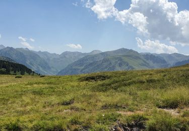
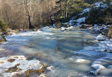
Tour Schneeschuhwandern von 7,7 km verfügbar auf Okzitanien, Ariège, Albiès. Diese Tour wird von tracegps vorgeschlagen.
Beschreibung
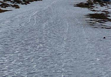
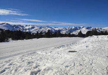
Départ de la station de Beille. Balade faite en raquette par une journée ensoleillée, sans nuages, sans vent, c'était magnifique.
Ort
Land:
France
Region :
Okzitanien
Abteilung/Provinz :
Ariège
Kommune :
Albiès
Standort:
Unknown
Gehen Sie:(Dec)
Gehen Sie:(UTM)
392831 ; 4731052 (31T) N.
Kommentare
Touren in der Umgebung
![Tour Nordic Walking Albiès - Plateau de Beille - L'ours - Photo](https://media.geolcdn.com/t/375/260/ext.jpg?maxdim=2&url=https%3A%2F%2Fservices.sitytrail.com%2FGeolivesWS%2FDownloadMedia.ashx%3FTrailID%3D239827%26Media%3Dfix__20140101140841.jpg)
![Nordic Walking Nordic Walking](https://static1.geolcdn.com/sitytour/trail-icons/102.png)
Plateau de Beille - L'ours
Nordic Walking
Medium
(1)
Albiès,
Okzitanien,
Ariège,
France
![](/images/other/stat-length.png)
11,5 km | 17 km-effort
3h 29min
![](https://static1.geolcdn.com/siteimages/upload/files/16400158638029165_repeat_loop_refresh_sync_direction_icon.png)
Ja
![Schneeschuhwandern Schneeschuhwandern](https://static1.geolcdn.com/sitytour/trail-icons/504.png)
Plateau de Beille
Schneeschuhwandern
Einfach
Albiès,
Okzitanien,
Ariège,
France
![](/images/other/stat-length.png)
7,2 km | 10,1 km-effort
2h 33min
![](https://static1.geolcdn.com/siteimages/upload/files/16400158638029165_repeat_loop_refresh_sync_direction_icon.png)
Ja
![Tour Schneeschuhwandern Albiès - Plateau de beille - Photo](https://media.geolcdn.com/t/375/260/da6a2572-4c1b-41ed-9590-3cd2a4cf46bb.jpg&format=jpg&maxdim=2)
![Schneeschuhwandern Schneeschuhwandern](https://static1.geolcdn.com/sitytour/trail-icons/504.png)
Plateau de beille
Schneeschuhwandern
Einfach
Albiès,
Okzitanien,
Ariège,
France
![](/images/other/stat-length.png)
9,6 km | 12,8 km-effort
2h 46min
![](https://static1.geolcdn.com/siteimages/upload/files/16400158638029165_repeat_loop_refresh_sync_direction_icon.png)
Nein
![Tour Wandern Albiès - Plateau de beille 2023 - Photo](https://media.geolcdn.com/t/375/260/fa1b8e61-ee1a-4848-b664-b8a72612b215.jpg&format=jpg&maxdim=2)
![Wandern Wandern](https://static1.geolcdn.com/sitytour/trail-icons/101.png)
Plateau de beille 2023
Wandern
Einfach
Albiès,
Okzitanien,
Ariège,
France
![](/images/other/stat-length.png)
7,4 km | 9,9 km-effort
4h 1min
![](https://static1.geolcdn.com/siteimages/upload/files/16400158638029165_repeat_loop_refresh_sync_direction_icon.png)
Ja
![Tour Wandern Albiès - Plateau de Beille et Crête des Gènibres - Photo](https://media.geolcdn.com/t/375/260/cf66f9fb-ea7d-4bb9-8906-e5d9cb1e9304.jpg&format=jpg&maxdim=2)
![Wandern Wandern](https://static1.geolcdn.com/sitytour/trail-icons/101.png)
Plateau de Beille et Crête des Gènibres
Wandern
Medium
Albiès,
Okzitanien,
Ariège,
France
![](/images/other/stat-length.png)
16,8 km | 25 km-effort
5h 40min
![](https://static1.geolcdn.com/siteimages/upload/files/16400158638029165_repeat_loop_refresh_sync_direction_icon.png)
Ja
![Tour Wandern Albiès - plateau Beille - Photo](https://media.geolcdn.com/t/375/260/f3b2cab8-bd62-4c33-9981-852ae48441a8.jpg&format=jpg&maxdim=2)
![Wandern Wandern](https://static1.geolcdn.com/sitytour/trail-icons/101.png)
![Tour Wandern Albiès - Beille 2022 - Photo](https://media.geolcdn.com/t/375/260/10123c6e-4d4a-40ba-9f46-828c7d62ad25.jpg&format=jpg&maxdim=2)
![Wandern Wandern](https://static1.geolcdn.com/sitytour/trail-icons/101.png)
![Tour Wandern Albiès - 2022 TRANSPYRÉNÉ - Plateau de Bielle (Angaka) - refuge de Ruhle - Photo](https://media.geolcdn.com/t/375/260/fd2d908d-d73f-431b-aa74-1af01944cbee.jpg&format=jpg&maxdim=2)
![Wandern Wandern](https://static1.geolcdn.com/sitytour/trail-icons/101.png)
2022 TRANSPYRÉNÉ - Plateau de Bielle (Angaka) - refuge de Ruhle
Wandern
Schwierig
Albiès,
Okzitanien,
Ariège,
France
![](/images/other/stat-length.png)
15,4 km | 25 km-effort
4h 23min
![](https://static1.geolcdn.com/siteimages/upload/files/16400158638029165_repeat_loop_refresh_sync_direction_icon.png)
Nein
![Tour Wandern Aston - Massayres janvier 2020 - Photo](https://media.geolcdn.com/t/375/260/bb411948-71b3-4a92-a42a-79e20006fb67.jpg&format=jpg&maxdim=2)
![Wandern Wandern](https://static1.geolcdn.com/sitytour/trail-icons/101.png)
Massayres janvier 2020
Wandern
Schwierig
Aston,
Okzitanien,
Ariège,
France
![](/images/other/stat-length.png)
9,7 km | 21 km-effort
5h 42min
![](https://static1.geolcdn.com/siteimages/upload/files/16400158638029165_repeat_loop_refresh_sync_direction_icon.png)
Ja