![](/images/other/stat-length.png)
![Tour Mountainbike Bosroumois - Boue'Roger 2012 - Le Bosc Roger en Roumois - Photo](https://media.geolcdn.com/t/1900/400/ext.pjpeg?maxdim=2&url=https%3A%2F%2Fservices.sitytrail.com%2FGeolivesWS%2FDownloadMedia.ashx%3FTrailID%3D118798%26Media%3D13008_2.jpg)
Boue'Roger 2012 - Le Bosc Roger en Roumois
tracegps
Benutzer
![Länge](/images/other/stat-length.png)
Länge
45 km
![Maximale Höhe](https://static1.geolcdn.com/siteimages/upload/files/1508320355ic_sort_altitude_max_24dp.png)
Maximale Höhe
154 m
![Positive Höhendifferenz](https://static1.geolcdn.com/siteimages/upload/files/1508320355ic_sort_den_pos_24dp.png)
Positive Höhendifferenz
853 m
![Km-Effort](/images/other/stat-length.png)
Km-Effort
56 km
![Min. Höhe](https://static1.geolcdn.com/siteimages/upload/files/1508320355ic_sort_altitude_min_24dp.png)
Min. Höhe
22 m
![Negative Höhendifferenz](https://static1.geolcdn.com/siteimages/upload/files/1508320355ic_sort_den_neg_24dp.png)
Negative Höhendifferenz
853 m
![Boucle](https://static1.geolcdn.com/siteimages/upload/files/16400158638029165_repeat_loop_refresh_sync_direction_icon.png)
Boucle
Ja
Erstellungsdatum :
2014-12-10 00:00:00.0
Letzte Änderung :
2014-12-10 00:00:00.0
![Mountainbike](https://static1.geolcdn.com/sitytour/trail-icons/202.png)
3h30
Schwierigkeit : Schwierig
![Scannen Sie diesen QR-Code, um die Tour in der SityTrail-Anwendung zu öffnen](https://capi.geolives.com/qq0zvz2zws4bq2lad0pu/sitytour/trails/118798/qr.png?size=200)
Kostenlosegpshiking-Anwendung
Über SityTrail
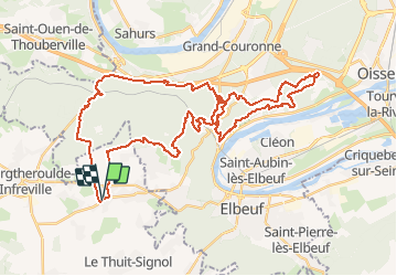
Tour Mountainbike von 45 km verfügbar auf Normandie, Eure, Bosroumois. Diese Tour wird von tracegps vorgeschlagen.
Beschreibung
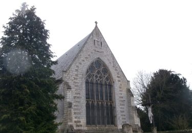
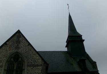
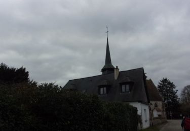
Superbe parcours technique avec de beaux panoramas sur la Seine. Passage dans des Troglodytes. Difficile quand le terrain est boueux.
Ort
Land:
France
Region :
Normandie
Abteilung/Provinz :
Eure
Kommune :
Bosroumois
Standort:
Unknown
Gehen Sie:(Dec)
Gehen Sie:(UTM)
349082 ; 5461925 (31U) N.
Kommentare
Touren in der Umgebung
![Tour Wandern La Londe - La Londe 76- 13 km - Photo](https://media.geolcdn.com/t/375/260/23588b19-2689-475f-b2bd-10608cbf7253.jpg&format=jpg&maxdim=2)
![Wandern Wandern](https://static1.geolcdn.com/sitytour/trail-icons/101.png)
La Londe 76- 13 km
Wandern
Schwierig
(1)
La Londe,
Normandie,
Seine-Maritime,
France
![](/images/other/stat-length.png)
13 km | 16,1 km-effort
3h 43min
![](https://static1.geolcdn.com/siteimages/upload/files/16400158638029165_repeat_loop_refresh_sync_direction_icon.png)
Ja
![Tour Wandern Saint-Pierre-du-Bosguérard - Bois De La Caboche XXL 2 - Photo](https://media.geolcdn.com/t/375/260/ext.jpg?maxdim=2&url=https%3A%2F%2Fstatic1.geolcdn.com%2Fsiteimages%2Fupload%2Ffiles%2F1553511878bg_sport_marche.png)
![Wandern Wandern](https://static1.geolcdn.com/sitytour/trail-icons/101.png)
Bois De La Caboche XXL 2
Wandern
Medium
(2)
Saint-Pierre-du-Bosguérard,
Normandie,
Eure,
France
![](/images/other/stat-length.png)
11,9 km | 14,1 km-effort
3h 5min
![](https://static1.geolcdn.com/siteimages/upload/files/16400158638029165_repeat_loop_refresh_sync_direction_icon.png)
Ja
![Wandern Wandern](https://static1.geolcdn.com/sitytour/trail-icons/101.png)
20240507-La Londe Cool
Wandern
Einfach
La Londe,
Normandie,
Seine-Maritime,
France
![](/images/other/stat-length.png)
7,3 km | 9,2 km-effort
2h 15min
![](https://static1.geolcdn.com/siteimages/upload/files/16400158638029165_repeat_loop_refresh_sync_direction_icon.png)
Ja
![Wandern Wandern](https://static1.geolcdn.com/sitytour/trail-icons/101.png)
20240409-StPierre des Fleurs Cool
Wandern
Einfach
Saint-Pierre-des-Fleurs,
Normandie,
Eure,
France
![](/images/other/stat-length.png)
7,5 km | 8,5 km-effort
2h 10min
![](https://static1.geolcdn.com/siteimages/upload/files/16400158638029165_repeat_loop_refresh_sync_direction_icon.png)
Ja
![Wandern Wandern](https://static1.geolcdn.com/sitytour/trail-icons/101.png)
la londe
Wandern
Schwierig
La Londe,
Normandie,
Seine-Maritime,
France
![](/images/other/stat-length.png)
11,6 km | 14,3 km-effort
3h 14min
![](https://static1.geolcdn.com/siteimages/upload/files/16400158638029165_repeat_loop_refresh_sync_direction_icon.png)
Nein
![Wandern Wandern](https://static1.geolcdn.com/sitytour/trail-icons/101.png)
20240312-La londe cool
Wandern
Einfach
(1)
La Londe,
Normandie,
Seine-Maritime,
France
![](/images/other/stat-length.png)
7,7 km | 8,9 km-effort
2h 7min
![](https://static1.geolcdn.com/siteimages/upload/files/16400158638029165_repeat_loop_refresh_sync_direction_icon.png)
Ja
![Wandern Wandern](https://static1.geolcdn.com/sitytour/trail-icons/101.png)
20240305-La Saussaye Cool
Wandern
Einfach
La Saussaye,
Normandie,
Eure,
France
![](/images/other/stat-length.png)
7 km | 7,7 km-effort
1h 44min
![](https://static1.geolcdn.com/siteimages/upload/files/16400158638029165_repeat_loop_refresh_sync_direction_icon.png)
Ja
![Wandern Wandern](https://static1.geolcdn.com/sitytour/trail-icons/101.png)
20240210-St Pierre des Fleurs
Wandern
Medium
Saint-Pierre-des-Fleurs,
Normandie,
Eure,
France
![](/images/other/stat-length.png)
12,2 km | 14,7 km-effort
2h 59min
![](https://static1.geolcdn.com/siteimages/upload/files/16400158638029165_repeat_loop_refresh_sync_direction_icon.png)
Ja
![Wandern Wandern](https://static1.geolcdn.com/sitytour/trail-icons/101.png)
20240130-La Saussaye
Wandern
Medium
La Saussaye,
Normandie,
Eure,
France
![](/images/other/stat-length.png)
11 km | 13,4 km-effort
2h 31min
![](https://static1.geolcdn.com/siteimages/upload/files/16400158638029165_repeat_loop_refresh_sync_direction_icon.png)
Ja