


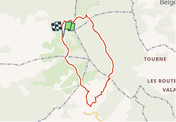

12,6 km | 16,7 km-effort


Benutzer


Kostenlosegpshiking-Anwendung
 SityTrail
IGN / Geografische Institute
SityTrail World
Die Welt öffnet sich für Sie
Tour Wandern von 15,7 km verfügbar auf Provence-Alpes-Côte d'Azur, Var, Signes. Diese Tour wird von pourrier vorgeschlagen.
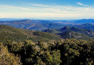
Siou Blanc - Le Grand CAP Promenade sans difficulté.
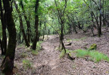
Pour la descente du Grand CAP, pour éviter la descente raide, on peut prendre le sentier plus long.

Wandern

Wandern
Wandern

Wandern
Wandern

Wandern

Laufen

Andere Aktivitäten
Wandern