


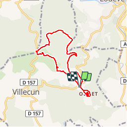


9,3 km | 12,4 km-effort

La marche dans les monts d'Orb, le Caroux, et dans l'Hérault et l'aveyron


Kostenlosegpshiking-Anwendung
 SityTrail
IGN / Geografische Institute
SityTrail World
Die Welt öffnet sich für Sie
Tour Wandern von 7,1 km verfügbar auf Okzitanien, Hérault, Olmet-et-Villecun. Diese Tour wird von Groupe de marche du Recantou vorgeschlagen.
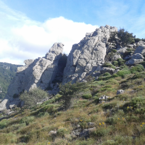
Joli montée au dessus d'Olmet jusqu'a la Défriche. Tous le dénivelé est dans le 1ier KM.
Pas de Balisage

Nordic Walking

Nordic Walking

Nordic Walking

Wandern

Wandern

Wandern

Wandern

Wandern

Wandern