![](/images/other/stat-length.png)
![Tour Wandern Fouesnant - Cap-Coz - Beg Meil - Mousterlin et retour - Photo](https://media.geolcdn.com/t/1900/400/ext.pjpeg?maxdim=2&url=https%3A%2F%2Fstatic1.geolcdn.com%2Fsiteimages%2Fupload%2Ffiles%2F1553511878bg_sport_marche.png)
Cap-Coz - Beg Meil - Mousterlin et retour
pijau
Benutzer
![Länge](/images/other/stat-length.png)
Länge
17,3 km
![Maximale Höhe](https://static1.geolcdn.com/siteimages/upload/files/1508320355ic_sort_altitude_max_24dp.png)
Maximale Höhe
39 m
![Positive Höhendifferenz](https://static1.geolcdn.com/siteimages/upload/files/1508320355ic_sort_den_pos_24dp.png)
Positive Höhendifferenz
137 m
![Km-Effort](/images/other/stat-length.png)
Km-Effort
19,1 km
![Min. Höhe](https://static1.geolcdn.com/siteimages/upload/files/1508320355ic_sort_altitude_min_24dp.png)
Min. Höhe
-1 m
![Negative Höhendifferenz](https://static1.geolcdn.com/siteimages/upload/files/1508320355ic_sort_den_neg_24dp.png)
Negative Höhendifferenz
138 m
![Boucle](https://static1.geolcdn.com/siteimages/upload/files/16400158638029165_repeat_loop_refresh_sync_direction_icon.png)
Boucle
Ja
Erstellungsdatum :
2014-12-10 00:00:00.0
Letzte Änderung :
2014-12-10 00:00:00.0
![Wandern](https://static1.geolcdn.com/sitytour/trail-icons/101.png)
3h22
Schwierigkeit : Medium
![Scannen Sie diesen QR-Code, um die Tour in der SityTrail-Anwendung zu öffnen](https://capi.geolives.com/qq0zvz2zws4bq2lad0pu/sitytour/trails/114386/qr.png?size=200)
Kostenlosegpshiking-Anwendung
Über SityTrail
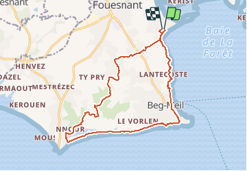
Tour Wandern von 17,3 km verfügbar auf Bretagne, Finistère, Fouesnant. Diese Tour wird von pijau vorgeschlagen.
Beschreibung
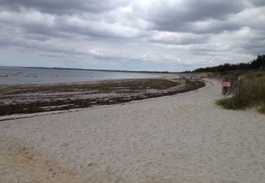
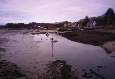
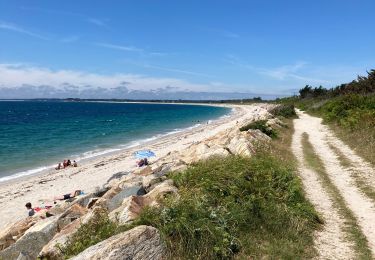
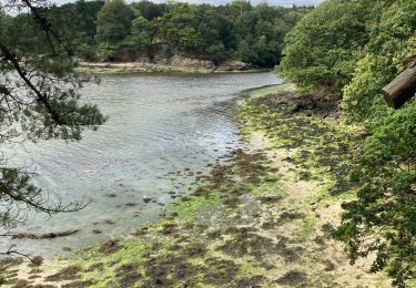
Randonnée au départ du Centre nautique de Fouesnant (Cap-Coz) vers Beg-Meil et la Pointe de Mousterlin par le bord de mer, et retour à travers les bocages
Ort
Land:
France
Region :
Bretagne
Abteilung/Provinz :
Finistère
Kommune :
Fouesnant
Standort:
Unknown
Gehen Sie:(Dec)
Gehen Sie:(UTM)
426114 ; 5304148 (30T) N.
Kommentare
Touren in der Umgebung
![Tour Wandern Fouesnant - GR34. Beg Meil -- Concarneau (+visite de la Ville Close) - Photo](https://media.geolcdn.com/t/375/260/ad390450-6534-4615-afd3-da2ec3868029.jpg&format=jpg&maxdim=2)
![Wandern Wandern](https://static1.geolcdn.com/sitytour/trail-icons/101.png)
GR34. Beg Meil -- Concarneau (+visite de la Ville Close)
Wandern
Medium
Fouesnant,
Bretagne,
Finistère,
France
![](/images/other/stat-length.png)
24 km | 27 km-effort
6h 5min
![](https://static1.geolcdn.com/siteimages/upload/files/16400158638029165_repeat_loop_refresh_sync_direction_icon.png)
Nein
![Tour Laufen Fouesnant - Des dunes à la mer blanche - Photo](https://media.geolcdn.com/t/375/260/7fdce5c7-5ee5-431b-bdc0-c7bba51fc745.jpg&format=jpg&maxdim=2)
![Laufen Laufen](https://static1.geolcdn.com/sitytour/trail-icons/103.png)
Des dunes à la mer blanche
Laufen
Sehr leicht
Fouesnant,
Bretagne,
Finistère,
France
![](/images/other/stat-length.png)
18,8 km | 19,8 km-effort
2h 18min
![](https://static1.geolcdn.com/siteimages/upload/files/16400158638029165_repeat_loop_refresh_sync_direction_icon.png)
Ja
![Tour Wandern Fouesnant - De Beg Meil à Concarneau - Photo](https://media.geolcdn.com/t/375/260/c435d3fb-721e-4af1-a29b-5e7ba8927772.jpg&format=jpg&maxdim=2)
![Wandern Wandern](https://static1.geolcdn.com/sitytour/trail-icons/101.png)
De Beg Meil à Concarneau
Wandern
Sehr schwierig
Fouesnant,
Bretagne,
Finistère,
France
![](/images/other/stat-length.png)
28 km | 31 km-effort
7h 1min
![](https://static1.geolcdn.com/siteimages/upload/files/16400158638029165_repeat_loop_refresh_sync_direction_icon.png)
Nein
![Tour Wandern Fouesnant - dune de MOUSTERLIN - Photo](https://media.geolcdn.com/t/375/260/ext.jpg?maxdim=2&url=https%3A%2F%2Fservices.sitytrail.com%2FGeolivesWS%2FDownloadMedia.ashx%3FTrailID%3D788875%26Media%3D20170713135032.jpg)
![Wandern Wandern](https://static1.geolcdn.com/sitytour/trail-icons/101.png)
dune de MOUSTERLIN
Wandern
Sehr leicht
Fouesnant,
Bretagne,
Finistère,
France
![](/images/other/stat-length.png)
8,9 km | 9,3 km-effort
2h 36min
![](https://static1.geolcdn.com/siteimages/upload/files/16400158638029165_repeat_loop_refresh_sync_direction_icon.png)
Ja
![Tour Wandern Fouesnant - Fouesnant - Photo](https://media.geolcdn.com/t/375/260/ext.jpg?maxdim=2&url=https%3A%2F%2Fservices.sitytrail.com%2FGeolivesWS%2FDownloadMedia.ashx%3FTrailID%3D670602%26Media%3Dfix__20141221100329.jpg)
![Wandern Wandern](https://static1.geolcdn.com/sitytour/trail-icons/101.png)
![Tour Wandern Fouesnant - Balade autour de la zone naturelle - Photo](https://media.geolcdn.com/t/375/260/ext.jpg?maxdim=2&url=https%3A%2F%2Fstatic1.geolcdn.com%2Fsiteimages%2Fupload%2Ffiles%2F1553511878bg_sport_marche.png)
![Wandern Wandern](https://static1.geolcdn.com/sitytour/trail-icons/101.png)
Balade autour de la zone naturelle
Wandern
Medium
(1)
Fouesnant,
Bretagne,
Finistère,
France
![](/images/other/stat-length.png)
12,3 km | 12,9 km-effort
2h 55min
![](https://static1.geolcdn.com/siteimages/upload/files/16400158638029165_repeat_loop_refresh_sync_direction_icon.png)
Ja
![Tour Mountainbike Concarneau - Concarneau-Rosporden voie verte - Photo](https://media.geolcdn.com/t/375/260/7a686b04-8cfd-450f-a54c-0c75110670d8.jpg&format=jpg&maxdim=2)
![Mountainbike Mountainbike](https://static1.geolcdn.com/sitytour/trail-icons/202.png)
Concarneau-Rosporden voie verte
Mountainbike
Medium
Concarneau,
Bretagne,
Finistère,
France
![](/images/other/stat-length.png)
25 km | 29 km-effort
1h 38min
![](https://static1.geolcdn.com/siteimages/upload/files/16400158638029165_repeat_loop_refresh_sync_direction_icon.png)
Ja
![Tour Wandern Fouesnant - Beg Meil - Mousterlin - Photo](https://media.geolcdn.com/t/375/260/fcb667fe-8cdf-4dd9-87f5-515df16d6769.jpg&format=jpg&maxdim=2)
![Wandern Wandern](https://static1.geolcdn.com/sitytour/trail-icons/101.png)
Beg Meil - Mousterlin
Wandern
Medium
Fouesnant,
Bretagne,
Finistère,
France
![](/images/other/stat-length.png)
14,6 km | 15,5 km-effort
5h 27min
![](https://static1.geolcdn.com/siteimages/upload/files/16400158638029165_repeat_loop_refresh_sync_direction_icon.png)
Ja
![Tour Wandern Concarneau - Concarneau - Photo](https://media.geolcdn.com/t/375/260/28e6d65b-3d8a-4520-b0a2-3b012eda7ba4.jpg&format=jpg&maxdim=2)
![Wandern Wandern](https://static1.geolcdn.com/sitytour/trail-icons/101.png)
Concarneau
Wandern
Einfach
Concarneau,
Bretagne,
Finistère,
France
![](/images/other/stat-length.png)
9,9 km | 11,6 km-effort
2h 43min
![](https://static1.geolcdn.com/siteimages/upload/files/16400158638029165_repeat_loop_refresh_sync_direction_icon.png)
Ja