![](/images/other/stat-length.png)
![Tour Wandern Saint-Vaast-lès-Mello - La Rando des Carrières de St Vaast les Mello_8,8 km - Photo](https://media.geolcdn.com/t/1900/400/ext.pjpeg?maxdim=2&url=https%3A%2F%2Fstatic1.geolcdn.com%2Fsiteimages%2Fupload%2Ffiles%2F1553511878bg_sport_marche.png)
La Rando des Carrières de St Vaast les Mello_8,8 km
Pousscailleux
Benutzer
![Länge](/images/other/stat-length.png)
Länge
8,8 km
![Maximale Höhe](https://static1.geolcdn.com/siteimages/upload/files/1508320355ic_sort_altitude_max_24dp.png)
Maximale Höhe
110 m
![Positive Höhendifferenz](https://static1.geolcdn.com/siteimages/upload/files/1508320355ic_sort_den_pos_24dp.png)
Positive Höhendifferenz
109 m
![Km-Effort](/images/other/stat-length.png)
Km-Effort
10,2 km
![Min. Höhe](https://static1.geolcdn.com/siteimages/upload/files/1508320355ic_sort_altitude_min_24dp.png)
Min. Höhe
33 m
![Negative Höhendifferenz](https://static1.geolcdn.com/siteimages/upload/files/1508320355ic_sort_den_neg_24dp.png)
Negative Höhendifferenz
104 m
![Boucle](https://static1.geolcdn.com/siteimages/upload/files/16400158638029165_repeat_loop_refresh_sync_direction_icon.png)
Boucle
Ja
Erstellungsdatum :
2014-12-10 00:00:00.0
Letzte Änderung :
2014-12-10 00:00:00.0
![Wandern](https://static1.geolcdn.com/sitytour/trail-icons/101.png)
2h05
Schwierigkeit : Einfach
![Scannen Sie diesen QR-Code, um die Tour in der SityTrail-Anwendung zu öffnen](https://capi.geolives.com/qq0zvz2zws4bq2lad0pu/sitytour/trails/113841/qr.png?size=200)
Kostenlosegpshiking-Anwendung
Über SityTrail
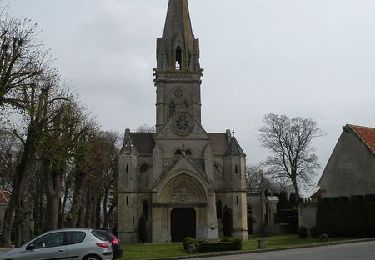
Tour Wandern von 8,8 km verfügbar auf Nordfrankreich, Oise, Saint-Vaast-lès-Mello. Diese Tour wird von Pousscailleux vorgeschlagen.
Beschreibung
Départ du parking de la Mairie, Rue de la Paix N49°16'01.04 / E002°23'20.73.
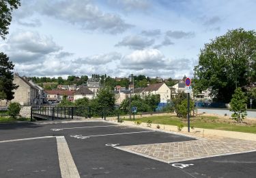
Autre point de départ possible sur la boucle : Parking Route de Cramoisy N49°15'51.29 / E002°23'20.73
Ort
Land:
France
Region :
Nordfrankreich
Abteilung/Provinz :
Oise
Kommune :
Saint-Vaast-lès-Mello
Standort:
Unknown
Gehen Sie:(Dec)
Gehen Sie:(UTM)
455540 ; 5457319 (31U) N.
Kommentare
Touren in der Umgebung
![Tour Mountainbike Montataire - Rando des Forges 2012 - Montataire - Photo](https://media.geolcdn.com/t/375/260/ext.jpg?maxdim=2&url=https%3A%2F%2Fstatic1.geolcdn.com%2Fsiteimages%2Fupload%2Ffiles%2F1524743154velo.jpg)
![Mountainbike Mountainbike](https://static1.geolcdn.com/sitytour/trail-icons/202.png)
Rando des Forges 2012 - Montataire
Mountainbike
Medium
(1)
Montataire,
Nordfrankreich,
Oise,
France
![](/images/other/stat-length.png)
43 km | 51 km-effort
2h 30min
![](https://static1.geolcdn.com/siteimages/upload/files/16400158638029165_repeat_loop_refresh_sync_direction_icon.png)
Ja
![Tour Mountainbike Cires-lès-Mello - Cires-lès-Mello, coté Ouest - Photo](https://media.geolcdn.com/t/375/260/ext.jpg?maxdim=2&url=https%3A%2F%2Fservices.sitytrail.com%2FGeolivesWS%2FDownloadMedia.ashx%3FTrailID%3D173205%26Media%3D14801_2.jpg)
![Mountainbike Mountainbike](https://static1.geolcdn.com/sitytour/trail-icons/202.png)
Cires-lès-Mello, coté Ouest
Mountainbike
Medium
Cires-lès-Mello,
Nordfrankreich,
Oise,
France
![](/images/other/stat-length.png)
58 km | 69 km-effort
3h 30min
![](https://static1.geolcdn.com/siteimages/upload/files/16400158638029165_repeat_loop_refresh_sync_direction_icon.png)
Ja
![Tour Wandern Montataire - Montataire - Photo](https://media.geolcdn.com/t/375/260/4bd814d9-48d9-47fd-8f11-f49f7a9caae2.jpg&format=jpg&maxdim=2)
![Wandern Wandern](https://static1.geolcdn.com/sitytour/trail-icons/101.png)
![Tour Wandern Nogent-sur-Oise - nogentaise - Photo](https://media.geolcdn.com/t/375/260/6bcdc239-691a-480d-b8a9-ae1900b616b5.jpg&format=jpg&maxdim=2)
![Wandern Wandern](https://static1.geolcdn.com/sitytour/trail-icons/101.png)
nogentaise
Wandern
Schwierig
Nogent-sur-Oise,
Nordfrankreich,
Oise,
France
![](/images/other/stat-length.png)
13,4 km | 15,6 km-effort
4h 3min
![](https://static1.geolcdn.com/siteimages/upload/files/16400158638029165_repeat_loop_refresh_sync_direction_icon.png)
Ja
![Tour Wandern Saint-Vaast-lès-Mello - 18 randonnée des carrières - Photo](https://media.geolcdn.com/t/375/260/ext.jpg?maxdim=2&url=https%3A%2F%2Fservices.sitytrail.com%2FGeolivesWS%2FDownloadMedia.ashx%3FTrailID%3D610812%26Media%3Dfix__20160807210015.jpg)
![Wandern Wandern](https://static1.geolcdn.com/sitytour/trail-icons/101.png)
18 randonnée des carrières
Wandern
Schwierig
Saint-Vaast-lès-Mello,
Nordfrankreich,
Oise,
France
![](/images/other/stat-length.png)
11 km | 12,9 km-effort
2h 49min
![](https://static1.geolcdn.com/siteimages/upload/files/16400158638029165_repeat_loop_refresh_sync_direction_icon.png)
Ja
![Tour Wandern Laigneville - Laigneville-Barisseuse 8k2 - Photo](https://media.geolcdn.com/t/375/260/ext.jpg?maxdim=2&url=https%3A%2F%2Fstatic1.geolcdn.com%2Fsiteimages%2Fupload%2Ffiles%2F1553511878bg_sport_marche.png)
![Wandern Wandern](https://static1.geolcdn.com/sitytour/trail-icons/101.png)
Laigneville-Barisseuse 8k2
Wandern
Medium
Laigneville,
Nordfrankreich,
Oise,
France
![](/images/other/stat-length.png)
8,2 km | 9,7 km-effort
2h 11min
![](https://static1.geolcdn.com/siteimages/upload/files/16400158638029165_repeat_loop_refresh_sync_direction_icon.png)
Ja
![Tour Rennrad Laigneville - VERBERIE - Photo](https://media.geolcdn.com/t/375/260/ext.jpg?maxdim=2&url=https%3A%2F%2Fstatic1.geolcdn.com%2Fsiteimages%2Fupload%2Ffiles%2F1524743154velo.jpg)
![Rennrad Rennrad](https://static1.geolcdn.com/sitytour/trail-icons/201.png)
VERBERIE
Rennrad
Sehr schwierig
Laigneville,
Nordfrankreich,
Oise,
France
![](/images/other/stat-length.png)
63 km | 68 km-effort
3h 35min
![](https://static1.geolcdn.com/siteimages/upload/files/16400158638029165_repeat_loop_refresh_sync_direction_icon.png)
Ja
![Tour Wandern Laigneville - Laigneville Rousseloy Randonnée courte - Photo](https://media.geolcdn.com/t/375/260/ext.jpg?maxdim=2&url=https%3A%2F%2Fstatic1.geolcdn.com%2Fsiteimages%2Fupload%2Ffiles%2F1553511878bg_sport_marche.png)
![Wandern Wandern](https://static1.geolcdn.com/sitytour/trail-icons/101.png)
Laigneville Rousseloy Randonnée courte
Wandern
Medium
Laigneville,
Nordfrankreich,
Oise,
France
![](/images/other/stat-length.png)
9,6 km | 11,1 km-effort
2h 31min
![](https://static1.geolcdn.com/siteimages/upload/files/16400158638029165_repeat_loop_refresh_sync_direction_icon.png)
Ja
![Tour Wandern Laigneville - Laigneville Rousseloy - Photo](https://media.geolcdn.com/t/375/260/ext.jpg?maxdim=2&url=https%3A%2F%2Fstatic1.geolcdn.com%2Fsiteimages%2Fupload%2Ffiles%2F1553511878bg_sport_marche.png)
![Wandern Wandern](https://static1.geolcdn.com/sitytour/trail-icons/101.png)
Laigneville Rousseloy
Wandern
Schwierig
Laigneville,
Nordfrankreich,
Oise,
France
![](/images/other/stat-length.png)
12 km | 14,1 km-effort
3h 12min
![](https://static1.geolcdn.com/siteimages/upload/files/16400158638029165_repeat_loop_refresh_sync_direction_icon.png)
Ja