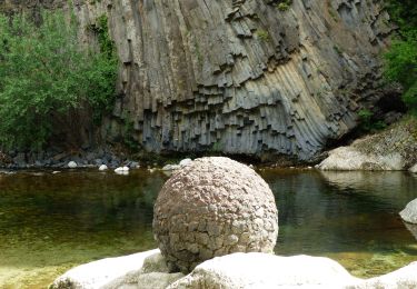
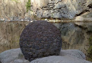
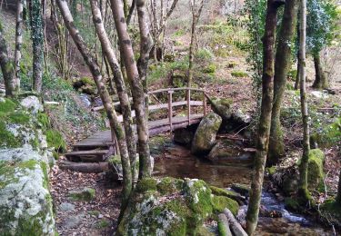
Tour Wandern Thueyts - Trail balisage 51 km_maj_20_01_2017 - Photo

Trail balisage 51 km_maj_20_01_2017

 Lustou
Lustou

Benutzer

© OpenStreetMap contributors
Länge
Länge
50 km
Maximale Höhe
Maximale Höhe
1349 m
Positive Höhendifferenz
2758 m
Km-Effort
Km-Effort  
87 km
Min. Höhe
Min. Höhe
387 m
Negative Höhendifferenz
2764 m
Boucle
Boucle
Ja
Erstellungsdatum :
2019-04-26 19:24:55.384
Letzte Änderung :
2019-04-26 19:24:55.384

(0 Nachricht)

Wandern
Wandern
17h42
Schwierigkeit : Unbekannt

Scannen Sie diesen QR-Code, um die Tour in der SityTrail-Anwendung zu öffnen

Kostenlosegpshiking-Anwendung

Logo SityTrail SityTrail

IGN / Geografische Institute

SityTrail aus dem App Store herunterladen SityTrail von Google Play herunterladen

Logo SityTrail SityTrail World

Die Welt öffnet sich für Sie

SityTrail aus dem App Store herunterladen SityTrail von Google Play herunterladen SityTrail auf Huawei AppGallery herunterladen

Über SityTrail

Tour Wandern von 50 km verfügbar auf Auvergne-Rhone-Alpen, Ardèche, Thueyts. Diese Tour wird von Lustou vorgeschlagen.

Höhenprofil

POIs

POI Mayres - COL D'ABRAHAM - Photo
Lustou
POI Thueyts - ROCHER MIDI 0990  - Photo
Lustou
POI Jaujac - ROCHER MIDI 0960 - Photo
Lustou
POI Barnas - GRANGES 1000 - Photo
Lustou
BARNAS 
POI Barnas - GRANGES 1960 - Photo
Lustou
BARNAS 
POI Barnas - GRANGES D'ABRAHAM - Photo
Lustou
POI Barnas - LE FENADOU - Photo
Lustou
BARNAS 
POI Le Roux - X CHAUMIENNE 3750 - Photo
Lustou
POI Jaujac - TRAVERSES 1960 - Photo
Lustou
POI Thueyts - COURCOUSSAT 0840 - Photo
Lustou
POI Le Roux - X CHAUMIENNE 3250 - Photo
Lustou
POI Barnas - FONTFREYDE 4330 - Photo
Lustou
POI Mazan-l'Abbaye - X CHAUMIENNE 2540 - Photo
Lustou
MAZAN-L'ABBAYE 
POI Mazan-l'Abbaye - X CHAUMIENNE 1540 - Photo
Lustou
MAZAN-L'ABBAYE 
POI Mazan-l'Abbaye - X CHAUMIENNE 1000 - Photo
Lustou
MAZAN-L'ABBAYE 
POI Jaujac - LE FAU 0480 - Photo
Lustou
JAUJAC 
POI Barnas - Ravito 1 km - Photo
Lustou
BARNAS 
POI Jaujac - LE FAU 0430 - Photo
Lustou
JAUJAC 
POI Mazan-l'Abbaye - X CHAUMIENNE 0380 - Photo
Lustou
MAZAN-L'ABBAYE 
POI Mayres - ABRAHAM 1000 - Photo
Lustou
MAYRES 
POI Jaujac - LE FAU 0350 - Photo
Lustou
JAUJAC 
POI Mayres - 1 km controle - Photo
Lustou
POI Mazan-l'Abbaye - CROIX DE CHAUMIENNE - Photo
Lustou
MAZAN-L'ABBAYE 
POI Mayres - VIEUX-MAYRES 2260 - Photo
Lustou
POI Mayres - MAYRES 3100 - Photo
Lustou
MAYRES 
POI Thueyts - FONTFREYDE - Photo
Lustou
THUEYTS 
POI Mayres - MAYRES 2790 - Photo
Lustou
MAYRES 
POI Thueyts - ROCHER MIDI 1380  - Photo
Lustou
POI Mayres - MAYRES 1520 - Photo
Lustou
MAYRES 
POI Mayres - MAYRES 0690 - Photo
Lustou
MAYRES 
POI Barnas - FONTFREYDE 1000 - Photo
Lustou
POI Barnas - 1 km point d'eau - Photo
Lustou
POI Barnas - FONTFREYDE 3200 - Photo
Lustou
POI Mazan-l'Abbaye - Point d'eau 1 km - Photo
Lustou
MAZAN-L'ABBAYE 
POI Mayres - VIEUX-MAYRES - Photo
Lustou
MAYRES 
POI Mayres - MAYRES 1000 - Photo
Lustou
MAYRES 
POI Thueyts - COURCOUSSAT - Photo
Lustou
THUEYTS 
POI Thueyts - 1 km ravitaillement - Photo
Lustou
POI Thueyts - FARGEBELLE-HAUT 0580 - Photo
Lustou
POI Thueyts - FARGEBELLE-HAUT 0050 - Photo
Lustou
POI Thueyts - FARGEBELLE-HAUT - Photo
Lustou
POI Meyras - COURCOUSSAT 1560 - Photo
Lustou
POI Meyras - COURCOUSSAT 1820 - Photo
Lustou
POI Mayres - PASSADOU 0970 - Photo
Lustou
POI Mayres - ABRAHAM 2490 - Photo
Lustou
MAYRES 
POI Mayres - LE PASSADOU - Photo
Lustou
MAYRES 
POI Mayres - ABRAHAM 2290 - Photo
Lustou
MAYRES 
POI Barnas - COL DE BARBEJO - Photo
Lustou
POI Barnas - FONTFREYDE 3920 - Photo
Lustou
POI Jaujac - ROCHER DU MIDI - Photo
Lustou
POI Jaujac - TRAVERSES 3090 - Photo
Lustou
POI Jaujac - TRAVERSES 2620 - Photo
Lustou
POI Jaujac - LE FAU - Photo
Lustou
JAUJAC 
POI Jaujac - SERANGELIER 2750 - Photo
Lustou
POI Jaujac - SERANGELIER 0200 - Photo
Lustou
POI Jaujac - SERANGELIER - Photo
Lustou
JAUJAC 
POI Mazan-l'Abbaye - Point d'eau - Photo
Lustou
MAZAN-L'ABBAYE 
POI Mayres - ravitaillement - Photo
Lustou
POI Mayres - Secours - Photo
Lustou
MAYRES 
POI Mayres - Controle MANUEL - Photo
Lustou
POI Mayres - Barriere hoaire - Photo
Lustou
POI Barnas - Controle - Photo
Lustou
BARNAS 
POI Barnas - Ravitaillement - Photo
Lustou
POI Barnas - Secours - Photo
Lustou
BARNAS 
POI Thueyts - Point d'eau - Photo
Lustou
THUEYTS 
POI Jaujac - Ravitaillement - Photo
Lustou
POI Jaujac - Controle - Photo
Lustou
JAUJAC 
POI Jaujac - Secours - Photo
Lustou
JAUJAC 
POI Jaujac - Barriere horaire - Photo
Lustou
POI Thueyts - Ravitaillement - Photo
Lustou
POI Thueyts - Controle - Photo
Lustou
THUEYTS 
POI Thueyts - Point d'eau - Photo
Lustou
THUEYTS 
POI Thueyts - FARGEBELLE - Photo
Lustou
THUEYTS 
POI Barnas - GRANGES 1960 - Photo
Lustou
BARNAS 
POI Le Roux - X CHAUMIENNE 2720 - Photo
Lustou
POI Thueyts - LES PLEINES - Photo
Lustou
THUEYTS 

Ort

Land:
France
Region :
Auvergne-Rhone-Alpen
Abteilung/Provinz :
Ardèche
Kommune :
Thueyts
Standort:
Unknown
Gehen Sie:(Dec)
Gehen Sie:(UTM)
596877 ; 4947734 (31T) N.

Touren in der Umgebung

Tour Wandern Jaujac - Jaujac Le Ventapet 14km - Photo
Wandern
GUIDE
thonyc

Wandern

Sehr schwierig
(1)
Jaujac, Auvergne-Rhone-Alpen, Ardèche, France
13,6 km | 23 km-effort
5h 18min
Ja
Tour Wandern Saint-Pierre-de-Colombier - SityTrail - 2775482 - st-pierre-burzet - Photo
Wandern
coureursdecretes

Wandern

Sehr schwierig
(1)
Saint-Pierre-de-Colombier, Auvergne-Rhone-Alpen, Ardèche, France
11,5 km | 17,1 km-effort
4h 45min
Ja
Tour Wandern Jaujac - 07 jaujac rocher de l aigle - Photo
Wandern
GUIDE
randodyssée

Wandern

Einfach
(1)
Jaujac, Auvergne-Rhone-Alpen, Ardèche, France
11,2 km | 19,7 km-effort
6h 23min
Ja
Tour Wandern Meyras - neyrac les bains - Photo
Wandern
raab

Wandern

Einfach
(1)
Meyras, Auvergne-Rhone-Alpen, Ardèche, France
4,4 km | 6,8 km-effort
1h 36min
Ja
Tour Wandern Chirols - Ste Marguerite - Photo
Wandern
Michel07

Wandern

Medium
(2)
Chirols, Auvergne-Rhone-Alpen, Ardèche, France
12,7 km | 22 km-effort
3h 57min
Ja
Tour Wandern Jaujac - 07_jaujac_Orgues_9km360m - Photo
Wandern
SyMA

Wandern

Medium
Jaujac, Auvergne-Rhone-Alpen, Ardèche, France
9,1 km | 13,8 km-effort
3h 7min
Ja
Tour Wandern Barnas - 231220 Barnas  - Photo
Wandern
Rudy07

Wandern

Medium
Barnas, Auvergne-Rhone-Alpen, Ardèche, France
6,7 km | 9,9 km-effort
2h 15min
Ja
Tour Wandern Thueyts - 231217 Thueyts-Brige - Photo
Wandern
Rudy07

Wandern

Einfach
(1)
Thueyts, Auvergne-Rhone-Alpen, Ardèche, France
5,7 km | 9,6 km-effort
2h 11min
Ja
Tour Wandern La Souche - La Souche : de Montflat au Rocher du Midi avec un retour par les Rudils - Photo
Wandern
jeannine grandjean

Wandern

Schwierig
La Souche, Auvergne-Rhone-Alpen, Ardèche, France
6,8 km | 12,8 km-effort
2h 53min
Ja


Schließen
Meine Abonnements