![](/images/other/stat-length.png)
![Tour Wandern Challex - Circuit du vignoble - Challex - Photo](https://media.geolcdn.com/t/1900/400/ext.pjpeg?maxdim=2&url=https%3A%2F%2Fservices.sitytrail.com%2FGeolivesWS%2FDownloadMedia.ashx%3FTrailID%3D112692%26Media%3D11541_6.jpg)
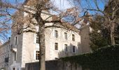
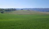
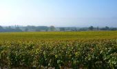
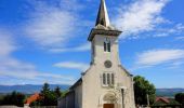
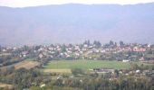
Circuit du vignoble - Challex
tracegps
Benutzer
![Länge](/images/other/stat-length.png)
Länge
7 km
![Maximale Höhe](https://static1.geolcdn.com/siteimages/upload/files/1508320355ic_sort_altitude_max_24dp.png)
Maximale Höhe
513 m
![Positive Höhendifferenz](https://static1.geolcdn.com/siteimages/upload/files/1508320355ic_sort_den_pos_24dp.png)
Positive Höhendifferenz
136 m
![Km-Effort](/images/other/stat-length.png)
Km-Effort
8,8 km
![Min. Höhe](https://static1.geolcdn.com/siteimages/upload/files/1508320355ic_sort_altitude_min_24dp.png)
Min. Höhe
405 m
![Negative Höhendifferenz](https://static1.geolcdn.com/siteimages/upload/files/1508320355ic_sort_den_neg_24dp.png)
Negative Höhendifferenz
134 m
![Boucle](https://static1.geolcdn.com/siteimages/upload/files/16400158638029165_repeat_loop_refresh_sync_direction_icon.png)
Boucle
Ja
Erstellungsdatum :
2014-12-10 00:00:00.0
Letzte Änderung :
2014-12-10 00:00:00.0
![Wandern](https://static1.geolcdn.com/sitytour/trail-icons/101.png)
1h45
Schwierigkeit : Einfach
![Scannen Sie diesen QR-Code, um die Tour in der SityTrail-Anwendung zu öffnen](https://capi.geolives.com/qq0zvz2zws4bq2lad0pu/sitytour/trails/112692/qr.png?size=200)
Kostenlosegpshiking-Anwendung
Über SityTrail
Tour Wandern von 7 km verfügbar auf Auvergne-Rhone-Alpen, Ain, Challex. Diese Tour wird von tracegps vorgeschlagen.
Beschreibung
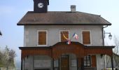
Circuit proposé par la commune de Challex. Départ de la place de la mairie de Challex. Retrouvez le circuit sur le site de la commune de Challex.
Ort
Land:
France
Region :
Auvergne-Rhone-Alpen
Abteilung/Provinz :
Ain
Kommune :
Challex
Standort:
Unknown
Gehen Sie:(Dec)
Gehen Sie:(UTM)
729376 ; 5118495 (31T) N.
Kommentare
Touren in der Umgebung
![Tour Wandern Dardagny - wa31 - Photo](https://media.geolcdn.com/t/375/260/ext.jpg?maxdim=2&url=https%3A%2F%2Fstatic1.geolcdn.com%2Fsiteimages%2Fupload%2Ffiles%2F1553511878bg_sport_marche.png)
![Wandern Wandern](https://static1.geolcdn.com/sitytour/trail-icons/101.png)
wa31
Wandern
Sehr leicht
Dardagny,
Genf,
Unbekannt,
Switzerland
![](/images/other/stat-length.png)
14,5 km | 17,2 km-effort
Unbekannt
![](https://static1.geolcdn.com/siteimages/upload/files/16400158638029165_repeat_loop_refresh_sync_direction_icon.png)
Nein
![Tour Wandern Dardagny - Au bord d''Allondon - Photo](https://media.geolcdn.com/t/375/260/ext.jpg?maxdim=2&url=https%3A%2F%2Fstatic1.geolcdn.com%2Fsiteimages%2Fupload%2Ffiles%2F1553511878bg_sport_marche.png)
![Wandern Wandern](https://static1.geolcdn.com/sitytour/trail-icons/101.png)
Au bord d''Allondon
Wandern
Sehr leicht
Dardagny,
Genf,
Unbekannt,
Switzerland
![](/images/other/stat-length.png)
6,3 km | 8,3 km-effort
Unbekannt
![](https://static1.geolcdn.com/siteimages/upload/files/16400158638029165_repeat_loop_refresh_sync_direction_icon.png)
Nein
![Tour Wandern Péron - trom - Photo](https://media.geolcdn.com/t/375/260/ext.jpg?maxdim=2&url=https%3A%2F%2Fstatic1.geolcdn.com%2Fsiteimages%2Fupload%2Ffiles%2F1553511878bg_sport_marche.png)
![Wandern Wandern](https://static1.geolcdn.com/sitytour/trail-icons/101.png)
![Tour Wandern Challex - trompettes - Photo](https://media.geolcdn.com/t/375/260/c3f027da-5c71-4e81-9102-208f2a9075a5.jpg&format=jpg&maxdim=2)
![Wandern Wandern](https://static1.geolcdn.com/sitytour/trail-icons/101.png)
trompettes
Wandern
Einfach
Challex,
Auvergne-Rhone-Alpen,
Ain,
France
![](/images/other/stat-length.png)
4,3 km | 5,2 km-effort
1h 49min
![](https://static1.geolcdn.com/siteimages/upload/files/16400158638029165_repeat_loop_refresh_sync_direction_icon.png)
Nein
![Tour Wandern Thoiry - 05.01 - Photo](https://media.geolcdn.com/t/375/260/ext.jpg?maxdim=2&url=https%3A%2F%2Fstatic1.geolcdn.com%2Fsiteimages%2Fupload%2Ffiles%2F1553511878bg_sport_marche.png)
![Wandern Wandern](https://static1.geolcdn.com/sitytour/trail-icons/101.png)
![Tour Reiten Péron - Prés Bouillet - Photo](https://media.geolcdn.com/t/375/260/e8e9193d-eaba-4d6b-b7ff-730c530b8e6b.jpg&format=jpg&maxdim=2)
![Reiten Reiten](https://static1.geolcdn.com/sitytour/trail-icons/301.png)
Prés Bouillet
Reiten
Medium
Péron,
Auvergne-Rhone-Alpen,
Ain,
France
![](/images/other/stat-length.png)
20 km | 30 km-effort
3h 39min
![](https://static1.geolcdn.com/siteimages/upload/files/16400158638029165_repeat_loop_refresh_sync_direction_icon.png)
Ja
![Tour Wandern Viry - AuxGues - Photo](https://media.geolcdn.com/t/375/260/ext.jpg?maxdim=2&url=https%3A%2F%2Fstatic1.geolcdn.com%2Fsiteimages%2Fupload%2Ffiles%2F1553511878bg_sport_marche.png)
![Wandern Wandern](https://static1.geolcdn.com/sitytour/trail-icons/101.png)
AuxGues
Wandern
Sehr leicht
Viry,
Auvergne-Rhone-Alpen,
Hochsavoyen,
France
![](/images/other/stat-length.png)
12,7 km | 14,9 km-effort
5h 4min
![](https://static1.geolcdn.com/siteimages/upload/files/16400158638029165_repeat_loop_refresh_sync_direction_icon.png)
Ja
![Tour Reiten Péron - Le près neuf - Photo](https://media.geolcdn.com/t/375/260/311f57c3-a5d0-4f52-828c-9d77a78b37ae.jpg&format=jpg&maxdim=2)
![Reiten Reiten](https://static1.geolcdn.com/sitytour/trail-icons/301.png)
Le près neuf
Reiten
Sehr leicht
Péron,
Auvergne-Rhone-Alpen,
Ain,
France
![](/images/other/stat-length.png)
2,8 km | 3,1 km-effort
33min
![](https://static1.geolcdn.com/siteimages/upload/files/16400158638029165_repeat_loop_refresh_sync_direction_icon.png)
Ja
![Tour Pferd Péron - Randonnée St jean de gonville - Photo](https://media.geolcdn.com/t/375/260/ext.jpg?maxdim=2&url=https%3A%2F%2Fservices.sitytrail.com%2FGeolivesWS%2FDownloadMedia.ashx%3FTrailID%3D727524%26Media%3Dfix__20170402153331.jpg)
![Pferd Pferd](https://static1.geolcdn.com/sitytour/trail-icons/300.png)
Randonnée St jean de gonville
Pferd
Einfach
Péron,
Auvergne-Rhone-Alpen,
Ain,
France
![](/images/other/stat-length.png)
22 km | 27 km-effort
4h 22min
![](https://static1.geolcdn.com/siteimages/upload/files/16400158638029165_repeat_loop_refresh_sync_direction_icon.png)
Ja