![](/images/other/stat-length.png)
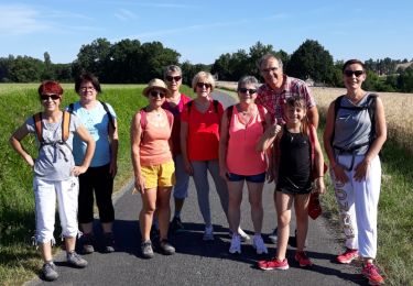
![Tour Wandern Bellon - Circuit Pierre Very - Bellon - Photo](https://media.geolcdn.com/t/1900/400/ext.pjpeg?maxdim=2&url=https%3A%2F%2Fservices.sitytrail.com%2FGeolivesWS%2FDownloadMedia.ashx%3FTrailID%3D112347%26Media%3D10424_2.jpg)
Circuit Pierre Very - Bellon
tracegps
Benutzer
![Länge](/images/other/stat-length.png)
Länge
9 km
![Maximale Höhe](https://static1.geolcdn.com/siteimages/upload/files/1508320355ic_sort_altitude_max_24dp.png)
Maximale Höhe
120 m
![Positive Höhendifferenz](https://static1.geolcdn.com/siteimages/upload/files/1508320355ic_sort_den_pos_24dp.png)
Positive Höhendifferenz
137 m
![Km-Effort](/images/other/stat-length.png)
Km-Effort
10,8 km
![Min. Höhe](https://static1.geolcdn.com/siteimages/upload/files/1508320355ic_sort_altitude_min_24dp.png)
Min. Höhe
72 m
![Negative Höhendifferenz](https://static1.geolcdn.com/siteimages/upload/files/1508320355ic_sort_den_neg_24dp.png)
Negative Höhendifferenz
137 m
![Boucle](https://static1.geolcdn.com/siteimages/upload/files/16400158638029165_repeat_loop_refresh_sync_direction_icon.png)
Boucle
Ja
Erstellungsdatum :
2014-12-10 00:00:00.0
Letzte Änderung :
2014-12-10 00:00:00.0
![Wandern](https://static1.geolcdn.com/sitytour/trail-icons/101.png)
2h15
Schwierigkeit : Medium
![Scannen Sie diesen QR-Code, um die Tour in der SityTrail-Anwendung zu öffnen](https://capi.geolives.com/qq0zvz2zws4bq2lad0pu/sitytour/trails/112347/qr.png?size=200)
Kostenlosegpshiking-Anwendung
Über SityTrail
Tour Wandern von 9 km verfügbar auf Neu-Aquitanien, Charente, Bellon. Diese Tour wird von tracegps vorgeschlagen.
Beschreibung
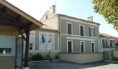
Circuit proposé par la commune de Bellon. Départ de la mairie de Bellon. Retrouvez le plan du circuit sur le site de la commune de Bellon
Ort
Land:
France
Region :
Neu-Aquitanien
Abteilung/Provinz :
Charente
Kommune :
Bellon
Standort:
Unknown
Gehen Sie:(Dec)
Gehen Sie:(UTM)
274137 ; 5020745 (31T) N.
Kommentare
Touren in der Umgebung
![Tour Wandern Bors-de-Montmoreau - Bord de Montmoreau - Photo](https://media.geolcdn.com/t/375/260/ext.jpg?maxdim=2&url=https%3A%2F%2Fservices.sitytrail.com%2FGeolivesWS%2FDownloadMedia.ashx%3FTrailID%3D759983%26Media%3Dfix__20170525113439.jpg)
![Wandern Wandern](https://static1.geolcdn.com/sitytour/trail-icons/101.png)
Bord de Montmoreau
Wandern
Einfach
Bors-de-Montmoreau,
Neu-Aquitanien,
Charente,
France
![](/images/other/stat-length.png)
8,8 km | 10,6 km-effort
2h 19min
![](https://static1.geolcdn.com/siteimages/upload/files/16400158638029165_repeat_loop_refresh_sync_direction_icon.png)
Ja
![Tour Wandern Bellon - Circuit des fontaines - Bellon - Photo](https://media.geolcdn.com/t/375/260/ext.jpg?maxdim=2&url=https%3A%2F%2Fservices.sitytrail.com%2FGeolivesWS%2FDownloadMedia.ashx%3FTrailID%3D112346%26Media%3D10423_3.jpg)
![Wandern Wandern](https://static1.geolcdn.com/sitytour/trail-icons/101.png)
Circuit des fontaines - Bellon
Wandern
Medium
Bellon,
Neu-Aquitanien,
Charente,
France
![](/images/other/stat-length.png)
9,3 km | 11,1 km-effort
2h 19min
![](https://static1.geolcdn.com/siteimages/upload/files/16400158638029165_repeat_loop_refresh_sync_direction_icon.png)
Ja
![Tour Mountainbike Bors-de-Montmoreau - aubetter 2 départ belon avec Adrien - Photo](https://media.geolcdn.com/t/375/260/ext.jpg?maxdim=2&url=https%3A%2F%2Fservices.sitytrail.com%2FGeolivesWS%2FDownloadMedia.ashx%3FTrailID%3D43953%26Media%3Dimage5.jpg)
![Mountainbike Mountainbike](https://static1.geolcdn.com/sitytour/trail-icons/202.png)
aubetter 2 départ belon avec Adrien
Mountainbike
Sehr leicht
Bors-de-Montmoreau,
Neu-Aquitanien,
Charente,
France
![](/images/other/stat-length.png)
26 km | 32 km-effort
2h 29min
![](https://static1.geolcdn.com/siteimages/upload/files/16400158638029165_repeat_loop_refresh_sync_direction_icon.png)
Ja
![Tour Zu Fuß Rouffiac - Circuit des trois Églises - Photo](https://media.geolcdn.com/t/375/260/f4b78ff9-99ef-42a0-9116-6825d6d415ea.jpeg&format=jpg&maxdim=2)
![Zu Fuß Zu Fuß](https://static1.geolcdn.com/sitytour/trail-icons/100.png)
Circuit des trois Églises
Zu Fuß
Einfach
Rouffiac,
Neu-Aquitanien,
Charente,
France
![](/images/other/stat-length.png)
11,7 km | 15,9 km-effort
3h 36min
![](https://static1.geolcdn.com/siteimages/upload/files/16400158638029165_repeat_loop_refresh_sync_direction_icon.png)
Ja
![Tour Wandern Saint-Romain - saint-romain 16 03 sept 2019 - Photo](https://media.geolcdn.com/t/375/260/1e41d834-0a0d-4737-8541-a0088a0ef2c6.jpg&format=jpg&maxdim=2)
![Wandern Wandern](https://static1.geolcdn.com/sitytour/trail-icons/101.png)
saint-romain 16 03 sept 2019
Wandern
Medium
Saint-Romain,
Neu-Aquitanien,
Charente,
France
![](/images/other/stat-length.png)
7,8 km | 9,5 km-effort
1h 57min
![](https://static1.geolcdn.com/siteimages/upload/files/16400158638029165_repeat_loop_refresh_sync_direction_icon.png)
Ja
![Tour Wandern Aubeterre-sur-Dronne - Aubeterre-Poltrot 28 juin 2018 - Photo](https://media.geolcdn.com/t/375/260/ext.jpg?maxdim=2&url=https%3A%2F%2Fservices.sitytrail.com%2FGeolivesWS%2FDownloadMedia.ashx%3FTrailID%3D995450%26Media%3Dfix__20180628093216.jpg)
![Wandern Wandern](https://static1.geolcdn.com/sitytour/trail-icons/101.png)
Aubeterre-Poltrot 28 juin 2018
Wandern
Einfach
(1)
Aubeterre-sur-Dronne,
Neu-Aquitanien,
Charente,
France
![](/images/other/stat-length.png)
11,2 km | 13,9 km-effort
3h 0min
![](https://static1.geolcdn.com/siteimages/upload/files/16400158638029165_repeat_loop_refresh_sync_direction_icon.png)
Ja
![Tour Wandern Aubeterre-sur-Dronne - dom - Photo](https://media.geolcdn.com/t/375/260/ext.jpg?maxdim=2&url=https%3A%2F%2Fservices.sitytrail.com%2FGeolivesWS%2FDownloadMedia.ashx%3FTrailID%3D995445%26Media%3Dfix__20180628093216.jpg)
![Wandern Wandern](https://static1.geolcdn.com/sitytour/trail-icons/101.png)
dom
Wandern
Einfach
Aubeterre-sur-Dronne,
Neu-Aquitanien,
Charente,
France
![](/images/other/stat-length.png)
27 km | 33 km-effort
3h 14min
![](https://static1.geolcdn.com/siteimages/upload/files/16400158638029165_repeat_loop_refresh_sync_direction_icon.png)
Nein
![Tour Wandern Bors-de-Montmoreau - Bors le 27/11/2023 - Photo](https://media.geolcdn.com/t/375/260/ext.jpg?maxdim=2&url=https%3A%2F%2Fstatic1.geolcdn.com%2Fsiteimages%2Fupload%2Ffiles%2F1553511878bg_sport_marche.png)
![Wandern Wandern](https://static1.geolcdn.com/sitytour/trail-icons/101.png)
Bors le 27/11/2023
Wandern
Einfach
Bors-de-Montmoreau,
Neu-Aquitanien,
Charente,
France
![](/images/other/stat-length.png)
4,3 km | 5,2 km-effort
1h 11min
![](https://static1.geolcdn.com/siteimages/upload/files/16400158638029165_repeat_loop_refresh_sync_direction_icon.png)
Ja
![Tour Wandern Saint-Romain - Saint-Romain - Photo](https://media.geolcdn.com/t/375/260/ext.jpg?maxdim=2&url=https%3A%2F%2Fstatic1.geolcdn.com%2Fsiteimages%2Fupload%2Ffiles%2F1553511878bg_sport_marche.png)
![Wandern Wandern](https://static1.geolcdn.com/sitytour/trail-icons/101.png)
Saint-Romain
Wandern
Medium
Saint-Romain,
Neu-Aquitanien,
Charente,
France
![](/images/other/stat-length.png)
11,3 km | 13,6 km-effort
2h 35min
![](https://static1.geolcdn.com/siteimages/upload/files/16400158638029165_repeat_loop_refresh_sync_direction_icon.png)
Ja