![](/images/other/stat-length.png)
![Tour Wandern Entre-Vignes - Le parcours des Chevaliers de Malte à Saint-Christol - Photo](https://media.geolcdn.com/t/1900/400/ext.pjpeg?maxdim=2&url=https%3A%2F%2Fservices.sitytrail.com%2FGeolivesWS%2FDownloadMedia.ashx%3FTrailID%3D111890%26Media%3D8863_1.jpg)
Le parcours des Chevaliers de Malte à Saint-Christol
tracegps
Benutzer
![Länge](/images/other/stat-length.png)
![Maximale Höhe](https://static1.geolcdn.com/siteimages/upload/files/1508320355ic_sort_altitude_max_24dp.png)
![Positive Höhendifferenz](https://static1.geolcdn.com/siteimages/upload/files/1508320355ic_sort_den_pos_24dp.png)
![Km-Effort](/images/other/stat-length.png)
![Min. Höhe](https://static1.geolcdn.com/siteimages/upload/files/1508320355ic_sort_altitude_min_24dp.png)
![Negative Höhendifferenz](https://static1.geolcdn.com/siteimages/upload/files/1508320355ic_sort_den_neg_24dp.png)
![Boucle](https://static1.geolcdn.com/siteimages/upload/files/16400158638029165_repeat_loop_refresh_sync_direction_icon.png)
![Wandern](https://static1.geolcdn.com/sitytour/trail-icons/101.png)
4h30
Schwierigkeit : Schwierig
![Scannen Sie diesen QR-Code, um die Tour in der SityTrail-Anwendung zu öffnen](https://capi.geolives.com/qq0zvz2zws4bq2lad0pu/sitytour/trails/111890/qr.png?size=200)
Kostenlosegpshiking-Anwendung
Über SityTrail
Tour Wandern von 14,8 km verfügbar auf Okzitanien, Hérault, Entre-Vignes. Diese Tour wird von tracegps vorgeschlagen.
Beschreibung
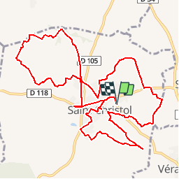
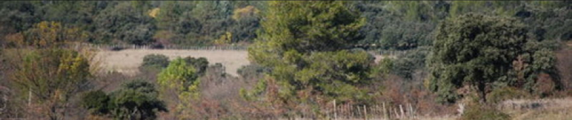
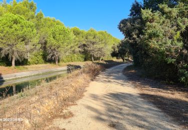
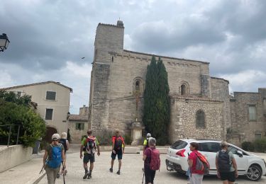
Le parcours des Chevaliers de Malte à Saint-Christol. 15 km pour randonneurs confirmés, accessible aux vélos, dans des paysages de vignes et de bois, au gré de croix d’architectures diverses, témoignages de la foi locale mais aussi symboles d’évènements marquants. Télécharger la fiche rando.
Ort
Kommentare
Touren in der Umgebung
![Tour Wandern Saussines - Saussines - Photo](https://media.geolcdn.com/t/375/260/ext.jpg?maxdim=2&url=https%3A%2F%2Fstatic1.geolcdn.com%2Fsiteimages%2Fupload%2Ffiles%2F1553511878bg_sport_marche.png)
![Wandern Wandern](https://static1.geolcdn.com/sitytour/trail-icons/101.png)
Wandern
![](/images/other/stat-length.png)
![](https://static1.geolcdn.com/siteimages/upload/files/16400158638029165_repeat_loop_refresh_sync_direction_icon.png)
![Tour Wandern Saint-Geniès-des-Mourgues - 30 beaulieu - Photo](https://media.geolcdn.com/t/375/260/e48acc05-ba85-4785-a34a-e2be2133d057.jpg&format=jpg&maxdim=2)
![Wandern Wandern](https://static1.geolcdn.com/sitytour/trail-icons/101.png)
Wandern
![](/images/other/stat-length.png)
![](https://static1.geolcdn.com/siteimages/upload/files/16400158638029165_repeat_loop_refresh_sync_direction_icon.png)
![Tour Wandern Saussines - Circuit des capot elles - Photo](https://media.geolcdn.com/t/375/260/6f4a9959-1f02-425b-b581-c3419555dbfc.jpg&format=jpg&maxdim=2)
![Wandern Wandern](https://static1.geolcdn.com/sitytour/trail-icons/101.png)
Wandern
![](/images/other/stat-length.png)
![](https://static1.geolcdn.com/siteimages/upload/files/16400158638029165_repeat_loop_refresh_sync_direction_icon.png)
![Tour Elektrofahrrad Junas - Boucle de la Vidourle - Photo](https://media.geolcdn.com/t/375/260/bfea6d61-9a81-4c7f-8a65-551fef99e67d.jpg&format=jpg&maxdim=2)
![Elektrofahrrad Elektrofahrrad](https://static1.geolcdn.com/sitytour/trail-icons/205.png)
Elektrofahrrad
![](/images/other/stat-length.png)
![](https://static1.geolcdn.com/siteimages/upload/files/16400158638029165_repeat_loop_refresh_sync_direction_icon.png)
![Tour Wandern Junas - Aubais - Photo](https://media.geolcdn.com/t/375/260/6d98e84b-2918-432b-a42a-3fc4dbb2b5a1.jpeg&format=jpg&maxdim=2)
![Wandern Wandern](https://static1.geolcdn.com/sitytour/trail-icons/101.png)
![Tour Wandern Saussines - Saussines et ses capitelles - Photo](https://media.geolcdn.com/t/375/260/0e3f4dc9-b3d2-4dd3-b56c-054def4dec10.jpg&format=jpg&maxdim=2)
![Wandern Wandern](https://static1.geolcdn.com/sitytour/trail-icons/101.png)
Wandern
![](/images/other/stat-length.png)
![](https://static1.geolcdn.com/siteimages/upload/files/16400158638029165_repeat_loop_refresh_sync_direction_icon.png)
![Tour Wandern Lunel - lunel_tour_de_farge - Photo](https://media.geolcdn.com/t/375/260/b70d97a3-9eda-4743-80e9-10a2f0f582c3.jpg&format=jpg&maxdim=2)
![Wandern Wandern](https://static1.geolcdn.com/sitytour/trail-icons/101.png)
Wandern
![](/images/other/stat-length.png)
![](https://static1.geolcdn.com/siteimages/upload/files/16400158638029165_repeat_loop_refresh_sync_direction_icon.png)
![Tour Wandern Saussines - Saussine, sentier des Romains - Photo](https://media.geolcdn.com/t/375/260/0836bc44-bd2a-4d13-93c8-7797a8f68ea7.jpg&format=jpg&maxdim=2)
![Wandern Wandern](https://static1.geolcdn.com/sitytour/trail-icons/101.png)
Wandern
![](/images/other/stat-length.png)
![](https://static1.geolcdn.com/siteimages/upload/files/16400158638029165_repeat_loop_refresh_sync_direction_icon.png)
![Tour Wandern Saussines - Saussines Les Capitelles de la Benovie - Photo](https://media.geolcdn.com/t/375/260/fdb3b940-9103-456c-b077-11ff4f962f60.jpg&format=jpg&maxdim=2)
![Wandern Wandern](https://static1.geolcdn.com/sitytour/trail-icons/101.png)
Wandern
![](/images/other/stat-length.png)
![](https://static1.geolcdn.com/siteimages/upload/files/16400158638029165_repeat_loop_refresh_sync_direction_icon.png)