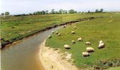

Le chant des Loups - Chanteloup

tracegps
Benutzer

Länge
9 km

Maximale Höhe
72 m

Positive Höhendifferenz
106 m

Km-Effort
10,4 km

Min. Höhe
25 m

Negative Höhendifferenz
106 m
Boucle
Ja
Erstellungsdatum :
2014-12-10 00:00:00.0
Letzte Änderung :
2014-12-10 00:00:00.0
2h00
Schwierigkeit : Medium

Kostenlosegpshiking-Anwendung
Über SityTrail
Tour Wandern von 9 km verfügbar auf Normandie, Manche, Chanteloup. Diese Tour wird von tracegps vorgeschlagen.
Beschreibung
Départ de la place de la mairie de Chanteloup vers le village Duprey puis le Mesnil et retour par le Village Bouillon et Le Gaillarbois.
Ort
Land:
France
Region :
Normandie
Abteilung/Provinz :
Manche
Kommune :
Chanteloup
Standort:
Unknown
Gehen Sie:(Dec)
Gehen Sie:(UTM)
610928 ; 5417318 (30U) N.
Kommentare
Touren in der Umgebung
Le Moulin de Guelle - Cérences


Wandern
Medium
Cérences,
Normandie,
Manche,
France

12,6 km | 15,8 km-effort
3h 0min
Ja
Balade Sarah samedi


Reiten
Medium
Lingreville,
Normandie,
Manche,
France

19,7 km | 21 km-effort
45min
Ja
VTT de Cérences à Beauchamps


Mountainbike
Sehr schwierig
Cérences,
Normandie,
Manche,
France

52 km | 65 km-effort
4h 0min
Ja

Le Moulin du Pont - Hudimesnil


Wandern
Medium
(1)
Hudimesnil,
Normandie,
Manche,
France

14,8 km | 17,3 km-effort
3h 30min
Ja

La Chapelle Sainte Suzanne - Hudimesnil


Wandern
Medium
Hudimesnil,
Normandie,
Manche,
France

5,2 km | 6,2 km-effort
1h 4min
Ja
La jambe de Loup - Le Loreur


Wandern
Medium
Le Loreur,
Normandie,
Manche,
France

7 km | 8,3 km-effort
1h 30min
Ja
La Voie Romaine - Cérences


Wandern
Medium
Cérences,
Normandie,
Manche,
France

6,6 km | 7,7 km-effort
1h 30min
Ja
Entre Batterel et Sienne - Cérences


Wandern
Medium
Cérences,
Normandie,
Manche,
France

11,7 km | 14 km-effort
2h 19min
Ja
Les Vallons de Cérences


Wandern
Medium
Cérences,
Normandie,
Manche,
France

19,3 km | 23 km-effort
4h 15min
Ja


 SityTrail


