


9,8 km | 14,4 km-effort

Benutzer


Kostenlosegpshiking-Anwendung
 SityTrail
IGN / Geografische Institute
SityTrail World
Die Welt öffnet sich für Sie
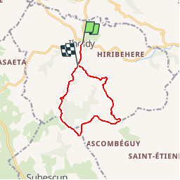
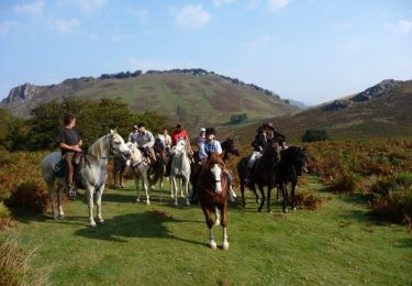
Tour Wandern von 10,4 km verfügbar auf Neu-Aquitanien, Pyrenäen-Atlantik, Iholdy. Diese Tour wird von tracegps vorgeschlagen.
Du village l´itinéraire permet l´ascension du mont Hoxa Handi, un des petits sommets des Pyrénées basques. On peut y admirer un magnifique panorama. La descente rejoint un col nommé Hiru Haitzeta, les trois chênes. La présence de nombreuses cabanes indique qu´à l´automne, on chasse la palombe. Une belle piste mène au village en passant devant le château. Iholdy se caractérise par son église dotée d´un clocher-fronton. On y célèbre chaque année depuis la Seconde Guerre Mondiale la Fête-Dieu (Besta Berri), cérémonie religieuse haute en couleur avec sa procession costumée. Retrouvez d’autres informations et la fiche descriptive sur le site Pays Basque et Béarn.

Wandern
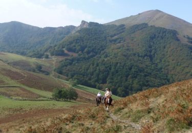
Pferd
Pferd

Mountainbike

Wandern


sport
Wandern