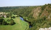
Tour Pferd Bourgvallées - La vallée de la Vire : 3 boucles pour cavaliers - Photo

La vallée de la Vire : 3 boucles pour cavaliers

 tracegps
tracegps

Benutzer

© OpenStreetMap contributors
Länge
Länge
44 km
Maximale Höhe
Maximale Höhe
138 m
Positive Höhendifferenz
673 m
Km-Effort
Km-Effort  
53 km
Min. Höhe
Min. Höhe
17 m
Negative Höhendifferenz
668 m
Boucle
Boucle
Ja
Erstellungsdatum :
2014-12-10 00:00:00.0
Letzte Änderung :
2014-12-10 00:00:00.0

(1 Nachricht)

Pferd
Pferd
9h00
Schwierigkeit : Schwierig

Scannen Sie diesen QR-Code, um die Tour in der SityTrail-Anwendung zu öffnen

Kostenlosegpshiking-Anwendung

Logo SityTrail SityTrail

IGN / Geografische Institute

SityTrail aus dem App Store herunterladen SityTrail von Google Play herunterladen

Logo SityTrail SityTrail World

Die Welt öffnet sich für Sie

SityTrail aus dem App Store herunterladen SityTrail von Google Play herunterladen SityTrail auf Huawei AppGallery herunterladen

Über SityTrail

Tour Pferd von 44 km verfügbar auf Normandie, Manche, Bourgvallées. Diese Tour wird von tracegps vorgeschlagen.

Beschreibung

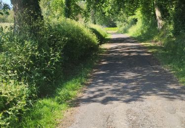
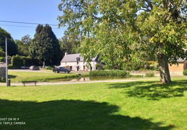
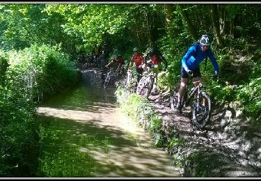
Un beau circuit « à la carte », avec 3 boucles qui peuvent être faites indépendamment les unes des autres. Parcourir les 3 la même journée est possible. Très beau circuit varié, qui suit le cours de la Vire, fleuve côtier qui arrive des confins de la Manche, du Calvados et de l'Orne. Après être passé à Saint-Lô, il passe par ici avant de se jeter dans la Manche, dans la baie des Veys. La navigation importante qui eut cours durant tout le XIXe siècle a laissé de beaux aménagements qui ponctuent ce circuit aménagé pour les randonneurs. Plus de détails sur le circuit (balisage, difficulté…), les points remarquables à proximité et téléchargements sur Manche Tourisme – Loisirs Randonnée GPS.

Höhenprofil

Foto-Galerie

POIs

POI Bourgvallées - 01_DEPART_MANCELLIERE - Photo
tracegps
BOURGVALLÉES 
POI Bourgvallées - 02_SUZANNE - Photo
tracegps
BOURGVALLÉES 
POI Bourgvallées - 03_DEPART_CONDE - Photo
tracegps
BOURGVALLÉES 
POI Condé-sur-Vire - 04_DEPART_MESNIL - Photo
tracegps
CONDÉ-SUR-VIRE 
POI Condé-sur-Vire - 05_INTERSECTION - Photo
tracegps
CONDÉ-SUR-VIRE 
POI Condé-sur-Vire - 06_CHAPELLE - Photo
tracegps
CONDÉ-SUR-VIRE 
POI Condé-sur-Vire - 07_INTERSECTION - Photo
tracegps
CONDÉ-SUR-VIRE 
POI Condé-sur-Vire - 08_ESCALADE - Photo
tracegps
CONDÉ-SUR-VIRE 
POI Condé-sur-Vire - 09_ROCHES_HAM_ - Photo
tracegps
CONDÉ-SUR-VIRE 
POI Domjean - 10_INTERSECTION - Photo
tracegps
POI Domjean - 11_DEPART_DOMJEAN_ - Photo
tracegps
POI Domjean - 12_INTERSECTION - Photo
tracegps

Ort

Land:
France
Region :
Normandie
Abteilung/Provinz :
Manche
Kommune :
Bourgvallées
Standort:
La Mancellière-sur-Vire
Gehen Sie:(Dec)
Gehen Sie:(UTM)
640862 ; 5436951 (30U) N.

Kommentare

Bitte melden Sie sich an, um einen Kommentar oder eine Bewertung zu hinterlassen


Touren in der Umgebung

Tour Mountainbike Agneaux - L'Agnelaise 2014 - Agneaux - Photo
Mountainbike
tracegps

Mountainbike

Schwierig
Agneaux, Normandie, Manche, France
44 km | 52 km-effort
3h 0min
Ja
Tour Wandern Torigny-les-Villes - Les Roches de Ham - Photo
Wandern
PatRando

Wandern

Medium
Torigny-les-Villes, Normandie, Manche, France
5 km | 6,3 km-effort
1h 4min
Ja
Tour Wandern Saint-Lô - BALLADE 2 JUIN - Photo
Wandern
PatRando

Wandern

Sehr leicht
Saint-Lô, Normandie, Manche, France
3,1 km | 3,7 km-effort
51min
Ja
Tour Wandern Saint-Lô - Ballade 2 juin 2020 - Photo
Wandern
PatRando

Wandern

Sehr leicht
Saint-Lô, Normandie, Manche, France
3,6 km | 4,2 km-effort
1h 2min
Ja
Tour Wandern Saint-Lô - Ballade - Photo
Wandern
PatRando

Wandern

Sehr leicht
Saint-Lô, Normandie, Manche, France
814 m | 940 m-effort
22min
Ja
Tour Wandern Saint-Lô - Le Hutrel 27 ai 2020 - Photo
Wandern
PatRando

Wandern

Sehr leicht
Saint-Lô, Normandie, Manche, France
2,3 km | 2,9 km-effort
48min
Ja
Tour Mountainbike Bourgvallées - La Samsonnaise 2014 - Photo
Mountainbike
tracegps

Mountainbike

Schwierig
Bourgvallées, Normandie, Manche, France
47 km | 57 km-effort
3h 25min
Ja
Tour Mountainbike Condé-sur-Vire - Boucle de Mesnil - Raoult    - Photo
Mountainbike
tracegps

Mountainbike

Medium
Condé-sur-Vire, Normandie, Manche, France
9,1 km | 11,1 km-effort
1h 0min
Ja
Tour Wandern Condé-sur-Vire - Boucle de Mesnil - Raoult    - Photo
Wandern
tracegps

Wandern

Medium
Condé-sur-Vire, Normandie, Manche, France
9,1 km | 11,1 km-effort
2h 15min
Ja


Schließen
Meine Abonnements