Tour Wandern Lessay - De l'Abbaye au bois du Pissot - Lessay - Photo

De l'Abbaye au bois du Pissot - Lessay

 tracegps
tracegps

Benutzer

© OpenStreetMap contributors
Länge
Länge
14,5 km
Maximale Höhe
Maximale Höhe
30 m
Positive Höhendifferenz
139 m
Km-Effort
Km-Effort  
16,3 km
Min. Höhe
Min. Höhe
5 m
Negative Höhendifferenz
139 m
Boucle
Boucle
Ja
Erstellungsdatum :
2014-12-10 00:00:00.0
Letzte Änderung :
2014-12-10 00:00:00.0

(1 Nachricht)

Wandern
Wandern
3h30
Schwierigkeit : Medium

Scannen Sie diesen QR-Code, um die Tour in der SityTrail-Anwendung zu öffnen

Kostenlosegpshiking-Anwendung

Logo SityTrail SityTrail

IGN / Geografische Institute

SityTrail aus dem App Store herunterladen SityTrail von Google Play herunterladen

Logo SityTrail SityTrail World

Die Welt öffnet sich für Sie

SityTrail aus dem App Store herunterladen SityTrail von Google Play herunterladen SityTrail auf Huawei AppGallery herunterladen

Über SityTrail

Tour Wandern von 14,5 km verfügbar auf Normandie, Manche, Lessay. Diese Tour wird von tracegps vorgeschlagen.

Beschreibung

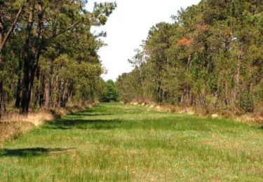
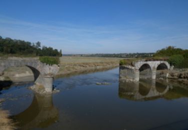
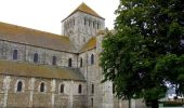
De l'Abbaye au bois du Pissot - Lessay. Zone d’éducation paysagère !! Savez-vous qu’il y a des plantes carnivores dans les tourbières de la Manche ? Avez-vous déjà humé les parfums de la pinède normande ? Et devinerez-vous de quelle couleur est le marais aujourd’hui ? N’oubliez pas d’aller visiter le joyau roman de l’abbaye Saint-Trinité de Lessay avant de repartir. Plus de détails sur le circuit (balisage, difficulté…), les points remarquables à proximité et téléchargements sur Manche Tourisme – Loisirs Randonnée GPS.

Höhenprofil

Foto-Galerie

POIs

POI Vesly - ITI_PRENEZ_A_DROITE - Photo
tracegps
POI Vesly - ITI_A_DROITE - Photo
tracegps
POI Lessay - 00_DEPART_ET_LAITERIE - Photo
tracegps
POI Lessay - 01_VARIANTE - Photo
tracegps
LESSAY 
POI Lessay - 02_TOURBIERE_MATHON - Photo
tracegps
POI Lessay - 03_SENTIER_MONTAGNE - Photo
tracegps
POI Vesly - 04_MOULIN_DE_PISSOT - Photo
tracegps
POI Vesly - 05_FORET_PISSOT - Photo
tracegps
POI Lessay - 06_MARAIS_AY - Photo
tracegps
LESSAY 
POI Lessay - 07_VOIE_FERREE - Photo
tracegps
POI Lessay - 08_ABBAYE_LESSAY - Photo
tracegps

Ort

Land:
France
Region :
Normandie
Abteilung/Provinz :
Manche
Kommune :
Lessay
Standort:
Lessay
Gehen Sie:(Dec)
Gehen Sie:(UTM)
607090 ; 5452746 (30U) N.

Kommentare

Bitte melden Sie sich an, um einen Kommentar oder eine Bewertung zu hinterlassen


Touren in der Umgebung

Tour Mountainbike Lessay - La lande de Lessay  - Photo
Mountainbike
tracegps

Mountainbike

Medium
(3)
Lessay, Normandie, Manche, France
29 km | 31 km-effort
2h 30min
Ja
Tour Wandern Lessay - Les chemins de Saint Michel - Lessay - Granville - Photo
Wandern
tracegps

Wandern

Medium
Lessay, Normandie, Manche, France
78 km | 88 km-effort
Unbekannt
Nein
Tour Rennrad Lessay - Velo Lessay la Haie du Puits - Photo
Rennrad
FOUCAULT

Rennrad

Lessay, Normandie, Manche, France
21 km | 22 km-effort
1h 55min
Ja
Tour sport Saint-Germain-sur-Ay - Randonnée saint germain sur Haye - Photo
sport
enoitna

sport

Sehr leicht
Saint-Germain-sur-Ay, Normandie, Manche, France
13,2 km | 13,9 km-effort
Unbekannt
Nein
Tour Wandern Lessay - Lessay - Photo
Wandern
JMJ53350

Wandern

Einfach
Lessay, Normandie, Manche, France
14,4 km | 15,5 km-effort
3h 31min
Ja
Tour Rennrad Vesly - COTENTIN  1 - Photo
Rennrad
UDGI54

Rennrad

Sehr schwierig
Vesly, Normandie, Manche, France
258 km | 292 km-effort
17h 40min
Nein
Tour Radtourismus  Vesly - TR DU COTENTIN 250K - Photo
Radtourismus
UDGI54

Radtourismus

Sehr leicht
Vesly, Normandie, Manche, France
240 km | 271 km-effort
Unbekannt
Ja
Tour sport Lessay - des-rives-de-l-ay-aux-landes-de-lessay 2 - Photo
sport
FOUCAULT

sport

Sehr leicht
Lessay, Normandie, Manche, France
12,5 km | 13,5 km-effort
Unbekannt
Nein
Tour Elektrofahrrad Lessay - 50 2022 04 17 Lessay - boucle les vents de huppelande - Photo
Elektrofahrrad
OLYMP42

Elektrofahrrad

Einfach
Lessay, Normandie, Manche, France
29 km | 33 km-effort
2h 3min
Ja


Schließen
Meine Abonnements