


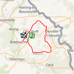


6,9 km | 8,6 km-effort

Benutzer


Kostenlosegpshiking-Anwendung
 SityTrail
IGN / Geografische Institute
SityTrail World
Die Welt öffnet sich für Sie
Tour Fahrrad von 18,3 km verfügbar auf Großer Osten, Mosel, Tromborn. Diese Tour wird von tracegps vorgeschlagen.
Cet itinéraire propose une variété de paysages et d'intéressantes possibilités de visites. A Tromborn, l'un des principaux points culminants du Pays de Nied, vous prendrez de la hauteur, le panorama y est saisissant et le point de vue s'étend jusqu'aux côtes de Moselle et au Pays des trois Frontières. Une table d'orientation vous aidera à localiser les principaux lieux. Le passage de l'itinéraire à Oberdorff, vous obligera à poser votre monture le temps d'une visite du musée de la maison lorraine. Cette ancienne ferme du XVIIème siècle, restaurée et transformée en musée d'Arts et Traditions populaires présente de magnifiques collections d'objets anciens. La visite des lieux est commentée par les propriétaires des lieux (03 87 78 43 67). L'itinéraire se poursuit tranquillement par les localités de Villing, Rémering et Dalem où de nombreux points de vue sur la plaine du Warndt agrémentent la balade. A la sortie de ce dernier village, une montée vers Tromborn vous attend, choisissez le bon braquet et observez au passage la ferme éolienne de Téterchen à votre gauche.


Wandern

Reiten
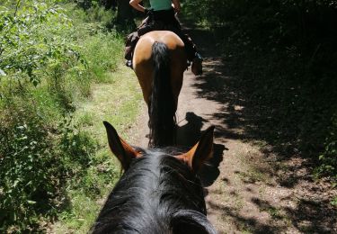
Reiten
Wandern
Andere Aktivitäten
Wandern
Wandern
Wandern