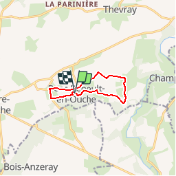

11,1 km | 12,7 km-effort

Benutzer


Kostenlosegpshiking-Anwendung
 SityTrail
IGN / Geografische Institute
SityTrail World
Die Welt öffnet sich für Sie
Tour Mountainbike von 7,7 km verfügbar auf Normandie, Eure, Mesnil-en-Ouche. Diese Tour wird von tracegps vorgeschlagen.
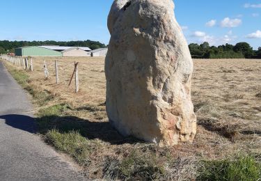
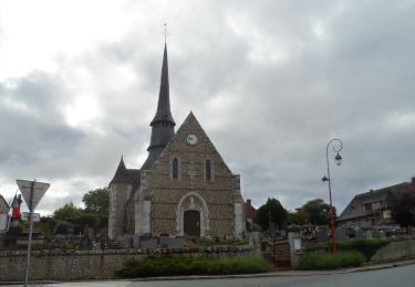
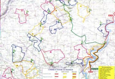
Circuit proposé par la Communauté de Communes du canton de Beaumesnil et l’Office de Tourisme de Beaumesnil. Départ de l’église de Bosc-Renoult-en-Ouche. Retrouvez ce circuit, parmi 17 autres, sur le dépliant proposé par l’office de Tourisme.


Wandern
Wandern
Wandern
Mountainbike
Wandern

Mountainbike

Wandern