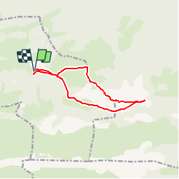
![](/images/other/stat-length.png)
![Tour Wandern Castet - Le Mail 1665m et le Pic Durban 1700m - Photo](https://media.geolcdn.com/t/1900/400/ext.pjpeg?maxdim=2&url=https%3A%2F%2Fservices.sitytrail.com%2FGeolivesWS%2FDownloadMedia.ashx%3FTrailID%3D110007%26Media%3D5095_1.jpg)
Le Mail 1665m et le Pic Durban 1700m
tracegps
Benutzer
![Länge](/images/other/stat-length.png)
![Maximale Höhe](https://static1.geolcdn.com/siteimages/upload/files/1508320355ic_sort_altitude_max_24dp.png)
![Positive Höhendifferenz](https://static1.geolcdn.com/siteimages/upload/files/1508320355ic_sort_den_pos_24dp.png)
![Km-Effort](/images/other/stat-length.png)
![Min. Höhe](https://static1.geolcdn.com/siteimages/upload/files/1508320355ic_sort_altitude_min_24dp.png)
![Negative Höhendifferenz](https://static1.geolcdn.com/siteimages/upload/files/1508320355ic_sort_den_neg_24dp.png)
![Boucle](https://static1.geolcdn.com/siteimages/upload/files/16400158638029165_repeat_loop_refresh_sync_direction_icon.png)
![Wandern](https://static1.geolcdn.com/sitytour/trail-icons/101.png)
5h00
Schwierigkeit : Medium
![Scannen Sie diesen QR-Code, um die Tour in der SityTrail-Anwendung zu öffnen](https://capi.geolives.com/qq0zvz2zws4bq2lad0pu/sitytour/trails/110007/qr.png?size=200)
Kostenlosegpshiking-Anwendung
Über SityTrail
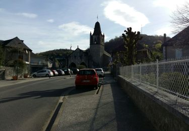
Tour Wandern von 11,1 km verfügbar auf Neu-Aquitanien, Pyrenäen-Atlantik, Castet. Diese Tour wird von tracegps vorgeschlagen.
Beschreibung
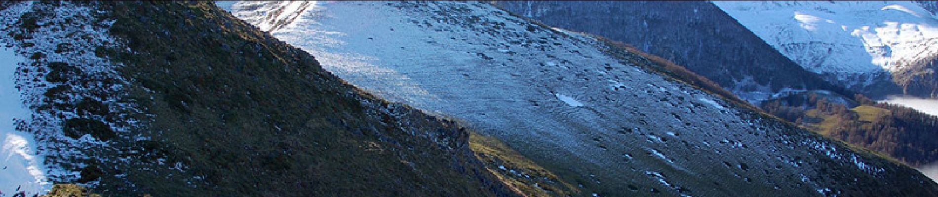
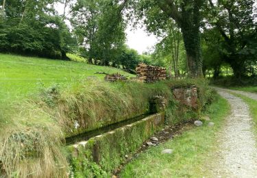
Le Mail 1665m et le Pic Durban 1700m depuis le plateau d'Espioubet (915m) Point culminant des crêtes entourant Pé-de-Hourat, le pic Durban est un intéressant belvédère que l'on peut aborder par l'Ouest après avoir bénéficié de la route pastorale reliant Castet au plateau d'Espioubet, ce qui diminue considérablement la dénivellation. Après une montée franche en boucle, nous effectuons un long parcours de crêtes et reviendrons en boucle pour découvrir de curieux vallons karstiques. Ceux qui le désirent se contenteront du Mail (1665m) et effectueront un circuit plus réduit. D’autres indications, photos et panoramiques sur le site « Les Pyrénées vues par Mariano ».
POIs
Ort
Kommentare
Touren in der Umgebung
![Tour Wandern Louvie-Juzon - Soum de las Picarras Montagne du Rey - Photo](https://media.geolcdn.com/t/375/260/ext.jpg?maxdim=2&url=https%3A%2F%2Fservices.sitytrail.com%2FGeolivesWS%2FDownloadMedia.ashx%3FTrailID%3D541294%26Media%3Dfix__20160320134039.jpg)
![Wandern Wandern](https://static1.geolcdn.com/sitytour/trail-icons/101.png)
Wandern
![](/images/other/stat-length.png)
![](https://static1.geolcdn.com/siteimages/upload/files/16400158638029165_repeat_loop_refresh_sync_direction_icon.png)
![Tour Zu Fuß Gère-Bélesten - La fontaine d'Esteret - Photo](https://media.geolcdn.com/t/375/260/d66768f9-56af-43eb-9e0f-c5096acb8e4f.jpeg&format=jpg&maxdim=2)
![Zu Fuß Zu Fuß](https://static1.geolcdn.com/sitytour/trail-icons/100.png)
Zu Fuß
![](/images/other/stat-length.png)
![](https://static1.geolcdn.com/siteimages/upload/files/16400158638029165_repeat_loop_refresh_sync_direction_icon.png)
![Tour Zu Fuß Louvie-Juzon - Le piémont du Rey - Photo](https://media.geolcdn.com/t/375/260/f491a556-8ecd-4525-a2fc-b2b6d591e533.jpeg&format=jpg&maxdim=2)
![Zu Fuß Zu Fuß](https://static1.geolcdn.com/sitytour/trail-icons/100.png)
Zu Fuß
![](/images/other/stat-length.png)
![](https://static1.geolcdn.com/siteimages/upload/files/16400158638029165_repeat_loop_refresh_sync_direction_icon.png)
![Tour Zu Fuß Sainte-Colome - Les buis - Photo](https://media.geolcdn.com/t/375/260/4276e983-4156-4966-8238-f2764987fcc4.jpeg&format=jpg&maxdim=2)
![Zu Fuß Zu Fuß](https://static1.geolcdn.com/sitytour/trail-icons/100.png)
Zu Fuß
![](/images/other/stat-length.png)
![](https://static1.geolcdn.com/siteimages/upload/files/16400158638029165_repeat_loop_refresh_sync_direction_icon.png)
![Tour Zu Fuß Gère-Bélesten - GERE BELESTEN terra aventura](https://media.geolcdn.com/t/375/260/819b0437-eecf-4739-88eb-a73ecd76aadc.jpg&format=jpg&maxdim=2)
![Zu Fuß Zu Fuß](https://static1.geolcdn.com/sitytour/trail-icons/100.png)
Zu Fuß
![](/images/other/stat-length.png)
![](https://static1.geolcdn.com/siteimages/upload/files/16400158638029165_repeat_loop_refresh_sync_direction_icon.png)
![Tour Wandern Sainte-Colome - SAINTE COLOME. BRUGES G4 3205801 - Photo](https://media.geolcdn.com/t/375/260/621774b8-5ac8-4904-8c9b-426616231e3f.jpg&format=jpg&maxdim=2)
![Wandern Wandern](https://static1.geolcdn.com/sitytour/trail-icons/101.png)
Wandern
![](/images/other/stat-length.png)
![](https://static1.geolcdn.com/siteimages/upload/files/16400158638029165_repeat_loop_refresh_sync_direction_icon.png)
![Tour Wandern Louvie-Juzon - LOUVIE-JUZON les tourbieres G3 - Photo](https://media.geolcdn.com/t/375/260/0ec40f33-eedf-4975-8492-b3db801a3635.jpg&format=jpg&maxdim=2)
![Wandern Wandern](https://static1.geolcdn.com/sitytour/trail-icons/101.png)
Wandern
![](/images/other/stat-length.png)
![](https://static1.geolcdn.com/siteimages/upload/files/16400158638029165_repeat_loop_refresh_sync_direction_icon.png)
![Tour Wandern Sainte-Colome - TERRA AVENTURA Ste Colome - Photo](https://media.geolcdn.com/t/375/260/fa6cd3ef-2f9e-46bf-a8dd-32eb62c410c1.jpg&format=jpg&maxdim=2)
![Wandern Wandern](https://static1.geolcdn.com/sitytour/trail-icons/101.png)
Wandern
![](/images/other/stat-length.png)
![](https://static1.geolcdn.com/siteimages/upload/files/16400158638029165_repeat_loop_refresh_sync_direction_icon.png)
![Tour Mountainbike Louvie-Juzon - louvie juzon. port de castet. col de jau. port de béon. - Photo](https://media.geolcdn.com/t/375/260/ext.jpg?maxdim=2&url=https%3A%2F%2Fservices.sitytrail.com%2FGeolivesWS%2FDownloadMedia.ashx%3FTrailID%3D461362%26Media%3Dfix__20150819114633.jpg)
![Mountainbike Mountainbike](https://static1.geolcdn.com/sitytour/trail-icons/202.png)
Mountainbike
![](/images/other/stat-length.png)
![](https://static1.geolcdn.com/siteimages/upload/files/16400158638029165_repeat_loop_refresh_sync_direction_icon.png)