![](/images/other/stat-length.png)
![Tour Wandern Laye - les Sagnes du Plateau de Bayard. (20-01-19)A prox - Photo](https://media.geolcdn.com/t/1900/400/ext.pjpeg?maxdim=2&url=https%3A%2F%2Fservices.sitytrail.com%2FGeolivesWS%2FDownloadMedia.ashx%3FTrailID%3D1099758%26Media%3Dfix__20190120142656.jpg)
les Sagnes du Plateau de Bayard. (20-01-19)A prox
Dervalmarc
Benutzer
![Länge](/images/other/stat-length.png)
Länge
9,3 km
![Maximale Höhe](https://static1.geolcdn.com/siteimages/upload/files/1508320355ic_sort_altitude_max_24dp.png)
Maximale Höhe
1290 m
![Positive Höhendifferenz](https://static1.geolcdn.com/siteimages/upload/files/1508320355ic_sort_den_pos_24dp.png)
Positive Höhendifferenz
220 m
![Km-Effort](/images/other/stat-length.png)
Km-Effort
12,2 km
![Min. Höhe](https://static1.geolcdn.com/siteimages/upload/files/1508320355ic_sort_altitude_min_24dp.png)
Min. Höhe
1129 m
![Negative Höhendifferenz](https://static1.geolcdn.com/siteimages/upload/files/1508320355ic_sort_den_neg_24dp.png)
Negative Höhendifferenz
220 m
![Boucle](https://static1.geolcdn.com/siteimages/upload/files/16400158638029165_repeat_loop_refresh_sync_direction_icon.png)
Boucle
Ja
Erstellungsdatum :
2019-05-06 10:24:17.002
Letzte Änderung :
2019-05-06 10:24:17.002
![Wandern](https://static1.geolcdn.com/sitytour/trail-icons/101.png)
1h47
Schwierigkeit : Einfach
![Scannen Sie diesen QR-Code, um die Tour in der SityTrail-Anwendung zu öffnen](https://capi.geolives.com/qq0zvz2zws4bq2lad0pu/sitytour/trails/1099758/qr.png?size=200)
Kostenlosegpshiking-Anwendung
Über SityTrail
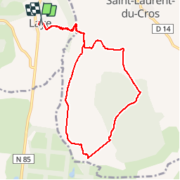
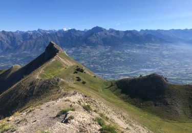
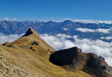
Tour Wandern von 9,3 km verfügbar auf Provence-Alpes-Côte d'Azur, Hochalpen, Laye. Diese Tour wird von Dervalmarc vorgeschlagen.
Beschreibung
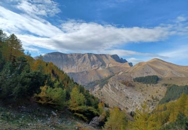
A proximité du plateau de Bayard on trouve des marais naturels appelés Sagnes en patois local.
Ce milieu présente une grande diversité et une richesse animale et végétale rare, et parfois unique en région paca.
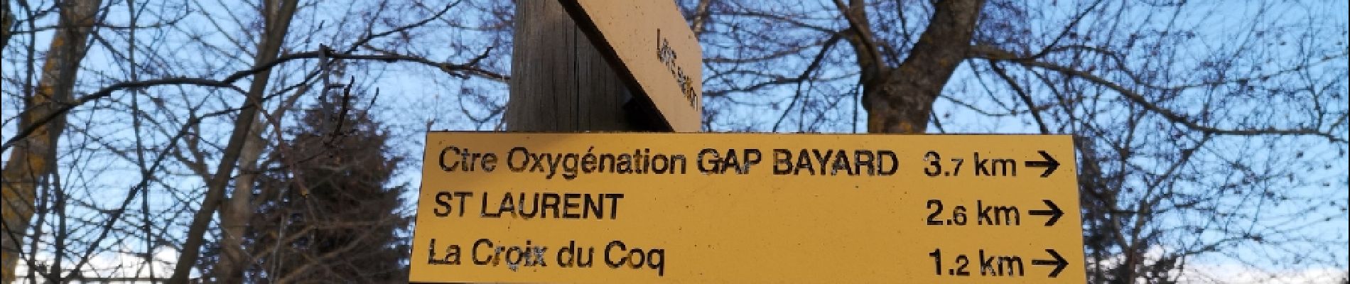
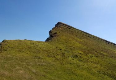
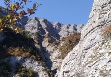
Ort
Land:
France
Region :
Provence-Alpes-Côte d'Azur
Abteilung/Provinz :
Hochalpen
Kommune :
Laye
Standort:
Unknown
Gehen Sie:(Dec)
Gehen Sie:(UTM)
268880 ; 4947144 (32T) N.
Kommentare
Touren in der Umgebung
![Tour Wandern Poligny - Sommet du Chamois - Photo](https://media.geolcdn.com/t/375/260/f50ce7ba-e398-45ff-a635-0e0060f28abc.jpg&format=jpg&maxdim=2)
![Wandern Wandern](https://static1.geolcdn.com/sitytour/trail-icons/101.png)
Sommet du Chamois
Wandern
Schwierig
Poligny,
Provence-Alpes-Côte d'Azur,
Hochalpen,
France
![](/images/other/stat-length.png)
8 km | 18,6 km-effort
4h 13min
![](https://static1.geolcdn.com/siteimages/upload/files/16400158638029165_repeat_loop_refresh_sync_direction_icon.png)
Ja
![Tour Wandern Gap - Pic de Gleize - Photo](https://media.geolcdn.com/t/375/260/9b3dcddd-15e9-4793-a987-aa74cd6c203d.jpg&format=jpg&maxdim=2)
![Wandern Wandern](https://static1.geolcdn.com/sitytour/trail-icons/101.png)
Pic de Gleize
Wandern
Medium
Gap,
Provence-Alpes-Côte d'Azur,
Hochalpen,
France
![](/images/other/stat-length.png)
4,8 km | 10,6 km-effort
2h 25min
![](https://static1.geolcdn.com/siteimages/upload/files/16400158638029165_repeat_loop_refresh_sync_direction_icon.png)
Ja
![Tour Wandern La Fare-en-Champsaur - Le Girolet - Photo](https://media.geolcdn.com/t/375/260/db985afe-8ded-41a5-8002-487c3b42ed04.jpg&format=jpg&maxdim=2)
![Wandern Wandern](https://static1.geolcdn.com/sitytour/trail-icons/101.png)
Le Girolet
Wandern
Medium
La Fare-en-Champsaur,
Provence-Alpes-Côte d'Azur,
Hochalpen,
France
![](/images/other/stat-length.png)
11,6 km | 24 km-effort
4h 45min
![](https://static1.geolcdn.com/siteimages/upload/files/16400158638029165_repeat_loop_refresh_sync_direction_icon.png)
Ja
![Tour Wandern Laye - Sentier de la Cuque prolongé - Photo](https://media.geolcdn.com/t/375/260/ext.jpg?maxdim=2&url=https%3A%2F%2Fstatic1.geolcdn.com%2Fsiteimages%2Fupload%2Ffiles%2F1553511878bg_sport_marche.png)
![Wandern Wandern](https://static1.geolcdn.com/sitytour/trail-icons/101.png)
Sentier de la Cuque prolongé
Wandern
Sehr leicht
(1)
Laye,
Provence-Alpes-Côte d'Azur,
Hochalpen,
France
![](/images/other/stat-length.png)
11,8 km | 19,7 km-effort
2h 24min
![](https://static1.geolcdn.com/siteimages/upload/files/16400158638029165_repeat_loop_refresh_sync_direction_icon.png)
Ja
![Tour Wandern Gap - Le pic de Gleize - Photo](https://media.geolcdn.com/t/375/260/98fb06f4-7e41-40e4-9105-39b39adc042d.jpeg&format=jpg&maxdim=2)
![Wandern Wandern](https://static1.geolcdn.com/sitytour/trail-icons/101.png)
Le pic de Gleize
Wandern
Medium
Gap,
Provence-Alpes-Côte d'Azur,
Hochalpen,
France
![](/images/other/stat-length.png)
5,8 km | 11,8 km-effort
2h 2min
![](https://static1.geolcdn.com/siteimages/upload/files/16400158638029165_repeat_loop_refresh_sync_direction_icon.png)
Ja
![Tour Wandern Saint-Laurent-du-Cros - St Laurent du Cros 27/01/24 - Photo](https://media.geolcdn.com/t/375/260/d4cde02a-197e-4aa7-9109-8dadf21b331d.jpg&format=jpg&maxdim=2)
![Wandern Wandern](https://static1.geolcdn.com/sitytour/trail-icons/101.png)
St Laurent du Cros 27/01/24
Wandern
Einfach
Saint-Laurent-du-Cros,
Provence-Alpes-Côte d'Azur,
Hochalpen,
France
![](/images/other/stat-length.png)
6,9 km | 9,2 km-effort
2h 4min
![](https://static1.geolcdn.com/siteimages/upload/files/16400158638029165_repeat_loop_refresh_sync_direction_icon.png)
Ja
![Tour Wandern Gap - 3-pics-gleize_randonnee-40057005 - Photo](https://media.geolcdn.com/t/375/260/b13b4dee-7b93-4938-922d-9160ff984ca3.jpg&format=jpg&maxdim=2)
![Wandern Wandern](https://static1.geolcdn.com/sitytour/trail-icons/101.png)
3-pics-gleize_randonnee-40057005
Wandern
Schwierig
Gap,
Provence-Alpes-Côte d'Azur,
Hochalpen,
France
![](/images/other/stat-length.png)
6,9 km | 13,7 km-effort
3h 6min
![](https://static1.geolcdn.com/siteimages/upload/files/16400158638029165_repeat_loop_refresh_sync_direction_icon.png)
Ja
![Tour Wandern La Fare-en-Champsaur - Le Bois Vert Station de Laye - Photo](https://media.geolcdn.com/t/375/260/7766bcf9-ceb8-4568-94e5-534143362c5f.jpg&format=jpg&maxdim=2)
![Wandern Wandern](https://static1.geolcdn.com/sitytour/trail-icons/101.png)
Le Bois Vert Station de Laye
Wandern
Medium
(1)
La Fare-en-Champsaur,
Provence-Alpes-Côte d'Azur,
Hochalpen,
France
![](/images/other/stat-length.png)
9,1 km | 13,1 km-effort
2h 44min
![](https://static1.geolcdn.com/siteimages/upload/files/16400158638029165_repeat_loop_refresh_sync_direction_icon.png)
Ja
![Tour Wandern Gap - GAP . Col de Gleize , ronde de Chaudun o - Photo](https://media.geolcdn.com/t/375/260/ca70f580-3b7a-424a-a66b-146642070022.jpg&format=jpg&maxdim=2)
![Wandern Wandern](https://static1.geolcdn.com/sitytour/trail-icons/101.png)
GAP . Col de Gleize , ronde de Chaudun o
Wandern
Schwierig
Gap,
Provence-Alpes-Côte d'Azur,
Hochalpen,
France
![](/images/other/stat-length.png)
17,5 km | 28 km-effort
7h 13min
![](https://static1.geolcdn.com/siteimages/upload/files/16400158638029165_repeat_loop_refresh_sync_direction_icon.png)
Nein