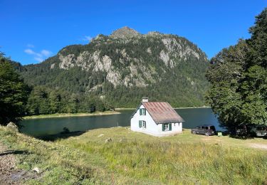
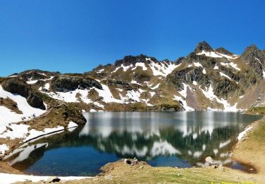
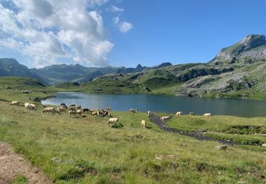
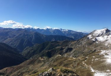
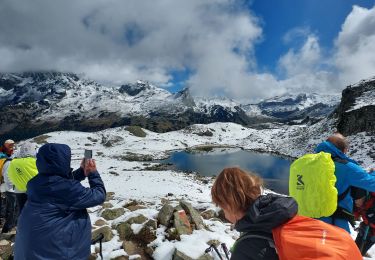
Tour Wandern Laruns - Pic d'Ayous (2288m) - Photo
 tracegps
tracegps

Benutzer

© OpenStreetMap contributors
Länge
Länge
17,4 km
Maximale Höhe
Maximale Höhe
2262 m
Positive Höhendifferenz
1021 m
Km-Effort
Km-Effort  
31 km
Min. Höhe
Min. Höhe
1419 m
Negative Höhendifferenz
1023 m
Boucle
Boucle
Ja
Erstellungsdatum :
2014-12-10 00:00:00.0
Letzte Änderung :
2014-12-10 00:00:00.0

(0 Nachricht)

Wandern
Wandern
6h30
Schwierigkeit : Schwierig

Scannen Sie diesen QR-Code, um die Tour in der SityTrail-Anwendung zu öffnen

Kostenlosegpshiking-Anwendung

Logo SityTrail SityTrail

IGN / Geografische Institute

SityTrail aus dem App Store herunterladen SityTrail von Google Play herunterladen

Logo SityTrail SityTrail World

Die Welt öffnet sich für Sie

SityTrail aus dem App Store herunterladen SityTrail von Google Play herunterladen SityTrail auf Huawei AppGallery herunterladen

Über SityTrail

Tour Wandern von 17,4 km verfügbar auf Neu-Aquitanien, Pyrenäen-Atlantik, Laruns. Diese Tour wird von tracegps vorgeschlagen.

Beschreibung

Tour des Lacs d'Ayous en boucle depuis Bious-Artigues (1423m) Avec possibilité de faire les Pics d'Ayous (2288m), moines (2349m) et Casterau (2227m) Avec ses Lacs où se mire l'Ossau (familièrement baptisé "Jean-Pierre"), la région d'Ayous est une des plus belle du Béarn. Y monter depuis Bious-Artigues est une balade classique pour les marcheurs; y descendre au cours d'un insolite circuit est plus original, d'autant que le pic d'Ayous est beaucoup moins connu que le col ou le refuge de même nom. D’autres indications, photos et panoramiques sur le site « Les Pyrénées vues par Mariano ».

Höhenprofil

Foto-Galerie

POIs

POI Laruns - Col-Ayous - Photo
tracegps
LARUNS 
POI Laruns - 2227-Caste - Photo
tracegps
LARUNS 
POI Laruns - Cabane-Cap - Photo
tracegps
LARUNS 
POI Laruns - Cabane-col - Photo
tracegps
LARUNS 
POI Laruns - Refuge-Ayo - Photo
tracegps
LARUNS 
POI Laruns - Lac-Bersau - Photo
tracegps
LARUNS 
POI Laruns - lac-Bious- - Photo
tracegps
LARUNS 
POI Laruns - Lac-Caster - Photo
tracegps
LARUNS 
POI Laruns - Lac-Gentau - Photo
tracegps
LARUNS 
POI Laruns - Lac-Roumas - Photo
tracegps
LARUNS 
POI Laruns - Parking - Photo
tracegps
LARUNS 
POI Laruns - Depart - Photo
tracegps
LARUNS 
POI Laruns - Pont - Photo
tracegps
LARUNS 
POI Laruns - 2288-Ayous - Photo
tracegps
LARUNS 

Ort

Land:
France
Region :
Neu-Aquitanien
Abteilung/Provinz :
Pyrenäen-Atlantik
Kommune :
Laruns
Standort:
Unknown
Gehen Sie:(Dec)
Gehen Sie:(UTM)
708453 ; 4749375 (30T) N.

Touren in der Umgebung

Tour Wandern Laruns - Ossau : Tour des lacs d’Ayous  - Photo
Wandern
ETMU5496

Wandern

Medium
(1)
Laruns, Neu-Aquitanien, Pyrenäen-Atlantik, France
15,5 km | 25 km-effort
4h 49min
Ja
Tour Wandern Laruns - Tour des Lacs d'Ayous en boucle depuis Bious-Artigues - Photo
Wandern
tracegps

Wandern

Medium
(4)
Laruns, Neu-Aquitanien, Pyrenäen-Atlantik, France
14,1 km | 24 km-effort
5h 30min
Ja
Tour Wandern Laruns - Tour des Lacs d'Ayous + Pic des Moines (2349m) - Photo
Wandern
tracegps

Wandern

Schwierig
(1)
Laruns, Neu-Aquitanien, Pyrenäen-Atlantik, France
15 km | 27 km-effort
5h 30min
Ja
Tour Wandern Laruns - GR 10 - U - Photo
Wandern
GUIDE
LouisROGER

Wandern

Sehr schwierig
(1)
Laruns, Neu-Aquitanien, Pyrenäen-Atlantik, France
12,9 km | 26 km-effort
5h 1min
Nein
Tour Wandern Laruns - chemin des fenetres - Photo
Wandern
mongo

Wandern

Einfach
(1)
Laruns, Neu-Aquitanien, Pyrenäen-Atlantik, France
8 km | 14,1 km-effort
3h 0min
Nein
Tour sport Laruns - Gabas Etsaut  - Photo
sport
GUIDE
viaul

sport

Sehr leicht
Laruns, Neu-Aquitanien, Pyrenäen-Atlantik, France
26 km | 44 km-effort
Unbekannt
Nein
Tour Wandern Laruns - Lac d’Aule et Col du Turin Garié - Photo
Wandern
Bearn64230

Wandern

Schwierig
Laruns, Neu-Aquitanien, Pyrenäen-Atlantik, France
11,7 km | 25 km-effort
5h 37min
Ja
Tour Wandern Laruns - lacs d'Ayous  - Photo
Wandern
GUIDE
LouisROGER

Wandern

Sehr schwierig
Laruns, Neu-Aquitanien, Pyrenäen-Atlantik, France
14,5 km | 24 km-effort
7h 33min
Ja
Tour Zu Fuß Laruns - Voie d'OssauB - Photo
Zu Fuß
GUIDE+

Zu Fuß

Medium
Laruns, Neu-Aquitanien, Pyrenäen-Atlantik, France
14,1 km | 24 km-effort
5h 32min
Nein


Schließen
Meine Abonnements