


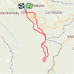


14,5 km | 22 km-effort


Benutzer


Kostenlosegpshiking-Anwendung
 SityTrail
IGN / Geografische Institute
SityTrail World
Die Welt öffnet sich für Sie
Tour Wandern von 11,8 km verfügbar auf Großer Osten, Mosel, Dagsburg. Diese Tour wird von tracegps vorgeschlagen.
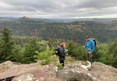
Promenade depuis le village de Dabo en Moselle vers le col de la Schleif et retour par le rocher St-Léon à travers les forêts du massif des Vosges. D’autres informations et photos sur le site des Balades de Stéphane.


Wandern

Wandern

Wandern

Wandern

Mountainbike

Wandern

Reiten
Wandern
Wandern