![](/images/other/stat-length.png)
![Tour Wandern Volckerinckhove - Autour de Sainte-Mildrede (Volckerinckhove) - Photo](https://media.geolcdn.com/t/1900/400/ext.pjpeg?maxdim=2&url=https%3A%2F%2Fservices.sitytrail.com%2FGeolivesWS%2FDownloadMedia.ashx%3FTrailID%3D109767%26Media%3D4685_1.jpg)
Autour de Sainte-Mildrede (Volckerinckhove)
tracegps
Benutzer
![Länge](/images/other/stat-length.png)
Länge
8,9 km
![Maximale Höhe](https://static1.geolcdn.com/siteimages/upload/files/1508320355ic_sort_altitude_max_24dp.png)
Maximale Höhe
62 m
![Positive Höhendifferenz](https://static1.geolcdn.com/siteimages/upload/files/1508320355ic_sort_den_pos_24dp.png)
Positive Höhendifferenz
86 m
![Km-Effort](/images/other/stat-length.png)
Km-Effort
10 km
![Min. Höhe](https://static1.geolcdn.com/siteimages/upload/files/1508320355ic_sort_altitude_min_24dp.png)
Min. Höhe
3 m
![Negative Höhendifferenz](https://static1.geolcdn.com/siteimages/upload/files/1508320355ic_sort_den_neg_24dp.png)
Negative Höhendifferenz
86 m
![Boucle](https://static1.geolcdn.com/siteimages/upload/files/16400158638029165_repeat_loop_refresh_sync_direction_icon.png)
Boucle
Ja
Erstellungsdatum :
2014-12-10 00:00:00.0
Letzte Änderung :
2014-12-10 00:00:00.0
![Wandern](https://static1.geolcdn.com/sitytour/trail-icons/101.png)
2h15
Schwierigkeit : Medium
![Scannen Sie diesen QR-Code, um die Tour in der SityTrail-Anwendung zu öffnen](https://capi.geolives.com/qq0zvz2zws4bq2lad0pu/sitytour/trails/109767/qr.png?size=200)
Kostenlosegpshiking-Anwendung
Über SityTrail
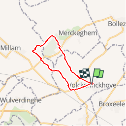
Tour Wandern von 8,9 km verfügbar auf Nordfrankreich, Nord, Volckerinckhove. Diese Tour wird von tracegps vorgeschlagen.
Beschreibung
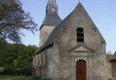
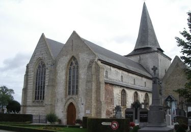
Circuit proposé par le comité départemental du tourisme du Nord. Départ de l’église de Volckerinckhove. Circuit, au patrimoine varié, praticable toute l'année. Retrouvez cette randonnée sur le site du Comité Départemental du Tourisme du Nord.
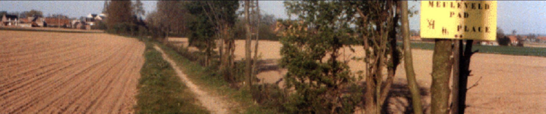
Ort
Land:
France
Region :
Nordfrankreich
Abteilung/Provinz :
Nord
Kommune :
Volckerinckhove
Standort:
Unknown
Gehen Sie:(Dec)
Gehen Sie:(UTM)
451094 ; 5632115 (31U) N.
Kommentare
Touren in der Umgebung
![Tour Wandern Buysscheure - Vers le paradis - Photo](https://media.geolcdn.com/t/375/260/ext.jpg?maxdim=2&url=https%3A%2F%2Fservices.sitytrail.com%2FGeolivesWS%2FDownloadMedia.ashx%3FTrailID%3D202854%26Media%3Dc89a9bf4-b065-43b0-ae31-88906460cb64.jpg)
![Wandern Wandern](https://static1.geolcdn.com/sitytour/trail-icons/101.png)
Vers le paradis
Wandern
Sehr leicht
(1)
Buysscheure,
Nordfrankreich,
Nord,
France
![](/images/other/stat-length.png)
7,1 km | 7,8 km-effort
Unbekannt
![](https://static1.geolcdn.com/siteimages/upload/files/16400158638029165_repeat_loop_refresh_sync_direction_icon.png)
Ja
![Tour Fahrrad Merckeghem - Boucle de Merckeghem - Photo](https://media.geolcdn.com/t/375/260/ext.jpg?maxdim=2&url=https%3A%2F%2Fservices.sitytrail.com%2FGeolivesWS%2FDownloadMedia.ashx%3FTrailID%3D129753%26Media%3D13293_4.jpg)
![Fahrrad Fahrrad](https://static1.geolcdn.com/sitytour/trail-icons/200.png)
Boucle de Merckeghem
Fahrrad
Medium
Merckeghem,
Nordfrankreich,
Nord,
France
![](/images/other/stat-length.png)
29 km | 31 km-effort
2h 0min
![](https://static1.geolcdn.com/siteimages/upload/files/16400158638029165_repeat_loop_refresh_sync_direction_icon.png)
Ja
![Tour Fahrrad Volckerinckhove - Boucle de Volckerinckhove - Photo](https://media.geolcdn.com/t/375/260/ext.jpg?maxdim=2&url=https%3A%2F%2Fservices.sitytrail.com%2FGeolivesWS%2FDownloadMedia.ashx%3FTrailID%3D118850%26Media%3D13063_6.jpg)
![Fahrrad Fahrrad](https://static1.geolcdn.com/sitytour/trail-icons/200.png)
Boucle de Volckerinckhove
Fahrrad
Einfach
Volckerinckhove,
Nordfrankreich,
Nord,
France
![](/images/other/stat-length.png)
29 km | 31 km-effort
1h 30min
![](https://static1.geolcdn.com/siteimages/upload/files/16400158638029165_repeat_loop_refresh_sync_direction_icon.png)
Ja
![Tour Wandern Buysscheure - Vers le Paradis - Buysscheure - Photo](https://media.geolcdn.com/t/375/260/ext.jpg?maxdim=2&url=https%3A%2F%2Fservices.sitytrail.com%2FGeolivesWS%2FDownloadMedia.ashx%3FTrailID%3D111846%26Media%3D8607_6.jpg)
![Wandern Wandern](https://static1.geolcdn.com/sitytour/trail-icons/101.png)
Vers le Paradis - Buysscheure
Wandern
Medium
Buysscheure,
Nordfrankreich,
Nord,
France
![](/images/other/stat-length.png)
7,8 km | 8,6 km-effort
2h 0min
![](https://static1.geolcdn.com/siteimages/upload/files/16400158638029165_repeat_loop_refresh_sync_direction_icon.png)
Ja
![Tour Wandern Buysscheure - Du bocage au Marais - Buysscheure - Photo](https://media.geolcdn.com/t/375/260/ext.jpg?maxdim=2&url=https%3A%2F%2Fservices.sitytrail.com%2FGeolivesWS%2FDownloadMedia.ashx%3FTrailID%3D111845%26Media%3D8606_6.jpg)
![Wandern Wandern](https://static1.geolcdn.com/sitytour/trail-icons/101.png)
Du bocage au Marais - Buysscheure
Wandern
Schwierig
Buysscheure,
Nordfrankreich,
Nord,
France
![](/images/other/stat-length.png)
13,8 km | 14,9 km-effort
3h 30min
![](https://static1.geolcdn.com/siteimages/upload/files/16400158638029165_repeat_loop_refresh_sync_direction_icon.png)
Ja
![Tour Wandern Bollezeele - Circuit du Pantgat - Bollezeele - Photo](https://media.geolcdn.com/t/375/260/ext.jpg?maxdim=2&url=https%3A%2F%2Fservices.sitytrail.com%2FGeolivesWS%2FDownloadMedia.ashx%3FTrailID%3D111842%26Media%3D8603_6.jpg)
![Wandern Wandern](https://static1.geolcdn.com/sitytour/trail-icons/101.png)
Circuit du Pantgat - Bollezeele
Wandern
Einfach
Bollezeele,
Nordfrankreich,
Nord,
France
![](/images/other/stat-length.png)
6,4 km | 7,1 km-effort
1h 40min
![](https://static1.geolcdn.com/siteimages/upload/files/16400158638029165_repeat_loop_refresh_sync_direction_icon.png)
Ja
![Tour Wandern Rubrouck - Circuit des mares - Rubrouck - Photo](https://media.geolcdn.com/t/375/260/ext.jpg?maxdim=2&url=https%3A%2F%2Fservices.sitytrail.com%2FGeolivesWS%2FDownloadMedia.ashx%3FTrailID%3D110320%26Media%3D5751_6.jpg)
![Wandern Wandern](https://static1.geolcdn.com/sitytour/trail-icons/101.png)
Circuit des mares - Rubrouck
Wandern
Medium
Rubrouck,
Nordfrankreich,
Nord,
France
![](/images/other/stat-length.png)
10 km | 10,4 km-effort
2h 30min
![](https://static1.geolcdn.com/siteimages/upload/files/16400158638029165_repeat_loop_refresh_sync_direction_icon.png)
Ja
![Tour Wandern Volckerinckhove - Volckerinckhove - Village Patrimoine - Photo](https://media.geolcdn.com/t/375/260/ext.jpg?maxdim=2&url=https%3A%2F%2Fservices.sitytrail.com%2FGeolivesWS%2FDownloadMedia.ashx%3FTrailID%3D105869%26Media%3D9847_6.jpg)
![Wandern Wandern](https://static1.geolcdn.com/sitytour/trail-icons/101.png)
Volckerinckhove - Village Patrimoine
Wandern
Einfach
Volckerinckhove,
Nordfrankreich,
Nord,
France
![](/images/other/stat-length.png)
6,2 km | 6,9 km-effort
1h 30min
![](https://static1.geolcdn.com/siteimages/upload/files/16400158638029165_repeat_loop_refresh_sync_direction_icon.png)
Ja
![Tour Wandern Merckeghem - Sentier de l'Eekhout Veld - Merckeghem - Photo](https://media.geolcdn.com/t/375/260/ext.jpg?maxdim=2&url=https%3A%2F%2Fservices.sitytrail.com%2FGeolivesWS%2FDownloadMedia.ashx%3FTrailID%3D109740%26Media%3D4498_1.jpg)
![Wandern Wandern](https://static1.geolcdn.com/sitytour/trail-icons/101.png)
Sentier de l'Eekhout Veld - Merckeghem
Wandern
Medium
(1)
Merckeghem,
Nordfrankreich,
Nord,
France
![](/images/other/stat-length.png)
7,3 km | 8,4 km-effort
2h 0min
![](https://static1.geolcdn.com/siteimages/upload/files/16400158638029165_repeat_loop_refresh_sync_direction_icon.png)
Ja
hospice